10. Spyglass
 Price: $5.99 app purchase then $2.99 p/m
Available on: iOS and Android
Key attributes: High tech compass, clever use of augmented reality
Best for: Visual innovations and technical features
Offline use: Yes
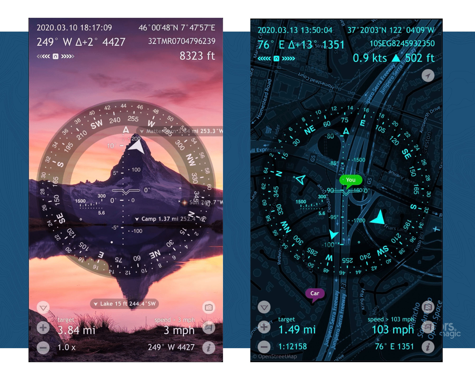
Spyglass is without a doubt one of the most visually impressive apps on this list. It’s also incredibly unique in its technical and navigational feature options – it serves as binoculars, a hi-tech compass, a gyrocompass, a GPS receiver, a waypoint tracker, a speedometer, an altimeter, a sun, moon and star finder, a gyro horizon, a rangefinder, a coordinate converter, a sextant, an inclinometer, an angular calculator and a camera. And that list isn’t even exhaustive.
The app operates in 3D using an augmented reality to display real-time object positions, information and directions overlaid on top of the map. These augmented reality GPS technologies track exactly where you are using your surroundings and the data from your device.
The option to navigate by the stars is also definitely in a league of its own.
Read more: spyglassnav.com
Rating: 3/5
11. Footpath Route Planner
Price: Basic: free, Single route: £1.99, Footpath Elite: £21.49 annually
Available on: iOS and Android
Key attributes: Very easy to use
Best for: Ease-of-use and fast planning
Offline use: Yes
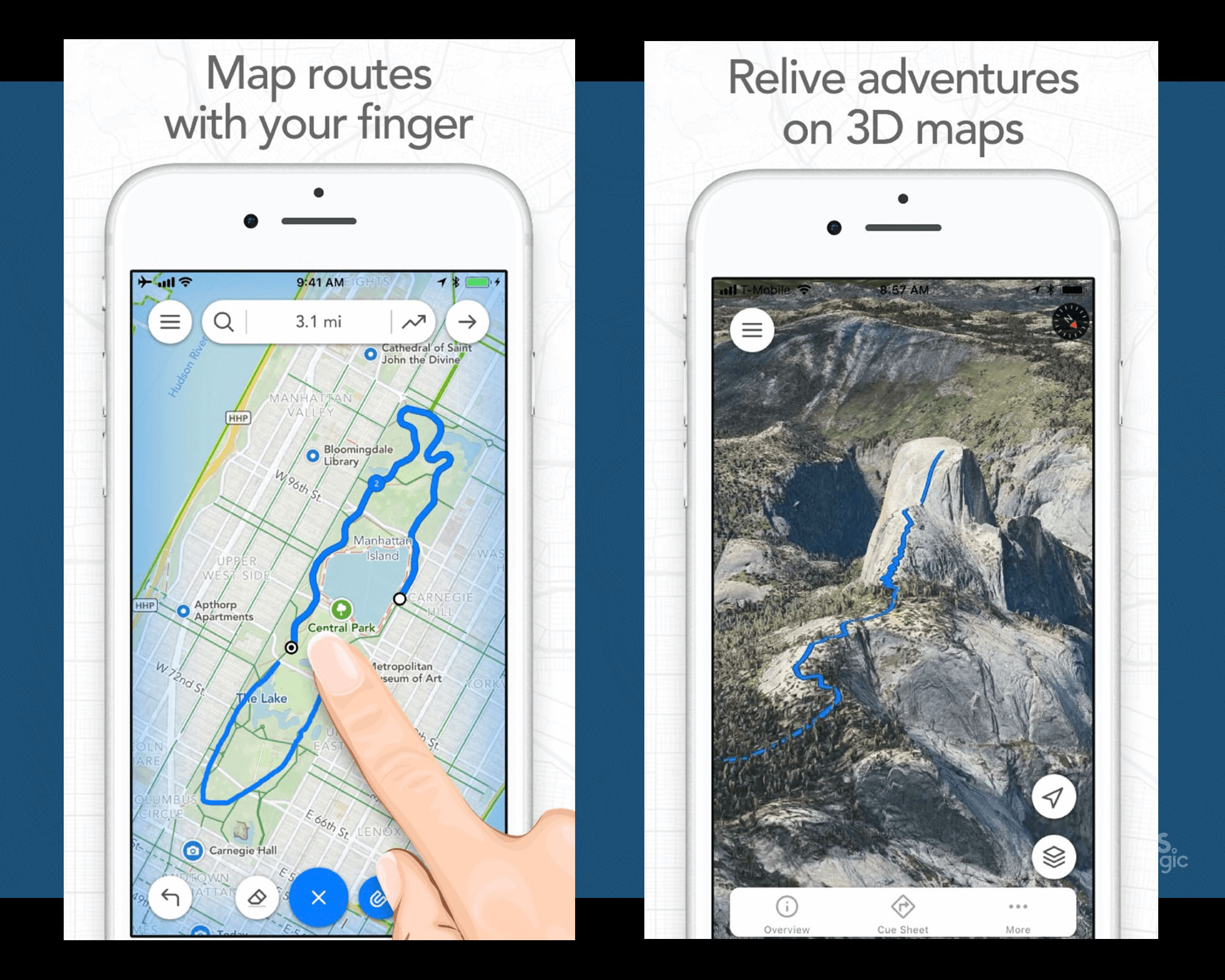
The Footpath Route Planner app literally maps routes using your finger. You tap the draw button and trace the outlines of a map with your finger. The app will then ‘snap to map’ and choose the best trail and road options according to your outline. You can also zoom in and customise specific segments further if you have points of interests (or pubs) you wish to stop at on the way.
Designed for any activity (even the SUP) in any country, you can share your adventures with your friends and also overlay your route line on top of your photos for memorable visuals.
The elite version will unlock turn-by-turn navigation, premium maps (with details such as cycle lanes and avalanche slope shading), organisation features, activity analysis and exporting and saving abilities. Your first five saved routes, however, will be free.
Read more: footpathapp.com
Rating: 3/5
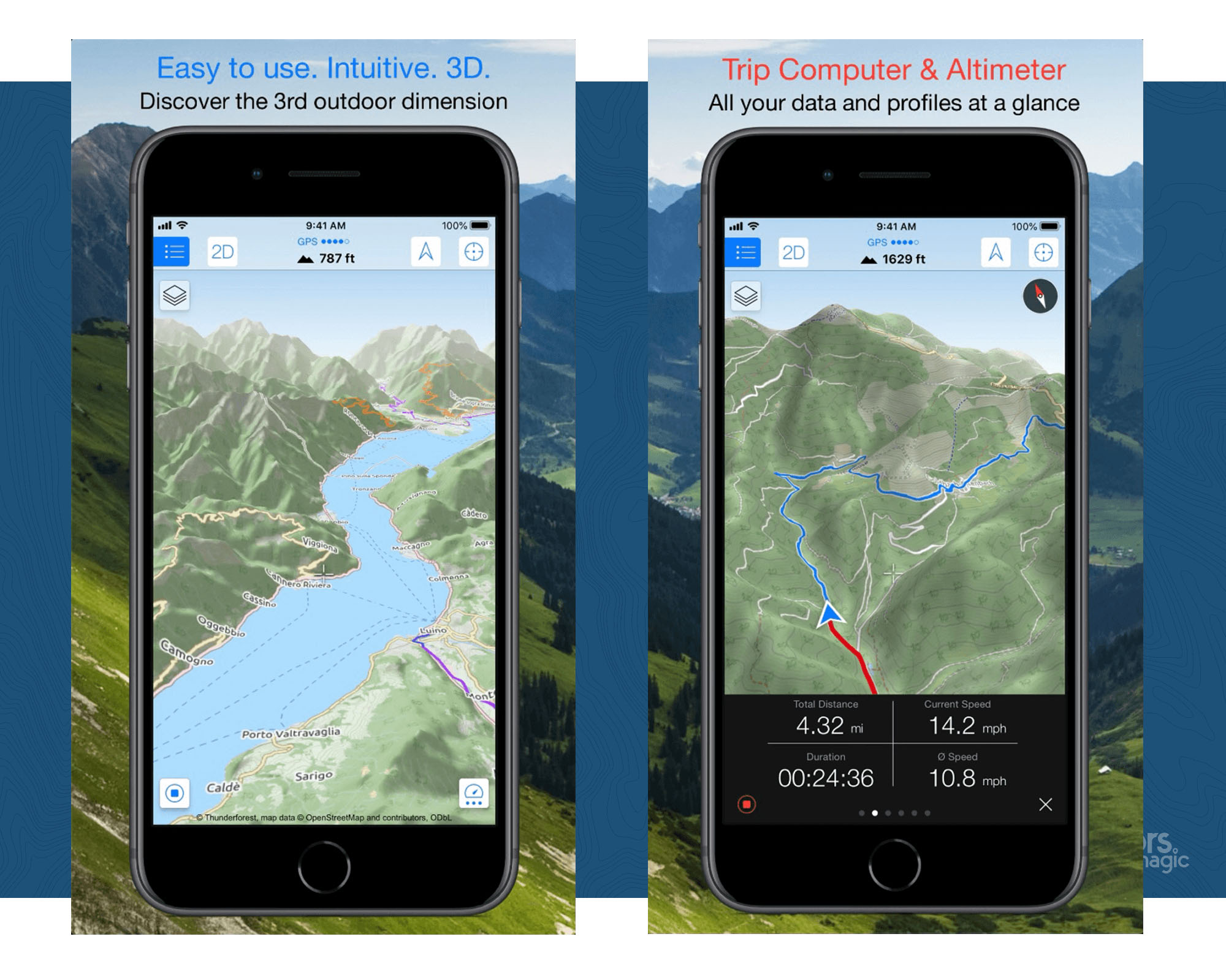
12. Maps 3D Pro
Price: £3.99 with in-app purchases
Available on: iOS
Key attributes: 3D viewer
Best for: 3D Visualisation
Offline use: Yes (if pre-loaded)
Maps 3D Pro is for the adventurer who prefers to be able to visually see terrain rather than just drawings, basic graphics or map coordinates.
With the topography all demonstrated in 3D, it allows you to visualise and inspect sections of hikes, so you can see the right line to take up a hill, perhaps, or search for possible wild camping locations away from the trails. You can also view distant landmarks, contour lines, water sources, towns, points of interest and the like. These routes can be stored, used offline and shared with your family and friends.
Related: A Beginner’s Guide To Wild Camping In The UK
It’s worth noting that this is the only app on this list that’s exclusively available with iOS systems.
Read more: movingworld.de
Rating: 4/5
13. PeakVisor
Price: Basic: free, Pro: $23.99 annually
Available on: iOS and Android
Key attributes: Clever use of augmented reality, high level of detail
Best for: Mountain hiking and winter sports
Offline use: Yes, if pre-downloaded
As you might have guessed, PeakVisor is the best app for mountainous terrain and is said to ‘make you a superhero of outdoor navigation’. It has a very cool design and identifies mountains using your camera and device data. The app will then tell you where you are based on recognition of these peaks, giving you information about the surrounding areas including elevation levels, trails, summits, passes, viewpoints and much more.
Due to the level of detail PeakVisor provides on mountains, it’s also incredibly handy for skiing trips when you want to identity what’s around you or find specific ski resorts, mountain lifts, ski runs and the like.
On another note – this app is actually really fun to mess around with when you’re at home too. You can inspire adventures and identify mountains hundreds of miles away from the comfort of your own bed.
Read more: peakvisor.com
Rating: 3/5
Non-Hiking Outdoor Apps We Liked
Hiking and route-planning aside, here’s a little list of some useful (and fun) outdoorsy apps we’ve also been using at the moment.
- What3Words
- Geocaching
- Cairn
- Knots 3D
- First aid by British Red Cross
- AuroraWatch
- Surfline
Why We Love Hiking Apps
Take my most recent trip to Bannau Brycheiniog (Brecon Beacons National Park), for example. Now I’ve been to Wales quite a few times in my life, but I’m by no means an expert. Most of the time I’ll either visit somewhere I’m recommended by a friend, or I’ll do some research online and hope for the best. This time, however, I found myself dogsitting in an old rectory house just outside of Abergavenny (don’t ask).
Anyhow, I thought I’d try out a hiking app for a change, so I hopped on Komoot and had a browse of the local hiker’s recommendations. I pretty much clicked on one of the nearby ‘hiking highlights’, thought the pictures looked nice, and just went for it.
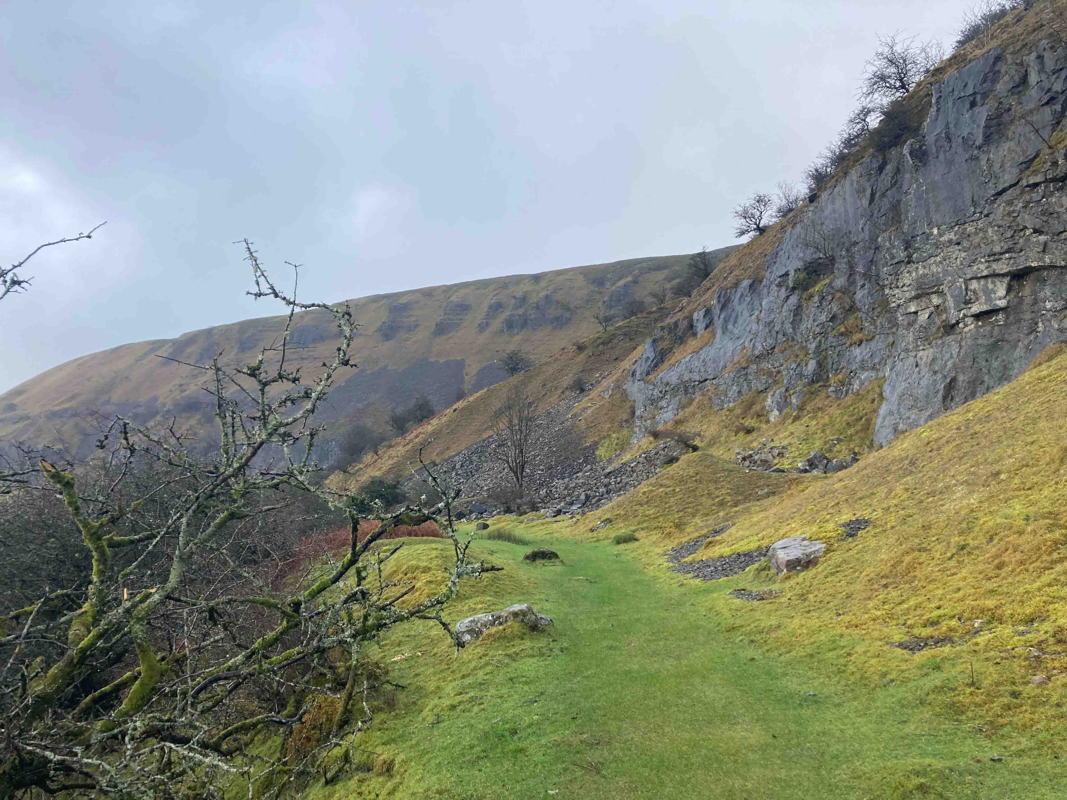
To my surprise, despite an intense downpour halfway through, it turned out to be my favourite hike in Wales so far. Specifically, it was a loop in the Craig Y Cilau Nature Reserve circling Eglwys Faen, a cave on Llangattock mountain. Including a mixture of muddy paths and steep ascents; the loop takes you alongside limestone escarpments, towards Eglwys Faen, and then back along moss-laden paths.
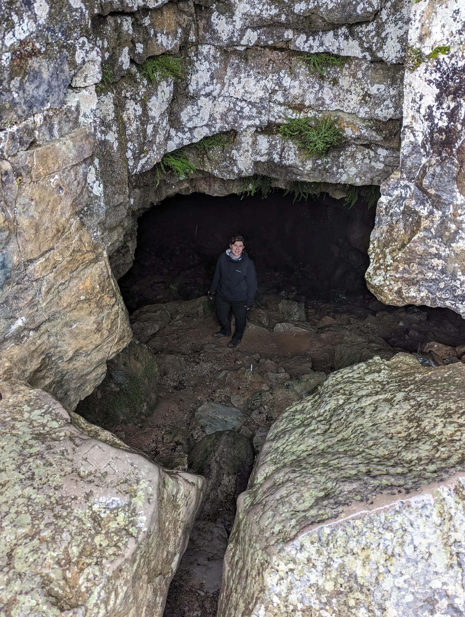
There’s even parts of the cave that you can walk straight into (see picture below, ignore facial expression). Note: there’s also parts of the cave that you shouldn’t enter without trained caving professionals.
What is the point of all this, I hear you ask…Well, the moral of the story is that I’d never have found this walk without using a hiking app. I’m sure it’s no secret to a local, or someone who’s actually from Wales. But to me, it felt like a hidden gem. Since then, I check the community recommendations on my hiking apps pretty much everywhere I go. You really never know what you’re going to find.
Main Photo: Outdooractive
You May Also Like:
Best GPS Watches
Long-Distance Walking Is Brilliant For Your Mental Health – Here’s The Evidence
5 Of The Best Scrambling Routes In Snowdonia