From the green hills of Pembrokeshire and the woodlands of Exmoor, to the dales of the Lake District and glens of Scotland, while the UK has some stunningly wild spots, you’re never too far away from a good pub. We’ve called upon five pub walking enthusiasts, including the author of CAMRA’s Wild Pub Walks and Britain’s ‘beer writer of the year’, to help us pick out some of the highlights across our fair isle.
Borrowdale, Lake District
Start/Finish: YHA Borrowdale
Distance: 5 miles*
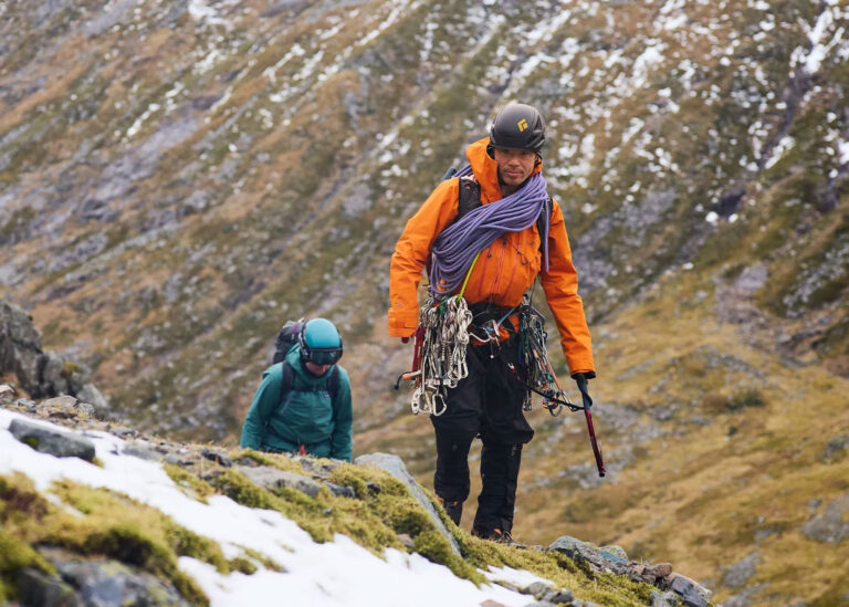
Recommended by: Alan Hinkes, legendary mountaineer and Fjällräven gear ambassador.
“From some viewpoints Castle Crag looks impregnable: a rocky fortress-like, mini fell plonked in the middle of Borrowdale, partly blocking the main valley and creating a gorge on its western flank known as ‘the Jaws of Borrowdale’.”
“The walk from the YHA is an easy bimble along a riverside path with a steepish rocky ascent to the summit. The view from the top is impressive for such a relatively short walk. To the north there is Skiddaw and Blencathra, to the south Great End and Scafell Pike, England’s highest mountain. Once safely back down in the YHA you can enjoy a cask beer in this interesting and cosy bar with a good selection of beer.”
Malham Cove and Gordale Scar, Yorkshire Dales
Start/Finish: Malham
Distance: 5 miles
Recommended by: Athena Mellor, founder of Ramble Guides
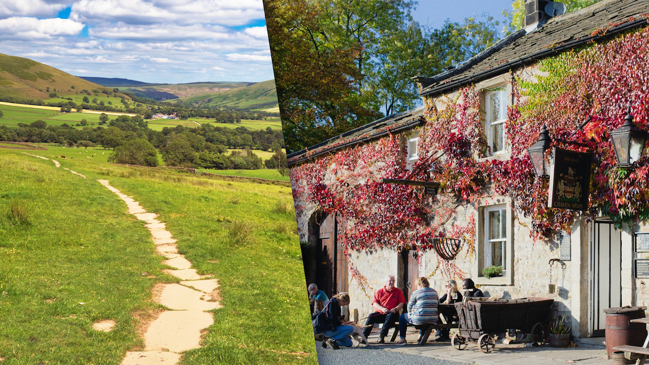
“A hike that ends with good pub grub is one that I love; though ‘grub’ might not be the right word to describe the food at The Lister Arms in Malham which serves traditional, home-cooked dishes displayed like mouth-watering art on your plate. Devour it in their lovely garden or in front of the log-burning fire in their cosy dining room after a walk around Malham Cove and Gordale Scar; two of the Dales’ most iconic settings.”
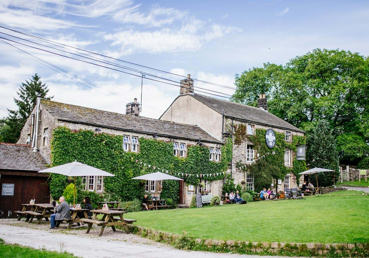
“The village of Malham and its encompassing natural features are popular with walkers and climbers alike. The historic, picturesque village is surrounded by Yorkshire limestone and there’s a gentle stream that meanders through it.”
Vale of Edale, Peak District
Start/Finish: Bamford
Distance: 13 miles
Recommended by: Daniel Neilson, author of CAMRA’s Wild Pub Walks.
“The Vale of Edale sweeps down from the mighty Kinder Scout in the north and up to the ridge between Lose Hill and Mam Tor in the south. In between, the seemingly year-round verdancy of the vale is a proud sight.”
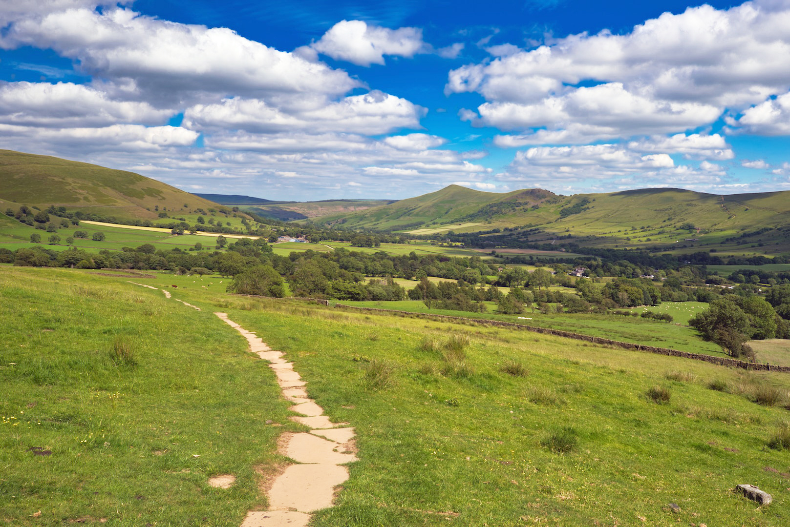
“This is a walk that offers 360-degree views over the best of the Peak District before seeking out some of its finest pubs. It starts out from Bamford to summit Win Hill before dipping down and back up again to Lose Hill, before descending into Hope and to the quaint old Cheshire Cheese.
“This is a delightful old pub that was originally built in 1632 as two cottages. The cottages sat on the route for sheep drovers and before then salt merchants. It’s the kind of pub that has a collection box for the local mountain rescue team and therefore it’s the kind of pub I like. The final cross-country walk brings you back to Bamford and the community-owned Anglers Rest.”
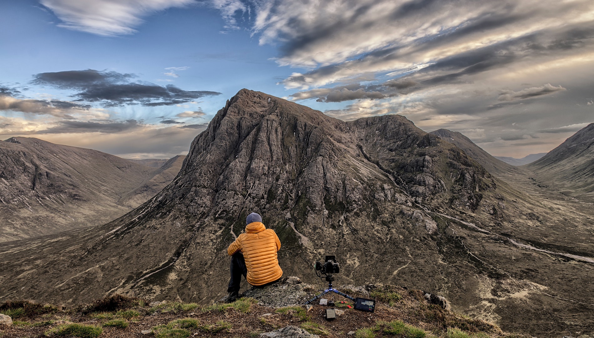
Glen Coe and Buachaille Etive Mòr
Start/Finish: Altnafeadh car park
Distance: 8 miles
Recommended by: Daniel Neilson, author of CAMRA’s Wild Pub Walks
“Across the vast moorland plains of Rannoch Moor, a pleasingly pyramidal mountain guards the entrance to Glen Coe: the vast bulk of Buachaille Etive Mòr, shown to the world in James Bond’s Skyfall. It provides one of the most beautiful high mountain walks in the area.”
“It would also be impossible to write about this area without the inclusion of the Clachaig Inn, probably the most important pub in Scotland for mountaineering history. Just a glance around the walls informs you of this inn’s importance (look out for signed pictures of some of the world’s greatest mountaineers including Doug Scott and Alan Hinkes).
“The walk itself – for experienced walkers and when there’s no snow on the ground – leaves from Altnafeadh and climbs steeply up Coire na Tulaich before ticking off the Munros of Stob Dearg and Stob na Broige. The return route dips down to River Coupall and back to Altnafeadh. It’s then a short drive to the Clachaig Inn and happiness.”
Crickhowell Circular, Brecon Beacons
Start/Finish: Bear Hotel, Crickhowell
Distance: 12 miles
Recommended by: Daniel Neilson, author of CAMRA’s Wild Pub Walks
“It’s not hard to see how the Black Mountains got their name: as the sun hides behind the cloud (as it does a fair bit in these parts), the lumbering hills of the area darken with dramatic effect.”
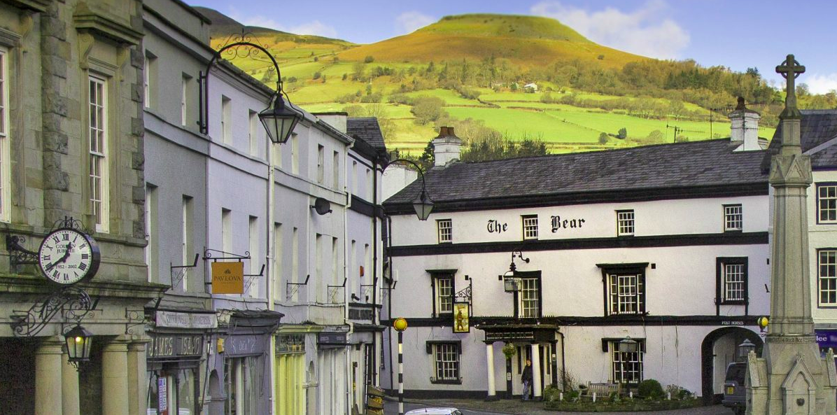
“The Black Mountains lie in the eastern region of the Brecon Beacons National Park and, while they don’t hold the magnetic draw of Pen y Fan in the west, these little-visited mountains offer a walk of solitude and probably the most magnificent views across southern Wales. This walk out of Crickhowell starts with a climb up to Table Mountain (Crug Hywel), an Iron Age hillfort. It then continues over Pen Cerrig-calch to Pen Allt-mawr and in a horseshoe around the high point of Waun Fach at 811 metres, before the long ridge walk back to Crickhowell. Back in town, The Bear Hotel is a busy pub, popular for its excellent locally-sourced food, as it has been since the 15th century when it opened as a coaching inn.”
Dulverton, Exmoor
Start/Finish: Dulverton
Distance: 8 miles
Recommended by: Adrian Tierney-Jones, beer writer of the year. 2019 His latest book, The Seven Moods of Craft Beer, is available in all good book shops.
“Depending on how thirsty you are, there is a pint or two at the start and the end of this rewarding hike that begins in the charming small town of Dulverton, often termed as the ‘gateway to Exmoor’.”
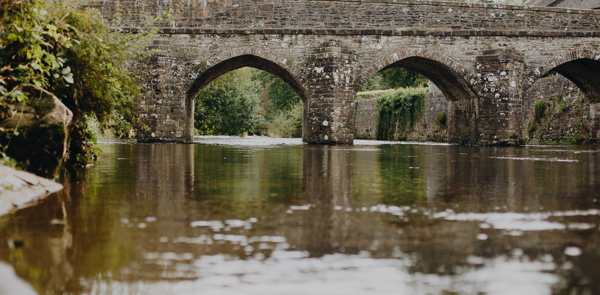
“You leave the town over the old bridge that spans the River Barle, a much less celebrated river of Exmoor, but just as beautiful as the Exe in its journey across the moor. Oh, and just in front of the river is the Bridge Inn, a cosy pub from the 19th century, where fires glow in the hearth in the winter and the sun shines on the sparkling waters of the Barle in the summer.
“The walk takes in a steep ascent through Burridge Woods, from which there are views over the town, then it follows over dale and field, through woodland, out on the exposed lower slopes of the moor and returns alongside the bubbling, broad-shouldered Barle as it strolls back into town with the promise of a pint or three at the Bridge. Take a dog, it’s even more fun.”
Preseli Hills, Pembrokeshire
Start/Finish: Tafarn Sinc, Rosebush
Distance: 5 miles
Recommended by: Will Renwick, Outdoors Magic editor
“While there are certainly some fine pub walks to be had along Pembrokeshire’s coastline, my favourite within the national park is actually inland within the Preseli Hills, a sort-of mini mountain range that possesses a wildness to match the Brecon Beacons, even despite the fact the highest point is a modest 536m.”
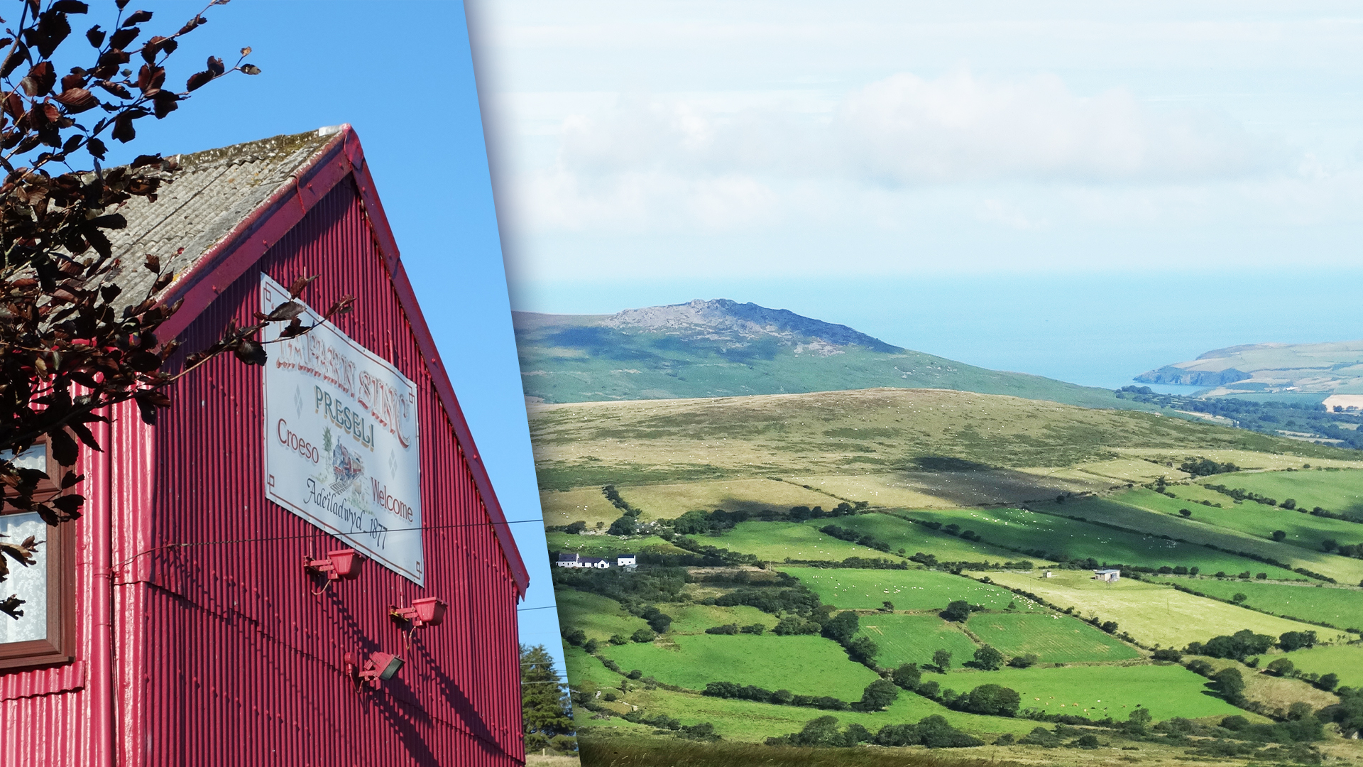
“My recommended walk here starts at the village of Rosebush, where you’ll find Tafarn Sinc, a pub that ’refuses to bow to the whims of modernisation’ as stated by the owners themselves,. The structure is made from red-painted corrugated iron, giving it the appearance of a workman’s shed, while inside, you’ll find sawdust-coated floorboards, a log burner, and photos adorning the walls that reveal the village’s stone quarrying heritage. A track from behind the pub will take you on a short and sharp walk to the top of Foel Cwmcerwyn which, on a clear day, will provide one of the finest views in Wales. You can see the Gower Peninsula, the islands of Skokholm, Ramsey, and even lonely Lundy off the coast of Devon. I’ve also seen Snowdon from here before, across the wide stretch of Cardigan Bay.”
“Once you’ve climbed Foel Cwmcerwyn you can then walk along the spine of the Preseli Hills on the ‘Golden Road’, which is believed to have been some kind of Neolithic ‘superhighway’. Or you can simply loop down through the forestry and back to the pub for some good cwrw (beer).”
* Distances stated are rough and should be considered the minimum.
For More Like This:
The Best Walks In The Peak District