News | Komoot Launches Brand New 'Trail View' Feature - Outdoors Magic

Outdoors Gear, Equipment, News, Reviews, Forums, Walking Routes and More at OutdoorsMagic.com

Share

News

News | Komoot Launches Brand New ‘Trail View’ Feature

Get a better understanding of the trail ahead with komoot's handy 'Trail View' technology, a proprietary new feature bringing maps to life

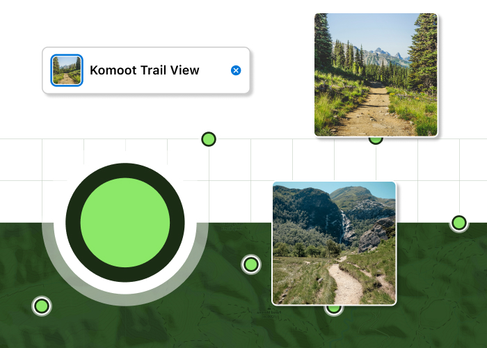
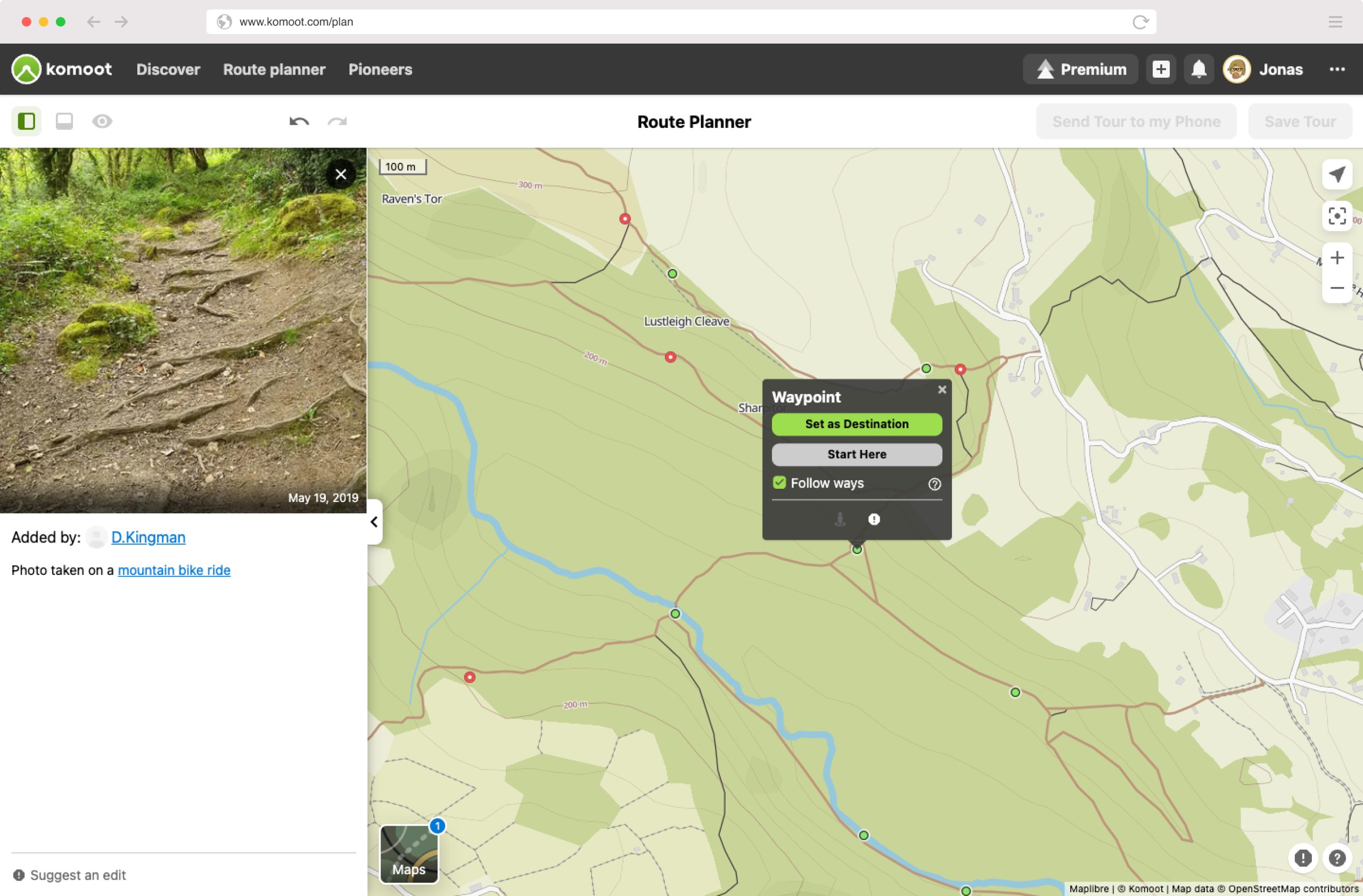
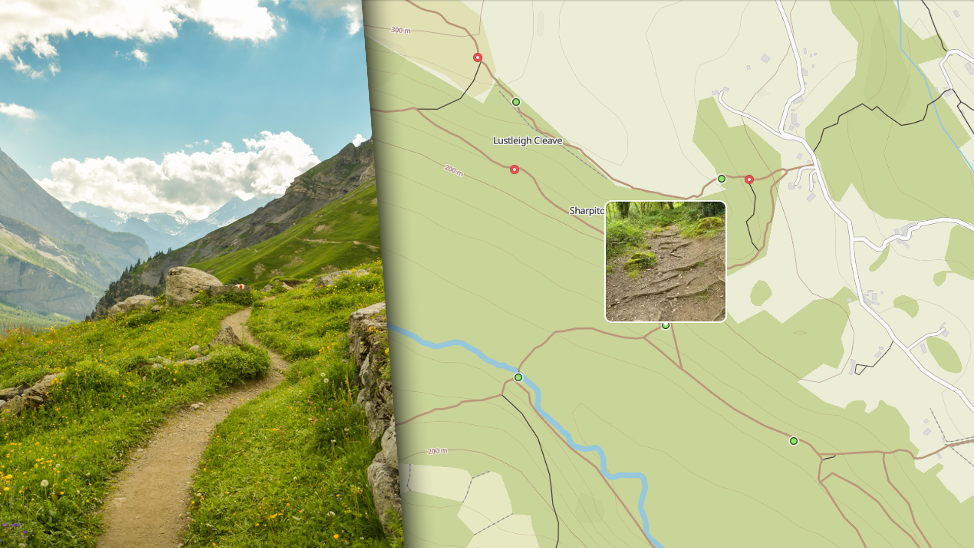
Outdoor navigation experts komoot have just launched a brand-new picture-led feature for their app and website called ‘Trail View’ .

In short, it’s an AI-powered image recognition technology that identifies user-uploaded photos of trails around the globe. The best of these trail photos are then featured to help users make better-informed decisions as to whether a specific path is suitable for their chosen sport or experience level.

Selected from over 15 million images uploaded by Komoot’s 28 million users, the photos are scanned using an AI-powered image recognition technology that identifies clear pictures of trails that are without any distractions. That means images with faces, animals and buildings won’t meet the criteria, but straightforward pictures of paths, tracks and bridleways will.

It’s a bit like Google Street View in this sense, but more user and community oriented.

“Trail View is such a great example of how innovation and AI intersect to empower people to plan better tours with confidence.”

Jonas Spengler, CTO at komoot commented: “Product development at komoot is geared towards leveraging the power of our outdoor collective out on the trails and finding innovative ways to enhance their outdoor experience by connecting everyone’s knowledge. And Trail View is such a great example of how innovation and AI intersect to empower people to plan better tours with confidence.”

The imagery will show up as green dots on the Trail View map layer in komoot. When clicked, you’ll find the best photos contributed by other komoot users who’ve been on that trail already. Not only is this handy if you’re more of a visual learner, it’s also useful if, for example, you’re going bikepacking and want to visualise exactly what the terrain looks like for your journey. You’ll then be able to make better-informed decisions about what to bring and can gain an understanding of how easy or difficult the adventure might be.

The brand also say it could help with safety in the outdoors as users can warn each other about obstacles on paths or loose and unstable terrains by taking photos and uploading them.

According to Lael Wilcox, ultra-endurance cyclist and komoot ambassador: “With Trail View, I can easily see if a trail is something for me or not. I can see if it’s rideable or if there are photos of obstacles that somebody took recently. It also means I can scout a whole area that I am not familiar with and get a feeling for the trails and roads I’m going to be riding.”

Related: Lael Wilcox Interview

Trail View is available for all komoot users via the komoot web platform, try it here, by selecting the Trail View map layer: https://www.komoot.com/plan

Newsletter Terms & Conditions

Please enter your email so we can keep you updated with news, features and the latest offers. If you are not interested you can unsubscribe at any time. We will never sell your data and you'll only get messages from us and our partners whose products and services we think you'll enjoy.

Read our full Privacy Policy as well as Terms & Conditions.

production