Best Bikepacking Routes UK | 10 Long-Distance And Off-Road Cycling Tours - Outdoors Magic

Outdoors Gear, Equipment, News, Reviews, Forums, Walking Routes and More at OutdoorsMagic.com

Share

How To Guides

Best Bikepacking Routes UK | 10 Long-Distance And Off-Road Cycling Tours

Thinking of getting a multi-day cycle in your calendar for this summer? Here are some of the best bikepacking adventures you'll find throughout the UK – and what you can expect to encounter on each one

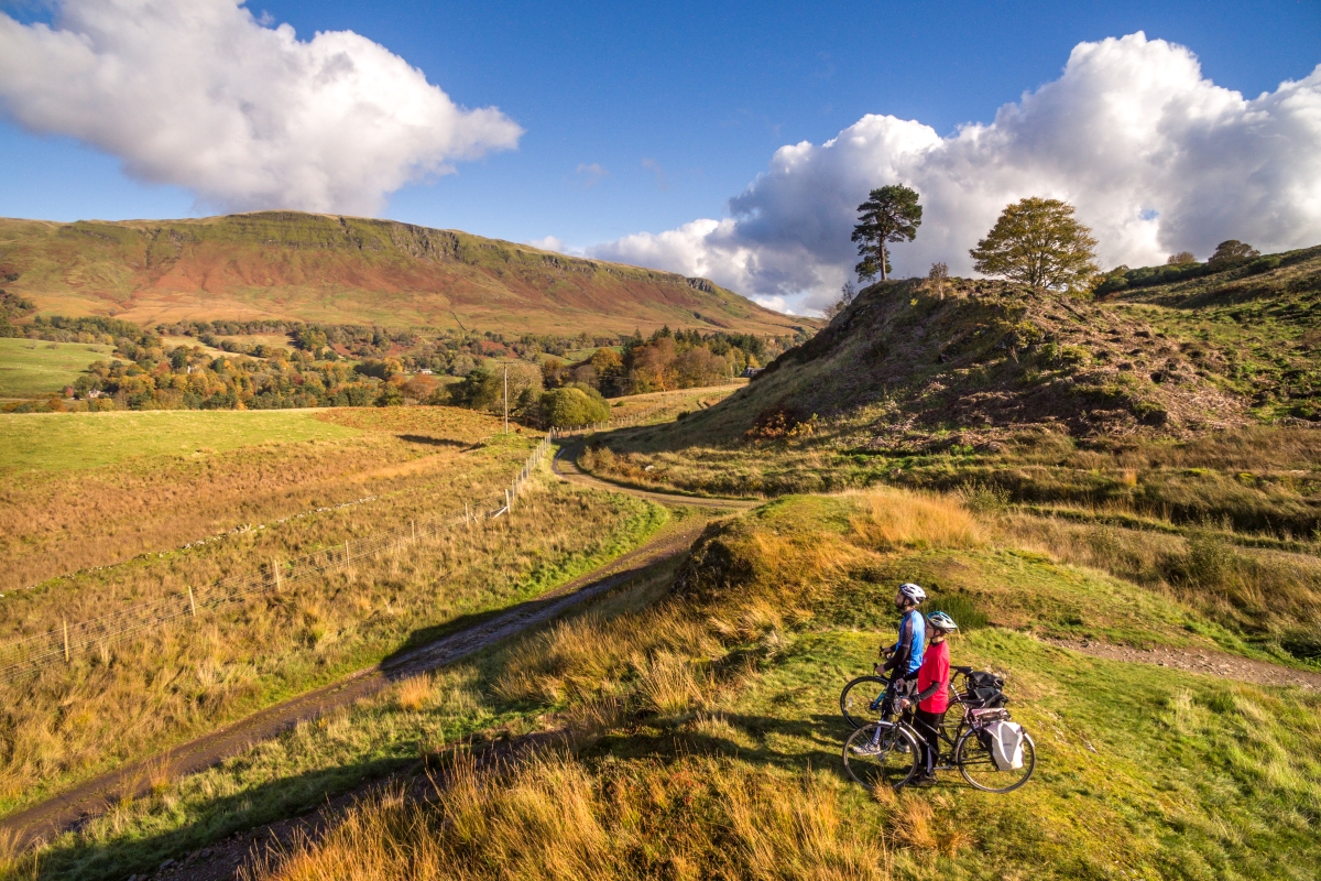
Bikepacking is one of the most rewarding ways to explore the eclectic landscapes of the UK. Self-sufficiency and adventure are at its core and it’s perfect for those seeking the roads less travelled in all their wild and untamed glory. With the right training and equipment, and hopefully a little luck in the way of weather, you’ll be in for a truly unforgettable experience, being able to sweep across some of the most iconic vistas these lands have to offer.  
 
Combining the speed of a bike, and the minimalist nature of backpacking gives you the opportunity to venture further, taking in far more sights and scenes on the way than you would on foot and still bringing about that feeling of wanderlust as well. You might scale (or hike-a-bike) a mountain, follow the meandering shores of a loch and travel down an old Roman road, all in a day’s ride, and hopefully with the wind always at your back.

For more technical info on bikepacking, check out our in-depth bikepacking guide we recently published. Looking for a cycle-touring route? There are plenty of routes here that’ll fit that type of trip – particularly if you’ve got your bike geared up for gravel. By the way, our friends at our sister title Mpora have covered the differences between cycle touring and bikepacking – just in case you were wondering.


The Top 10 Best Bikepacking Routes in the UK

  • LEJOG (Land’s End to John O’Groats)
  • King Alfred’s Way
  • Lakeland 200
  • The Pennine Bridleway
  • The Northern Irish Coast (Ballyshannon to Larne)
  • West Highland Way
  • Highland Trail 550
  • John Muir Way
  • Sarn Helen
  • The Trans-Cambrian Way


LEJOG (Land’s End to John O’Groats)  


Start / Finish:
Land’s End
to John O’Groats. The above route is one of many variations.  
Distance:
 874 + miles / 1407 km
Days: 
10 to 21 

Spanning across the entire length of the British mainland, LEJOG begins in the south-west corner of England, and ends in the most north-easterly point of Scotland. Though you can complete the route from north to south, the south to north route tends to be the more popular direction as it follows the prevailing south-westerly winds of the UK. The traditional distance is 874 miles, though some routes can extend to 1,189 miles depending on which areas you are keen to explore, and which hills you might be hoping to avoid… 
 
This journey is regarded as the grandaddy of all bikepacking routes in the UKDue to its sheer length, you are likely to come across just about every type of terrain there is within these shores. From wild greenways, to bike-friendly country roads, to muddy hills; prepare for it all. In this sense, all-terrain, hybrid and touring bikes are recommended.  
 
On this journey mapped out above, you’ll overlap with the Cornish Way, the West Country Way, the Avon Cycleway, the Pennine Cycleway, the Cheshire and Lancashire Cycleways, the Lochs and Glens Way, amongst others. Passing through national parks all across the UK, you’ll never be short of magnificent views and places to stop and explore. 


King Alfred’s Way

Start / Finish: Winchester
Distance:
217 miles / 350 km
Days:
3 to 6

The King Alfred’s Way is a tour around the heartlands of the ancient kingdom of Wessex, starting and finishing at the statue of its legendary ruler and arguably one of the most famous Britons of all time.

The journey, which was only launched as recently as August 2021, follows ancient transport routes and visits old battlegrounds, with historic sites including Winchester and Salisbury cathedrals, Old Sarum hill fort, the Devil’s Punch Bowl, Roman roads, Saxon camps and Iron Age hill forts, and castles.

As a mostly off-road route, gravel and touring bikes are recommended. Fortunately this is one trail where you are never too far from towns and railways stations should anything go awry. The terrain includes gravel tracks, rolling hills, pastures, heathlands, bridleways, and towering woods. Making use of the North Downs Way, the South Down Way, the Thames Path, Pilgrim’s Trail and the Ridgeway, you can combine multiple routes if you fancy straying from the traditional trail, or simply elongating your travels.


Lakeland 200

Start / Finish: Staveley 
Distance:
127 miles / 204 km
Days:
2 to 4

Set in the Lake District National Park, with roughly 21646 ft of total ascent, this route is definitely a challenge. Having said that, if you want to push yourself even further, there’s also a Lakeland 300 route spanning 186 miles. Mountain bikes are recommended for both.  
 
This loop of the mountains and lakes of this beautiful part of the world traditionally begins in Staveley, and goes clockwise around the national park. Involving bridleways through forests, hike-a-bike climbs up mountains, narrow tracks through bogland, and some rocky, cross-country terrain, this is a classic ride for those who want an authentic, off-road, bikepacking experience. 


The Pennine Bridleway 

 
Start / Finish: South Peak Distinct to Yorkshire Dales 
Distance: 205 miles / 330 km 
Days: 3 to 5

Beginning in the south of the Peak District, traditionally in Wirksworth, and finishing in the Yorkshire Dales, this is the longest off-road trail in the UK. Initially founded by Mary Towneley, The Pennine Bridleway has since been elongated, traversing across the Pennine hills, otherwise known as the backbone of England. 
 
You will be riding mostly on bridleways, tracks through peat bog, old-timey country roads and some ancient packhorse trails used in centuries gone by. With some technical descents and quite a few tough climbs, gravel or mountain bikes are recommended for this route. 
 
As you reach the Yorkshire Dales the area becomes more remote, and open moorlands expand for milesfinishing at the tip of the Dales in Kirkby Stephen where you can toast the end of your journey in one (or two) of the market town’s pubs. 

Photo: johnmuirway.org
Photo: highlandtrail.net

The Northern Irish Coast

Start / Finish: Ballyshannon to Larne  
Distance:
281 miles / 452 km
Days:
4-8 

Due to the unique terrain combined with limited rights of way in Northern Ireland, this route is predominantly on public roads, though it is still a challenging ride, boasting some of the most magnificent views the Northern Irish Coast has to offer. The more straightforward route extends for roughly 213 miles, however, the traditional route found here, includes two loops and extends for 281 miles. 
 
This route begins in Ballyshannonon the coast of Donegal, so if you fancy surfing as a warm-up, Rossnowlagh beach comes highly recommended. From here, you travel through the Fermanagh lakelands, passing the stunning landscapes of Lough Erne, and onwards to Derg valley and the looming Sperrin mountains.
 
Riding along the Foyle River to historic Derry, and onward to Castlerock, you finally reach the Antrim coastline, known globally for the Giant’s Causeway and the Bushmills distilleryFrom here you can go on to explore the Glens of Antrim, and the winding coastal roads to Larne. Clinging to hillsides, this part of the journey can be a tough ride, but the views of the coast (and out to Scotland) and rolling landscapes of the Emerald Isle are worth the journey (and exertion!)


West Highland Way

Start / Finish: Milngavie to Fort Wiliam 
Distance: 
96 miles / 154 km
Days:
1-3

Originally designed as a walking route, the West Highland Way is another testing ride, with a total of 9,150 feet of ascent in just 96 miles.
 
Beginning in Milngavie (pronounced ‘mil-gai’), just north of Glasgow, this trail passes through some of the most stunning landscapes of the Scottish Highlands, including Loch Lomond and The Trossachs, the Falls of Falloch, Rannoch Moor, Glencoe, Glen Nevis and Munros such as Ben Lomond, and Ben Nevis.
 
Due to the changeable weather on the west of Scotland, spring and summer are the ideal times to tackle this trail, though beware of the infamously feisty Highland midge (with the swarms tending to be at their worst at the height of summer). As wild camping is permitted in Scotland, you’ll have a plethora of unique spots to choose from, as well as bothies to shelter in during any besieging weather conditions.


View this post on Instagram


A post shared by West Highland Way (@westhighlandways)


Highland Trail 550

Start / Finish: Tyndrum
Distance:
550 miles / 885 km
Days:
4 to 14 

At 550 miles and with a hefty amount of ascent to deal with this is another of the UK’s big ones.

Related: Bikepacking The 321km Badger Divide

From nature trails and quiet gravel roads to technical climbs and steep rocky descents, this trail covers it all. Starting out at Tyndrum, it passes over the Lyon and Gaur river valleys then goes around Ben Alder and through Fort Augustus. The Northern Loop then takes you into Fisherfield Forest, passing Loch Maree and the waterfalls and mountains of Glen Affric and Glen Nevis.

The final stretch then crosses over the Devil’s Staircase, the highest point of the journey. As you can imagine; it is no small feat, with May to June the recommended window to take it out.

John Muir Way

Start / Finish: Dunbar to Helensburgh 
Distance:
134 miles / 215 km
Days:
1 to 4

Venturing south to the Scottish Lowlands, we have this coast-to-coast trail called the John Muir Way. Known as one of Scotland’s ‘Great Trails’, the route is based on the journey by conservationist John Muir, as he travelled from his birthplace in Dunbar, to the west coast of Scotland, with the aim of travelling across the Atlantic to America. With an 8829 ft ascent, many, howeverchoose to travel from west to east to have the winds at their back. 
 
Opened in 2014, the John Muir Way passes through Scotland’s first national park, Loch Lomond and The Trossachs, as well as ancient Roman areas of interest such as The Antonine Wall and its forts. Crossing through parts of the West Highland way at points, this route has similarly varied terrain, though there are some cycle braids and branches, should you seek a little respite.   
 
Other highlights include, the east Lothian coastal scenery, the Glengoyne distillery, as well the rolling farmlands of more central parts of the route. For a more in-depth description of the John Muir Way, check out this full account of cycling the John Muir Way over on our sister site Mpora.


Sarn Helen  

Start / Finish: Conwy to Gower 
Distance:
160 miles / 260 km
Days:
4 to 7

Another coast-to-coast route, Sarn Helen begins in Conwy and makes its way down Wales towards the Gower peninsula. This route takes its name from Celtic saint, Helen of Caernarfon, who, according to legend, ordered the building of roads in Wales around the 4th century. The roads are actually mostly Roman made, with plenty of relics from those invaders to be seen along the way.

The route takes in Snowdonia National Park, with panoramic views of Llyn Cowlyd; the Cambrian mountains; Elan Valley; the wilds of the Brecon Beacons and then finishes at Worm’s Head at the tip of the Gower Peninsula. A mountain bike with a good range of gears is recommended for these Welsh hillsides while spring and summer months are the time to go if you want the best chance of dry trails.


The Trans-Cambrian Way

Start / Finish: Knighton to Dyfi Junction 
Distance:
110 miles / 177 km
Days:
3 to 5

Stretching across the heart of mid Wales, the Trans-Cambrian Way begins on the English border in Knighton and ends by the Irish sea at Dyfi Junction. Though it is one of the shorter routes, it still involves some tough terrain, likened to a rollercoaster ride, with a total ascent of 10,525ft.

You’ll cut across the Cambrian mountains, the oldest mountain range in Europe, as well as the remote valley of Cwmystwyth with its mines that date back to 1500 BC. The wild Elan Valley is another highlight, a network of man-made reservoirs and dams situated in amongst heather-laden hills.

Though, like England, wild camping isn’t strictly legal in Wales, it’s certainly still possible if it’s done respectfully. There are also a few bothies to shelter in along the way. Plenty of B&Bs and campsites to plan your route between too.

Main Photo: iStock/ roibu

You May Also Like:

Best Bikepacking Tents | Buyers Guide

Best Bikepacking Bikes | Buyers Guide

Best Bikepacking Bags

Newsletter Terms & Conditions

Please enter your email so we can keep you updated with news, features and the latest offers. If you are not interested you can unsubscribe at any time. We will never sell your data and you'll only get messages from us and our partners whose products and services we think you'll enjoy.

Read our full Privacy Policy as well as Terms & Conditions.

production