Walking the West Highland Way | How To Walk It - Outdoors Magic

Outdoors Gear, Equipment, News, Reviews, Forums, Walking Routes and More at OutdoorsMagic.com

Share

Outdoor Features

Walking the West Highland Way | How To Walk It

Savouring a first taste of long-distance walking on a 96-mile hike through some of the finest landscapes to be found in Scotland

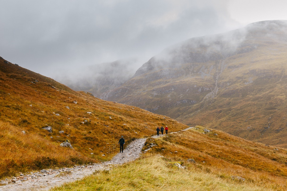
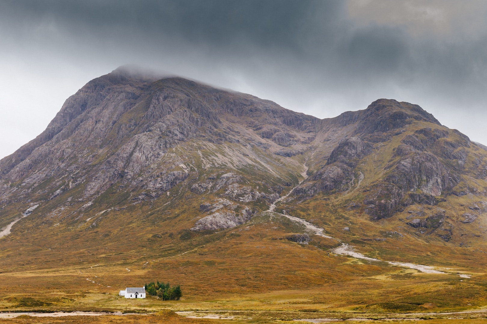
The West Highland Way is one of the UK’s most popular trek running from the edges of Glasgow, along the banks of Loch Lomond (the bonnie ones), into the Highlands and then on to Fort William. Here’s Athena Mellor’s account of her solo journey along it. 

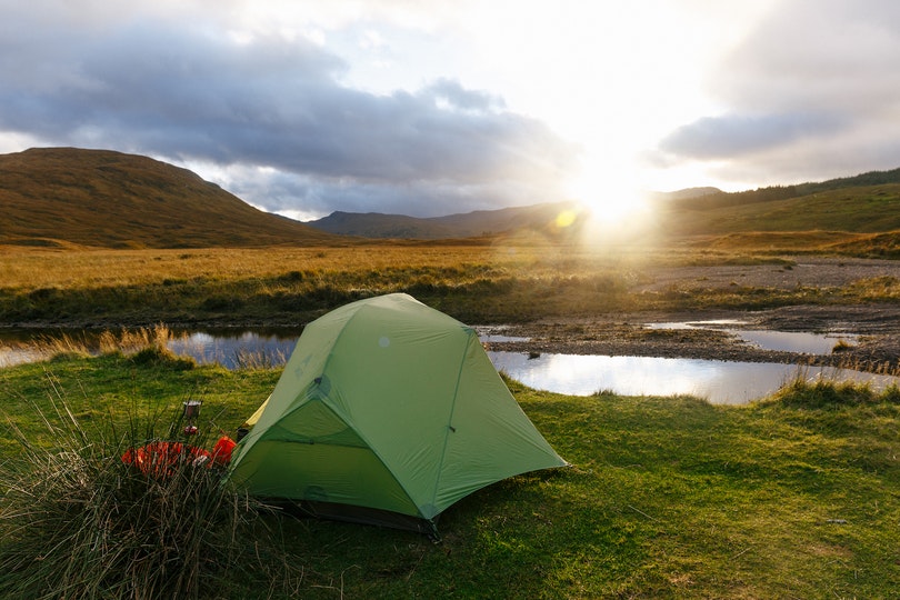
There was a distinct ruffling of leaves coming from somewhere over my right-hand shoulder and seconds later my waterproof coat, which I’d hung outside my tent to dry, fell mysteriously to the ground. Minutes earlier, I had heard the creaky opening and closing of a gate on the West Highland Way, just 50ft from where I had decided to pitch. My heart hammered out of my chest as I considered who could be lurking outside. At that moment, a bright glow lit up the green wall of my tent and I sat stark upright attempting to control my breathing. Then I slowly unzipped the door and nervously peered into the direction of the light. There, I saw a full moon suspended in the sky, just peeping between two pines and beaming into the forest clearing where I was camped.

It was not what I had expected to see; the sight was breathtakingly beautiful.

It was my first ever solo wild camp and I was a little on edge. I had walked 12 miles since 2pm that day until I could barely walk anymore due to fading light and energy, and I’d flung my big backpack down at the first moment possible without giving much thought as to whether or not the area was suitable.

Though I failed to sleep a wink all night, my first night on the West Highland Way showed me the true wildness of Scotland and I was already infatuated by it.

West Highland Way: The Lure of the Wild Lands

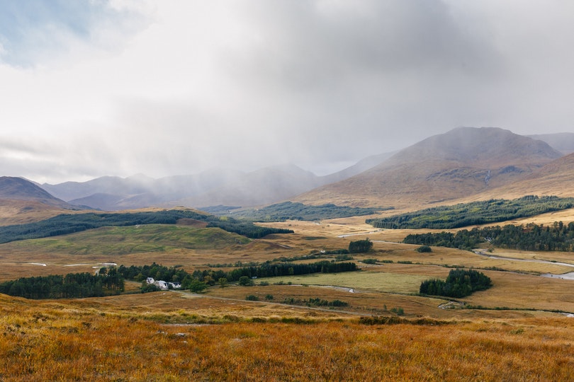
I don’t remember what made me want to walk the West Highland Way, all I can tell you is that it became a fixation. Perhaps it all began after reading and watching ‘WILD’ and making an oath to myself to complete the Pacific Crest Trail one day; this 96-mile long-distance hike in the Scottish Highlands – from Milngavie to Fort William – seemed like a good way to dip my feet into long-distance walking. Or maybe it was because the mundaneness of city life had me restless, and after previously spending four months cycling around New Zealand, a month on the road in the Pacific Northwest and three weeks backpacking around Italy, packing up once again and hitting the trail actually felt like the most natural thing in the world.

Yet though I was quite accustomed to 20-mile hill walks and cycle-touring trips in foreign countries, I was anxious at the thought of wild camping alone, and the long days in the hills with no one to complain to about the weight of my backpack.

Perhaps that fear is another reason why I decided to do it. And indeed, it turns out that walking every day with a heavy rucksack on my back and nothing much to think about but how beautiful the hills looked in their glorious autumn glow was my idea of heaven. The West Highland Way was my first long-distance hike and it undoubtedly sparked a fire in my legs and my heart to spend more time on the trails, and maybe one day to just keep walking.

The West Highland Way: In a Nutshell

Scotland’s first long-distance footpath, established in 1980, the West Highland Way runs from lowland to highland: from the urban outskirts of Glasgow to the picturesque shores of Loch Lomond, and from the wilderness of Rannoch Moor to the familiar romance of Glencoe.

“The landscape became noticeably more rugged once I reached the northern edge of the loch. Suddenly I was all-consumed by those distant hills I’d seen from atop Conic Hill a couple of days before…”

Despite its range of terrain, geology, flora and fauna, in summer, you don’t need any overly specialist kit for the hike – a good pair of walking boots, a warm sleeping bag and relatively lightweight tent are some of the main essentials. In fact, though I carried both a map and compass, I didn’t use them often (only really using the map for mileage). I soon become accustomed to looking for a small hexagonal symbol with a thistle inside that highlights the trail, much of which follows historic routes on old Highlander footpaths, farm roads and railway lines.

The author on the West Highland Way. Photo: Athena Mellor
Entering the Highlands. Photo: Athena Mellor
Sunrise from camp. Photo: Athena Mellor

The West Highland Way is the perfect inauguration to long-distance hiking; passing cafes, pubs and villages, and offering the option of staying inside in either a B&B, hotel, hostel or bothy every night. It’s even possible to have your bags transferred, so the only thing you have to carry is a day-pack. I, on the other hand, yearned for the wildness of the trail so was carrying around 16kg of gear with the plan to wild camp every night. I was hoping to finish the 96-mile hike in six days.

West Highland Way: Milngavie to Inveronan

Getting to the trailhead involves a train to Glasgow, and then a local train to a little village called Milngavie (pronounced “Mull-guy” I later discovered). In the centre of this small town, there is a plaque commemorating the start of the trail. It was a regular Monday at the beginning of October when I arrived here with my big backpack and camera slung over my shoulder. A friendly local man with a strong Scottish accent offered to take my photo, and despite the nervous look on my face, in my heart I was raring to go.

After that first sleepless night on the trail, my legs and spirits were awoken the next morning with a hike over Conic Hill. At 200m, Conic Hill gets its distinct shape from the Highland Boundary Fault which follows the alignment of the islands that are scattered through Loch Lomond. First visible from the top of the hill, the loch is followed for the next two or three days.

The view of Loch Lomond from Conic Hill

Despite my heavy eyes on the second day, I hiked around 19 miles to Rowchoish Bothy – a mountain hut nestled amidst woodland on the banks of the loch. Where once there were nine families, there is now just one cottage, converted into a bothy as a memorial to William Ferris, the founder of the Rucksack Club and former chairman of the Rights of Way Society. With room for over 10 people, I would definitely recommend staying at Rowchoish for a chance to meet other hikers on the WHW; sharing stories around the log-burning stove over hot chocolate and whiskey.

The landscape became noticeably more rugged once I reached the northern edge of the loch. Suddenly I was all-consumed by those distant hills I’d seen from atop Conic Hill a couple of days before; rolling moorland scattered with Highland cattle, wide glens and pine-covered peaks.

That afternoon was undoubtedly my favourite on the trail. The rainclouds parted and the sky became a hazy shade of blue as I walked towards the distinct 1000m bulk of Beinn Dorain, with its near-perfect bald peak and craggy banks. I was finally able to stuff my down jacket into my rucksack; wearing just a thermal baselayer and t-shirt as the sun beat down on my beaming face and my feet stomped on the wild Scottish ground beneath the watchful eyes of mighty Beinn Odhar, Beinn a’Chaisteil and Beinn Dorain.

Looking northwards on the trail to Beinn Dorain. Photo: Athena Mellor

West Highland Way: Inveronan to Fort William

I descended towards lovely Loch Tulla with its autumn-coloured banks, pitching my tent in a wildly beautiful campsite; a small clearing not far from the Inveroran Hotel, the base for some of the first meets of the Scottish Mountaineering Club in the 1890s.

Settling for the night beside a still pond that reflected the surrounding yellow moorland and distant hills, I was delighted to spot some stags grazing on the other side of the water, and as the sun went down I ate my three-minute pasta in complete contentment.

Yet the peaceful night’s sleep that I really needed turned into a sleepless and mildly terrifying experience as a rutting stag decided to stalk my tent all night. If you’ve ever heard the intensity of the noise that these stags make at this time of year, you’ll understand when I say that it was an experience I certainly won’t forget.

From Loch Tulla, the West Highland Way skirts the western edge of Rannoch Moor; a vast area of lochs, rivers, flora and fauna that’s often considered one of the last remaining wildernesses of Europe. It then ambles to Glencoe, passing the looming pyramid of Buachaille Etive Moor to then ascend the zig-zag path of Devil’s Staircase to 550m, the highest point on the Way. From here, there are panoramic views of the rising moorland around Kingshouse (namely Meall a’Bhuiridh, Sron na Creise and the Three Sisters of Glencoe) and the remarkable pass between the two Buachailles (Mor and Beag).

The final day on the trail is a short 13 miles from Kinlochleven to Fort William, the end of which offers excellent views of Ben Nevis – climbed by many West Highland Way walkers once Fort William is reached. By this point I had become somewhat addicted to the Scottish wilds; to getting lost in my thoughts as my boots pounded on the soil; to the weight of my backpack and having no phone service or time restraints. I think the weather had aligned with my mood that day, as rain became sun became cloud became rainbows, and I fluctuated between feeling a desire to walk as fast as possible to reach the finish line, and a great sadness that the adventure would soon be ending.

Hikers facing a typical ‘dreich’ day. Photo: Athena Mellor

That is the contradiction of doing a shorter long-distance walk like the West Highland Way; though it is the perfect escape from life for a while, it instills the greatest desire to just keep going.

Perhaps one day I will, I thought to myself. Indeed, for me at least, the West Highland Way opened a Pandora’s box of multi-day hiking across the world. Where next will my big backpack take me, I wonder…

West Highland Way Day-by-Day Breakdown

Day 1: Milngavie to Drymen – 12 miles – wild-camp
An easy day following foot-paths, tracks, and an old railway line. A trip to Glengoyne distillery may help you for those final miles…

Day 2: Drymen to Rowchoish – 19 miles – bothy
A morning hike over Conic Hill, take a break at St. Mocha Coffee Shop in Balmaha, views of Loch Lomond and the Arrochar Alps.

Day 3: Rowchoish to Crianlarich – 16 miles – hostel
Difficult and slow terrain for the remainder of the loch followed by a pleasant section through Glen Falloch. Take a detour to the quirky Drover’s Arms for lunch.

Day 4: Crianlarich to Inveroran Hotel – 14 miles – primitive campground
My favourite section of the trail. Outstanding mountain scenery with views of Beinn Dorain for the first part of the day. Stop at the Real Food cafe in Tyndrum. Descending towards Loch Tulla is breathtaking.

Day 5: Inveroran Hotel to Kinlochleven – 18 miles – campground
Skirting the western edge of the wild Rannoch Moor. Have lunch at the Kingshouse pub then ascend Devil’s staircase, before a long and somewhat tedious descent into Kinlochleven. A big day in the hills.

Day 6: Kinlochleven to Fort William – 13 miles – hostel
The final day involves a pleasant amble over the Lairigmor, before entering the forested area around Glen Nevis. A descent into Fort William, a wander through town and then you’re at the finish line! Head to the Grog & Gruel for a post 96-mile pint.


For More Like This:

Walking The Snowdonia Slate Trail

Walking The Cambrian Way

Bikepacking Scotland’s Badger Divide Trail

Newsletter Terms & Conditions

Please enter your email so we can keep you updated with news, features and the latest offers. If you are not interested you can unsubscribe at any time. We will never sell your data and you'll only get messages from us and our partners whose products and services we think you'll enjoy.

Read our full Privacy Policy as well as Terms & Conditions.

production