The Transcaucasian Trail (TCT) is arguably one of the most exciting long-distance hiking trails under development in the world right now. And the hard work’s not over yet.
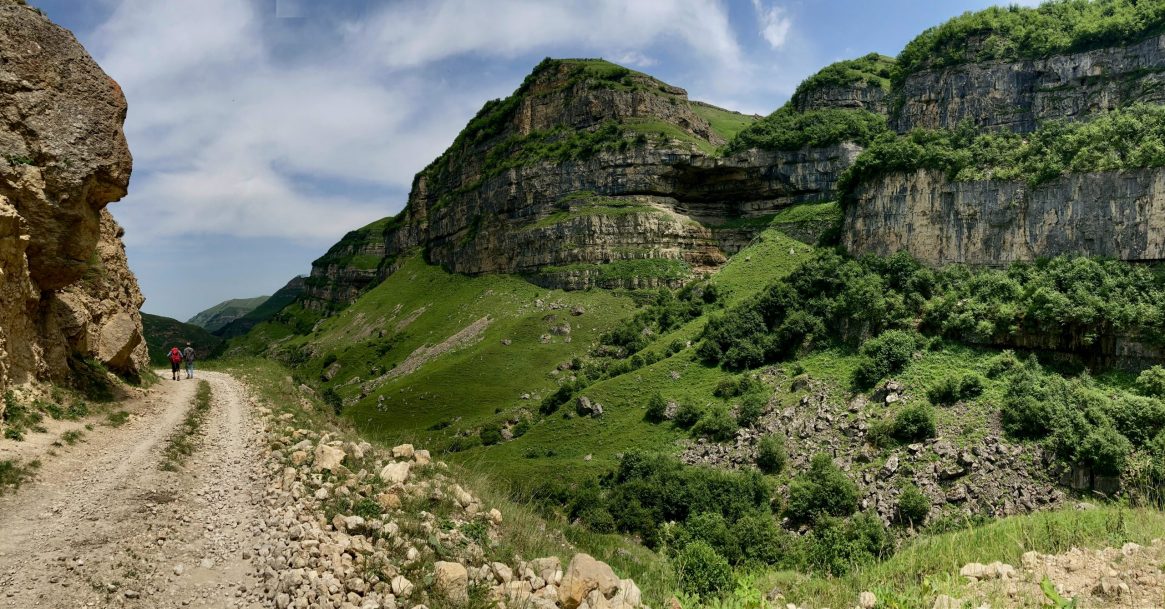
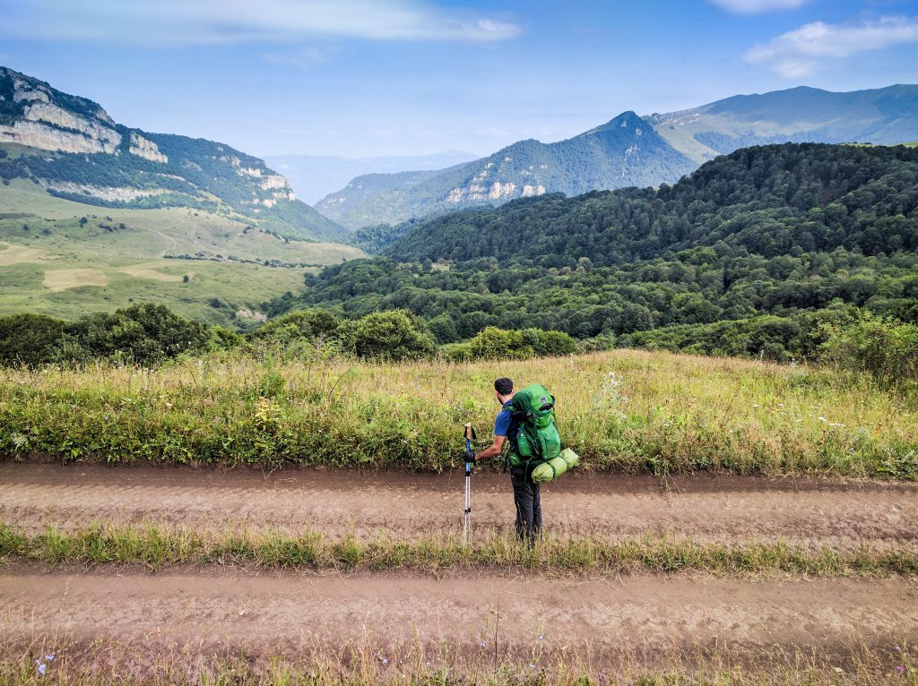
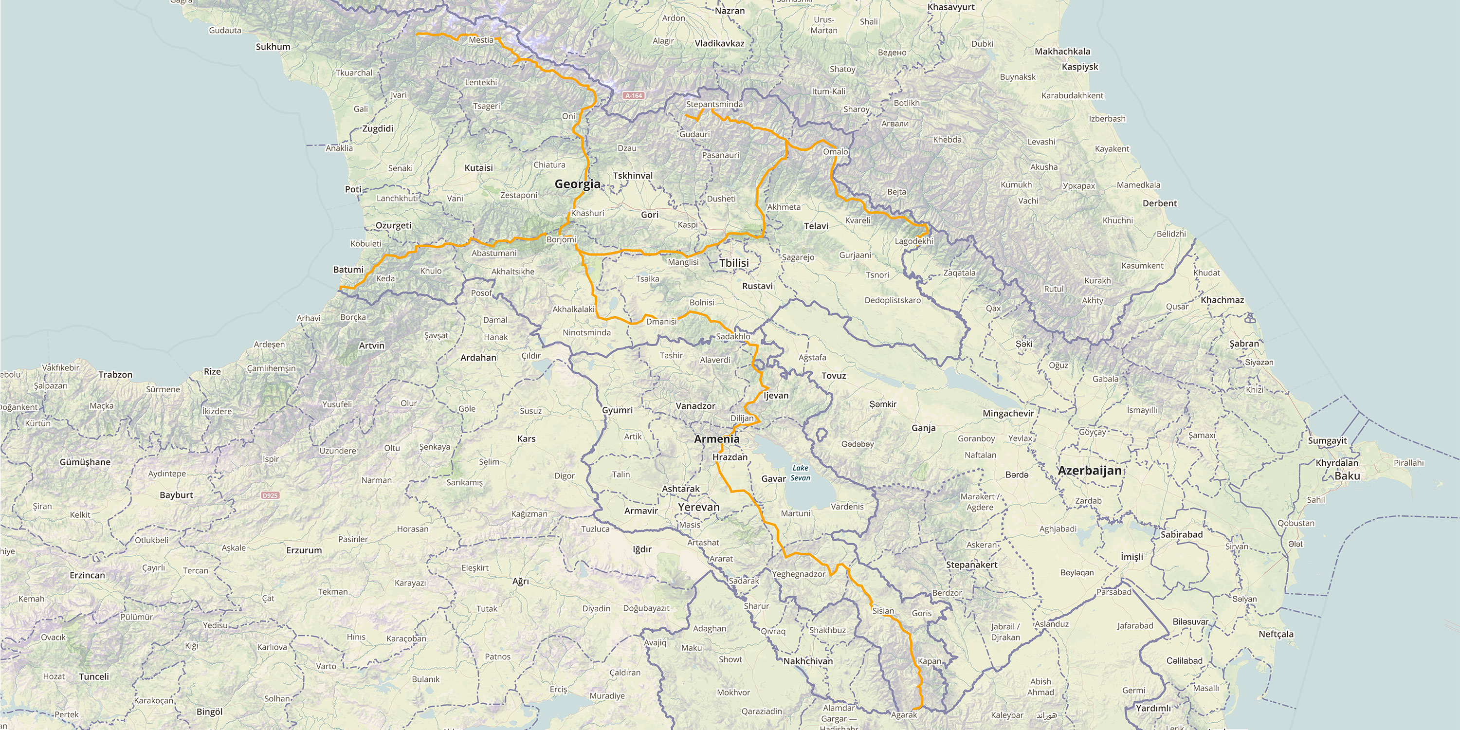
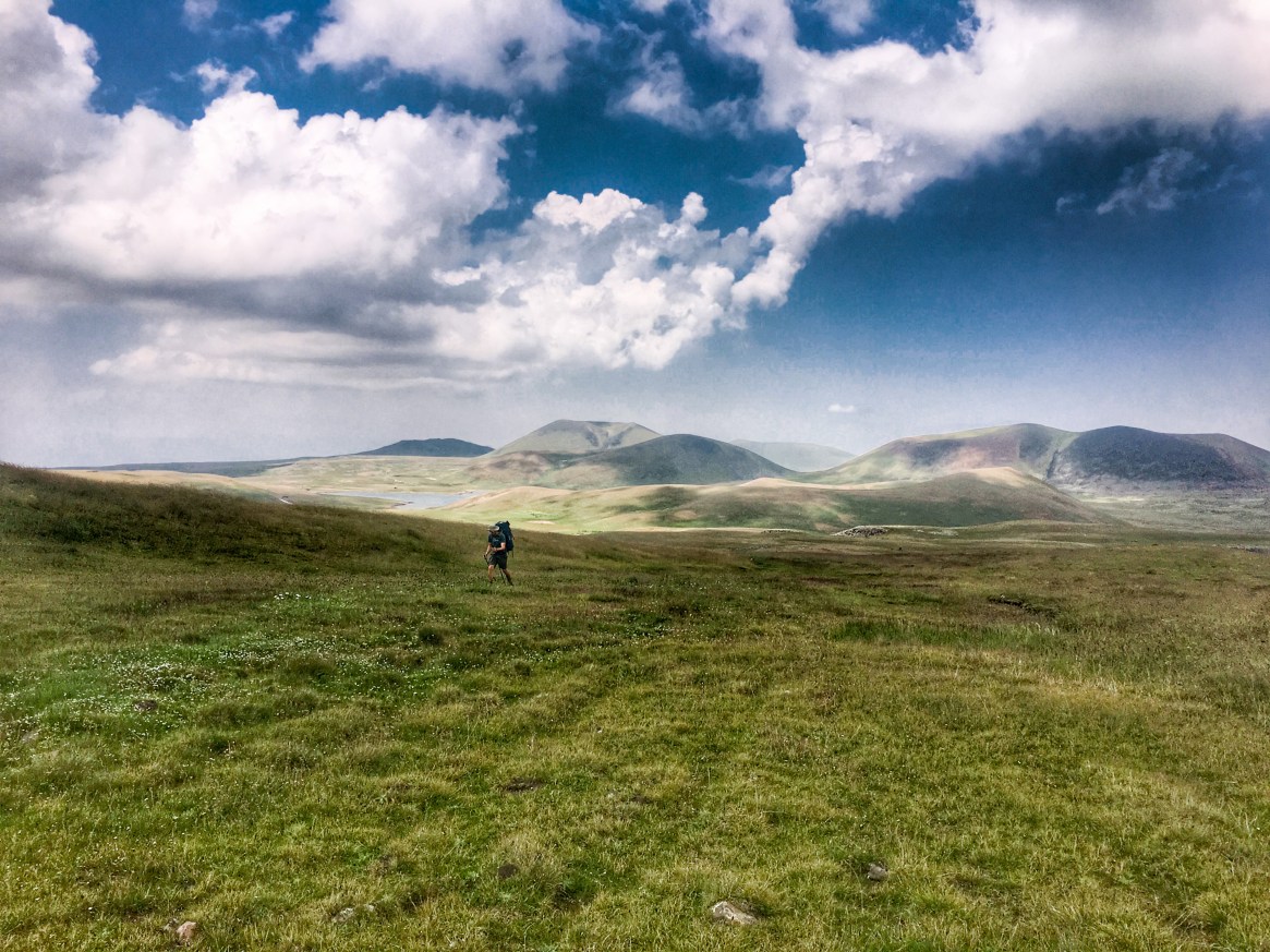
Situated in the heart of the Caucasus Mountains, the TCT is, in theory, going to consist of two intersecting trail corridors covering 3000km (1864 miles) of Europe, Asia and parts of the Middle East. The first trail is the north to west route spanning across 1500km (roughly 932 miles) of Georgia and Armenia, whilst the second is the north to south route connecting the Greater and Lesser Caucasus mountains from the border of Russia to the border of Iran.
Though people have been hiking sections of the Caucasus for centuries, a purpose-built trail similar to the likes of the Tour du Mont Blanc or the Kungsleden Trail, for example, is yet to be built. That is, until Tom Allen, Paul Stephens and the whole TCT Association team came on the scene.
Related: Best Long-Distance Hikes In Europe
Related: Best Hiking Destinations In Europe
Beginning in 2015, they started with a vision to improve access to the region’s incredibly diverse landscapes. They also sought to create sustainable tourism throughout the Caucasus that would benefit both local communities and the wider hiking communities throughout the globe. With roughly 34 biodiversity hotspots, and over 40 indigenous languages in the region, it’s not hard to see why they’ve taken on this mammoth task.
Now almost half-way through the entire project, and with 827km (514 miles) of thru-hiking in Armenia ready for testing (along with some shorter trails too), we caught up with Tom to find out exactly how one goes about building a hiking trail…
For our readers who aren’t familiar with the work you’ve been doing, could you give them a bit of a background?
Starting from the very beginning then… In 2015 I came to Armenia to try and hike the length of the country and I just couldn’t. I couldn’t find any information on trails or good quality maps for the back country. At the same time, I realised I had nothing to do at that point in my life. So the idea just came about that if I could design a route for myself, maybe that route might also be useful for other people, and for Armenia in general. And a bit of backstory: I’ve been coming here a long time and I met a girl here and we’re now married. So that’s the personal connection to Armenia. It wasn’t quite as random as it might sound.
Then as far as the Transcaucasian Trail goes, that being a route across Georgia, Armenia, and Azerbaijan, that was a combination of my idea to build a trail across Armenia and another hiker in Georgia who had the same idea for Georgia. We came across each other pretty quickly and once we got into it, that’s how the TCT started. And that was six years ago. Since then, we’ve all just been working as much as we can, as hard as we can, to get this trail from an idea to a physical footpath that’s marked and signposted with all the information anyone would need to walk it.
It’s very much a case of hikers trying to create what they want to hike. Plus, I think there’s a certain mood at the moment towards long-distance walking. I think it’s ‘of the moment’. And the other thing to say is that there was no such trail in this region, even though the mountains here are just as spectacular as any major mountain range in the world. So the absence of such a thing was also a big part of why we decided to do it.
So in practical terms then, where did you start? How do you begin to build a trail that hasn’t been built?
I think different people would start in different ways. My way of starting it was to go out and start walking and see what I found. Because, you know, I’m an outdoor obsessive; that’s the way I see things. You can sit at an office like I am right now, and you can apply for grant money, and you can come up with all these strategies, or you can just go and design a route by exploring. And in 2016 I got some funding from the Royal Geographical Society. They basically funded a year of exploration and mapping of Georgia and Armenia. And because they get some of their funding from Land Rover, they also supported me with a 4×4 car. So that gave me a whole summer to just go out and map out everything I could find in the region by off-road vehicle and on foot as a starting point.
A lot of it is a real mixture of taking information from locals and combining it with information from old maps, from the Cold War, and looking at satellite imagery on Google Earth. Sometimes it’s that simple. And then you just go out and document it really. So I still spend most of my time out in the mountains with a GPS unit, but there’s a whole mini industry now of people here who raise money and apply for grants and write reports and make maps, all that kinda stuff.
Am I right in thinking the Armenian part of the route is now finished and ready for people to try next year?
The latter is probably the best description of it. It’s ready. I’m happy to send people on it
now but I’m not gonna say it’s finished because it’s not all perfect. There’s not a sign post to every junction. There’s not a bridge on every river crossing, but I would happily send an experienced hiker off to follow the route now. So that’s what we’re planning to do this summer: to try and encourage the first year of thru-hikers to come and follow the whole route across the country.
And is there a mountain rescue system in place?
In Armenia, it’s called the ‘Ministry of Emergency Situations’. Basically, if somebody calls up and says, I’ve fallen off a cliff and broken my leg, they’re in charge of search and rescue. There’s nothing like what we have in the UK in the mountains with helicopters and search and rescue teams and volunteer crews going out every day to get people off the mountains. And that’s just because there’s no way near as many people out there as there are in places like the UK. If people do get in trouble, usually the local farmers get involved because they know the area, and then the army ‘cause they’ve got the helicopters. It’s all a bit haphazard and spontaneous and takes a long time. But I think it’s a chicken and egg thing. As the number of people grows, more incidents will occur and then they’ll realise that there’s a need for a bit more professionalism.
In terms of what people coming to Armenia to hike this trail should expect, I think it’s worth saying that people need to be aware of the limitations of the rescue services and to be prepared to look after themselves and self-evacuate and take extra precautions over what they might at home.
Do you have a favourite viewpoint or section of the Armenian trail?
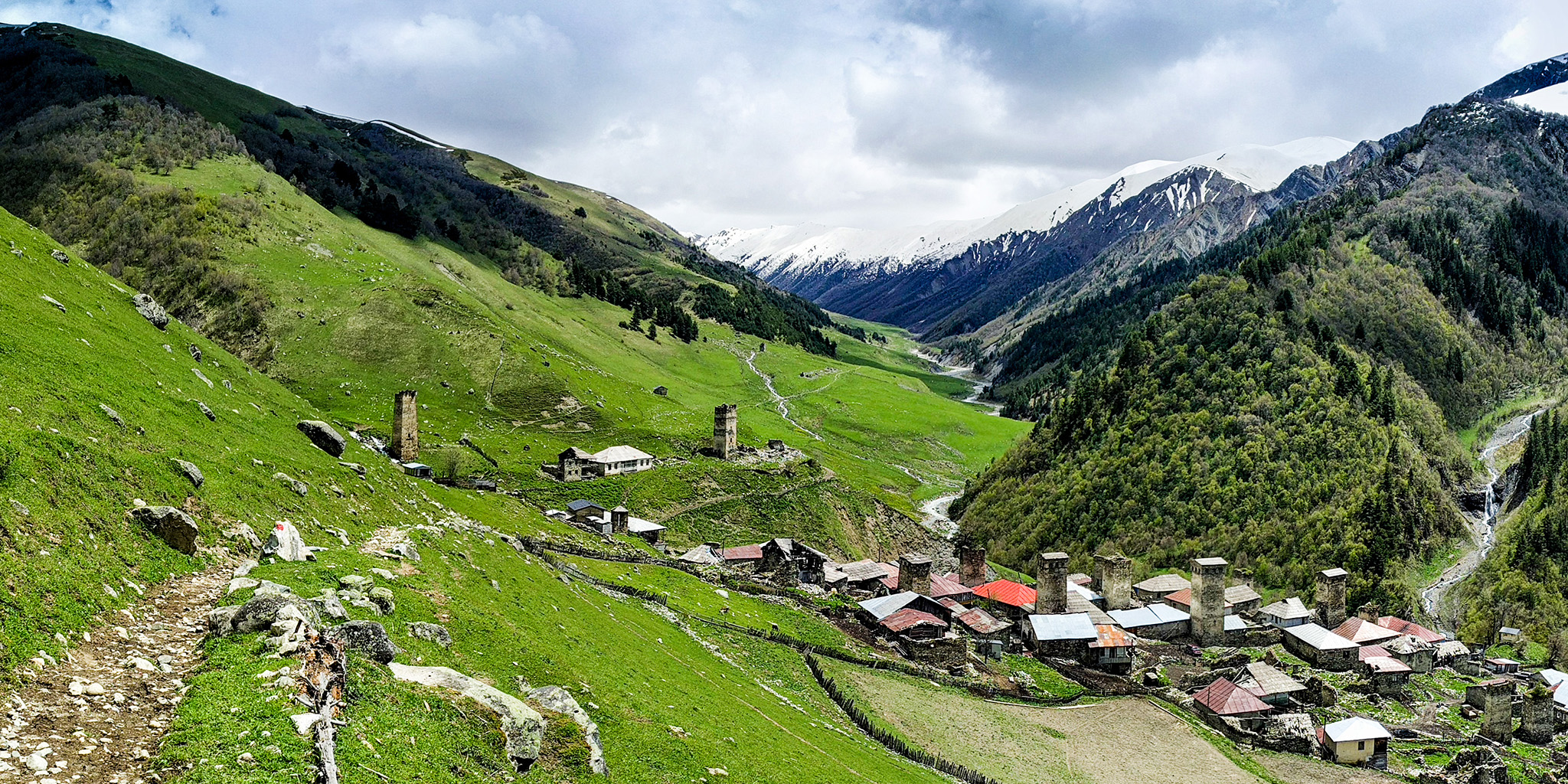
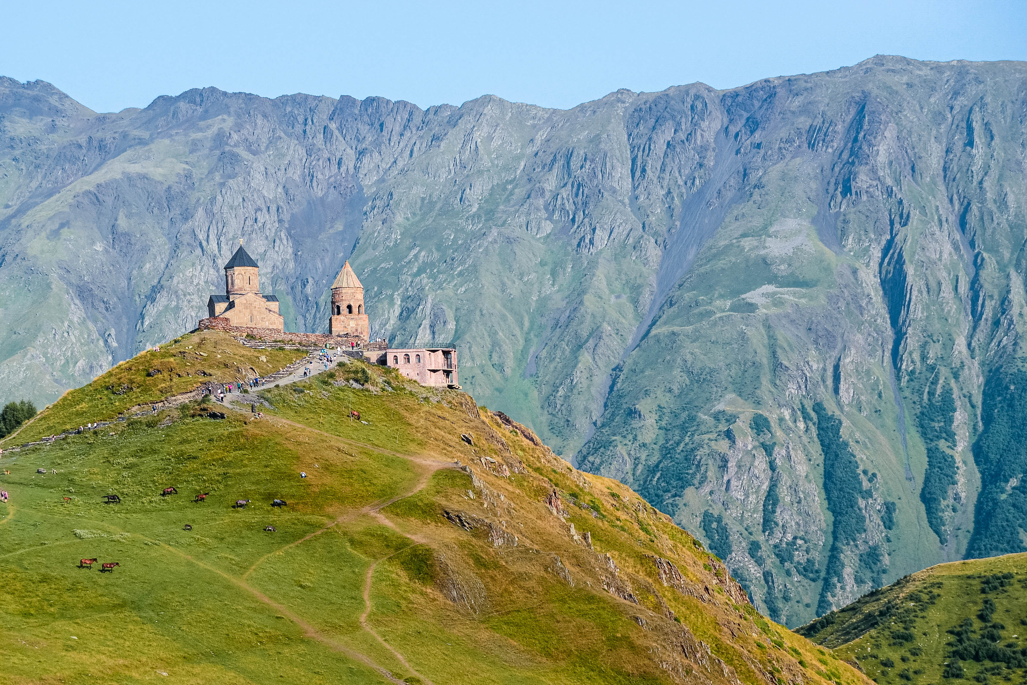
My personal favourite stretch of trail is right in the very far south along the Araks river valley. It’s literally the last three days of hiking before you reach the Iranian border. You come through these forests and then suddenly you’re on a ridge line looking down into this gigantic valley which is one of the cradles of civilisation. You’ve got bronze age villages here from civilisations dating back 6,000 years. Plus you get this view of the whole of northwest Iran into the Middle East. The trails are hundreds of years old and almost completely unknown. And this section of the trail isn’t even open yet. We have some plans to try and get them open this year, but it’s really just unexplored territory…wild and uninhabited.
Are there any existing tracks or trails there?
There are old footpaths between the ruins of former villages. Maybe the village has been
abandoned for a few hundred years and the path has also been abandoned. You can see it amongst all the undergrowth and rockfall, and you can just about follow it, but it’s slow going. I’m not much of a trail hiker so I like that kind of thing. My interest is in the undiscovered stuff. That’s more exciting to me.
And what what’s been the most challenging part of creating the trail so far?
I think the most challenging aspect of it has been to convince people that working together is the only way to get it done. Because trail development is a new thing here. It’s an unknown for most people. They don’t quite understand what it is we’re trying to do. People understand that we’re talking about public infrastructure that everybody can use for free. But people’s first impression is that we’re developing some kind of tourism product and we’re a business and we’re trying to make money etc.… And in a competitive market, we’re therefore the competition. So there’s a lot of hurdles to get over before we can show people that if they help us, everyone’s gonna benefit in this outdoor community, including the businesses.
Have you managed to get much feedback from locals?
In the last two years, understandably, there’s not that much tourism coming to Armenia. But as that’s decreased, what’s increased is the number of people from the cities of Armenia going out and hiking around in the beauty spots and the national parks. It’s a bit of a global thing too, but it’s been really nice to see locals using the trails. Originally, we were thinking, this is gonna be a big, international bucket list trail that people will fly into Armenia and do, but recently it’s been way more about local people doing it.
It’s also been really nice to see people from rural areas using the trails to just get
around. There’s one really nice example of that down in the south where we basically reopened an old footpath between two villages that had been abandoned since the Soviet times. So we mapped it out and took a crew down there and we rebuilt it. We rebuilt one of the bridges and reinforced some of the eroded sections. People at the far end of the trail in this tiny village were like ‘this is the trail I used to go to school on when I was a kid’, or ‘I used to walk to the next village and I haven’t been able to do that for so long’. So now they can actually go and see their neighbours by walking rather than getting in a four by four and doing this huge circuit loop to get to the exact same place. So that’s been pretty gratifying on a smaller scale.
And have you come across a lot of wildlife along the way?
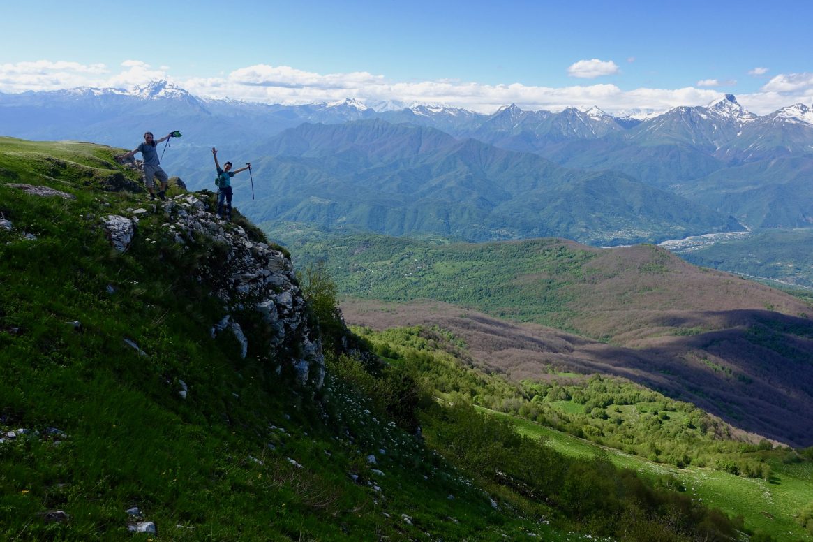
So the region has brown bears, it has wolves, and it has lynx. It also has the Caucasian
leopard which is a highly endangered species. All of these animals are around but they’re very, very shy so you rarely see any of them. What I do see a lot of tracks and scat and things like that – evidence of the fact that they’re here, even if I don’t see them. I think I’ve seen two bears, maybe three wolves in one day, and a fair amount of snakes and birds of prey. And then just tons and tons of plant life. The most striking thing is the wildflowers and just how abundant they are. And it’s just because the landscapes are not intensively managed here. You have huge tracks of land which are just left to nature. They’re not harvested, they’re not cultivated.
So you have all of these wildflower meadows and these old great forests which gives you a totally different feeling as a hiker to let’s say, hiking in Europe where so many of the landscapes are managed in some way.
Of course there are manmade landscapes and manmade features of landscapes. And of course there’s some farming going on. It’s just not as heavy handed here as it is in Europe. So I wouldn’t call it a wilderness because there are people around, but what they’re doing has a much lighter touch on the environment.
Related: Beyond Leave No Trace
I should also mention that another big difference in the way the landscapes are used here is that they’re not enclosed. They’re not subdivided into owned plots of lands. So as you know, in England, everything is a field with a hedge or a gate and a footpath and everything is tightly managed apart from a few bits of national parks where you’ve got access land and stuff like that. Whereas here, even if somebody owns a piece of land, they haven’t put a fence around it and they’re not gonna complain if you walk across it. It might as well be open access everywhere you go. So that’s a real luxury as a hiker to feel that you are not bound in by these rights of way.
So in terms of the whole Transcaucasian trail, when do you expect to finish?
I think there will be stages and milestones rather than finishing points because even
thousand-year-old, long-distance walking trails are still a work in progress. When we first started the whole thing, people were asking how long it would take, as if we had an answer and we didn’t… But we kept saying 10 years, and we’re now halfway through and 10 years still feels about right.
And what in the way amenities and shops are there? Or is it very much a bring everything you need situation?
Last summer I hiked the whole thing because I wanted to answer this question – so I didn’t take anything with me. I just decided I’m gonna see if it’s possible to restock along the route. And it turned out that it was. I think I carried four days worth of food on one section because I knew it was going to be very remote. But that was the longest I went without finding a shop or a place to resupply, which might have just been buying food from local people. We’ve tried to put the rest days along the trail at kind of distances where people will naturally want to take a break. And in those places you can go find a proper supermarket and an ATM and a pharmacy and all the other stuff you might need. So there’s a little bit of strategic trail design involved to make sure it is possible to resupply regularly.
What would you say to someone asking why they should hike the Transcaucasian trail?
I would say do it now because, if we do our job right, it’s going to become a very popular trail and it’s going to inevitably change the places it goes through. By doing it now, I think you get the best chance of experiencing this part of the world the way we experienced it when we first started work on it. And that is a big part of why we’re all doing it; it’s because of the experience you have as a traveler in this region. So I’m not gonna say before it’s too late… but while it’s still new and exciting and raw, now is the time to do it.
And just lastly, to finish things up, how can people help? Is there a way for people to get involved and support?
Yes. In many ways. Right now what we need is hikers. We want people on the trail and we want to hear their feedback. We want to hear their stories and we want local people to see people using the trail because otherwise it’s all meaningless. Second thing is if people actually want to volunteer, then every summer we run trail building camps. And that’s where people show up and spend a week or two learning what it takes to actually construct footpaths in the wilderness. We have professional trail builders leading volunteer crews and everyone lives in tents for two weeks out in the wilderness. We filter water, we cook food together and people learn skills. It’s really manual work. We get people from all over the world building trails in the Caucasus.
That’s also a way to permanently change your perspective of footpaths ‘cause you’ll never be able to look at one again without thinking of all the work that went into making it easy to walk along it. When it actually comes down to it, it’s basically picking up an axe and starting to dig. People find it very rewarding to participate in and learn a whole new skillset, and contribute to the global trail community.
For more information, visit transcaucasiantrail.org