Could this be our new go-to navigation app for hiking?
Founded in 2019, HiiKER is an outdoor navigation app with roots in Wicklow, Ireland, and Liverpool. It’s our first time testing it here at Outdoors Magic, and, while we’re a little late to the game, we’ve been seriously impressed so far.
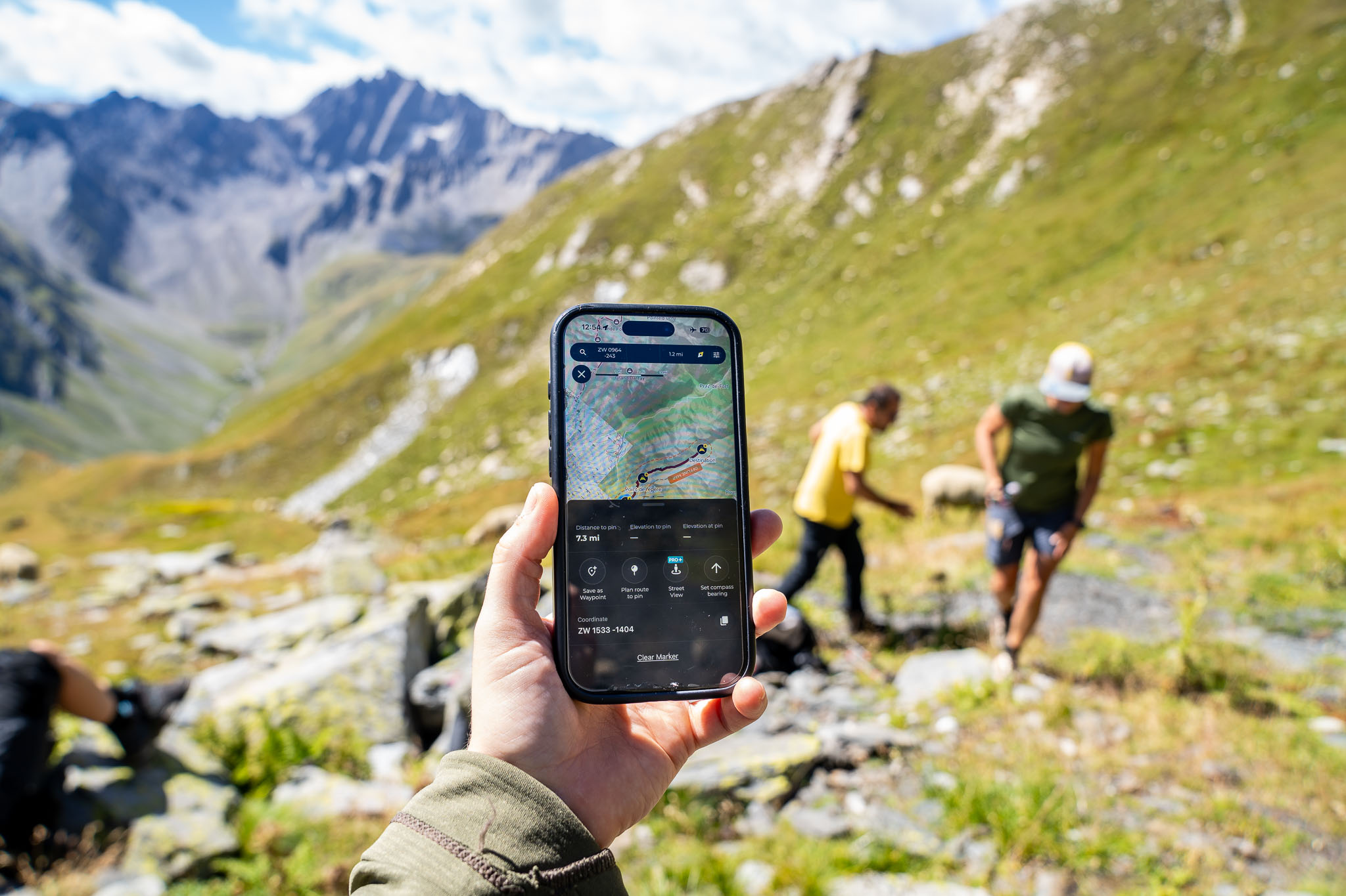
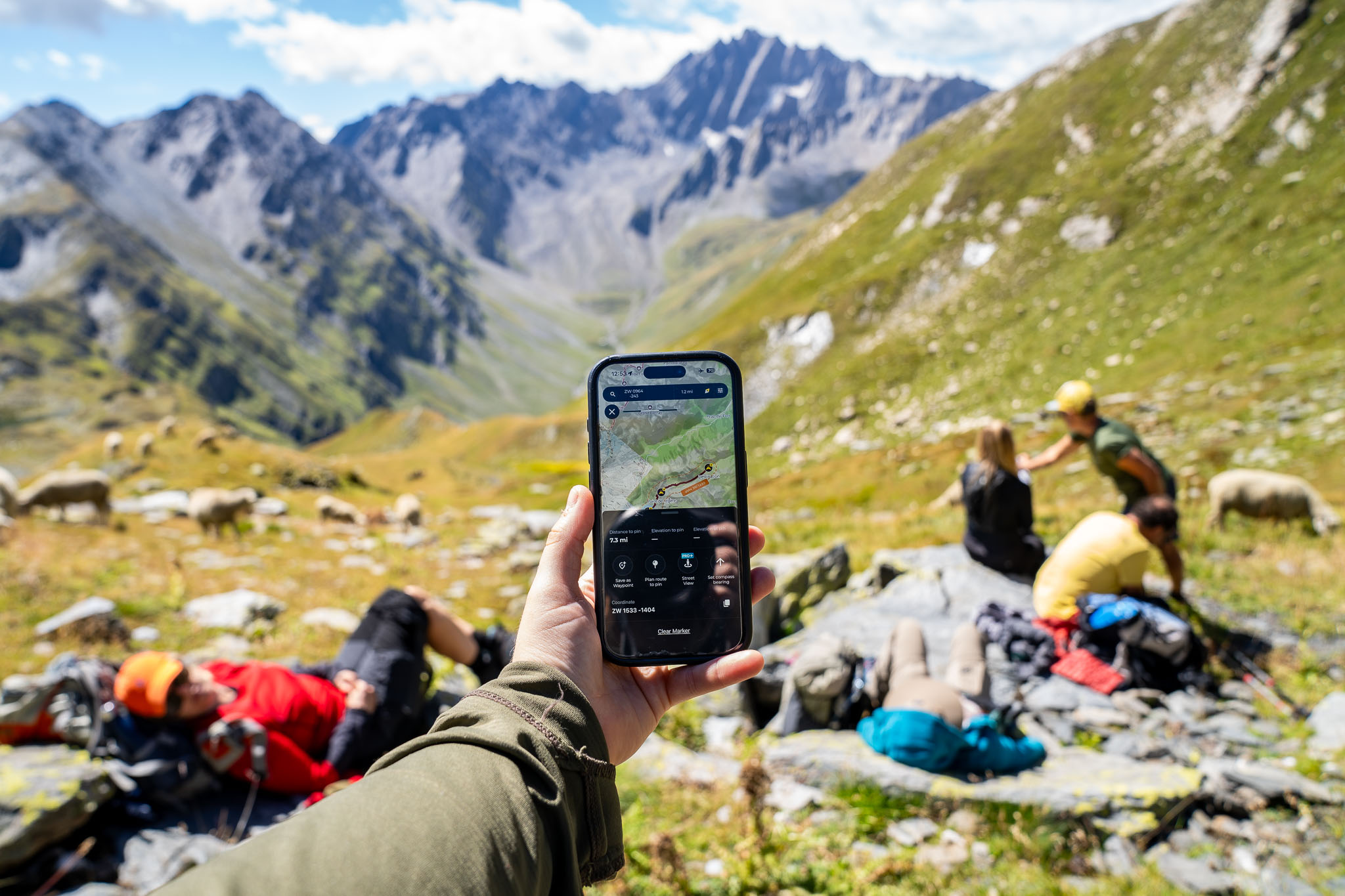
Specifically, I’ve been using the HiiKER app over the course of the summer, most recently on the Grand Tour des Combins multi-day hiking route in the Swiss Alps. Elsewhere, I’ve used it for walking around the South Downs and on some big hiking days in Fermanagh and Sligo in the north of Ireland.
In use in the Swiss Alps.
HiiKER App: The Top Line
The HiiKER app is well on track to give longstanding hiking app favourites like Komoot and AllTrails a run for their money. It has pretty much all of the features we’d want in a dedicated hiking app, all in a very intuitive and easy-to-use package. You might not get the same range of activity options as other apps, but what you get instead is something altogether more focused – a specialist app that meets the exact needs of hikers rather than trying to do it all.
HiiKER App: Overview
Where To Buy
HiiKER App
Our tester’s verdict: “For people looking for a hiking app that genuinely operates to get you on the trail, rather than keep you constantly staring at your screen – this is the app I’d recommend.”
Price: Pro+ monthly: £4.99 to £5.99 per month, Pro+ annual: £29.99 per year Pros: extensive map types, practical (and interesting) overlays and POIs, simple and functional interface, easy route planning, multi-day stage option is really useful, hiking-focused features, great value for money Cons: a few of the overlays could do with refining, less community routes logged than older apps
HiiKER is a dedicated navigation app for hiking and trekking, though there’s also access to some cycling route overlays too. It’s free to download and has three main plans: the free plan, the PRO+ monthly subscription (£4.99 to £5.99 per month) and the PRO+ annual subscription (£29.99 per year). The range of maps available for the UK, Europe and beyond is seriously impressive and includes the likes of OS, Harvey, IGN, Kompass, USGS, EastWest mapping, Anavasi, and Purple Lizard, to name a few. There’s also a really cool ‘Historical’ map feature (more on this later) for the cartophiles among us. Offline maps are always downloadable at no extra charge.
Key features include: route planning, live track recording, GPX import/export, offline maps, route discovery via community recommendations, printable maps, 3D flyover videos, multi-day stages for longer trips, points of interest, an array of overlays, as well as easy access to the support team. This list is by no means exhaustive, though I’ll aim to run through all my favourite and least favourite features within this review.
Map Types
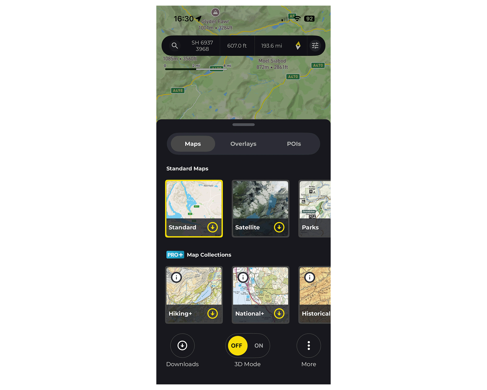
As I mentioned earlier, there’s a huge range of maps available here and I’d say this is one of the biggest benefits of this app. You can find a list of HiiKER’s mapping partners here.
During my tests so far, I’ve primarily been using OpenStreetMap, Satellite mapping, Harvey Maps and OS mapping (both 1:25 and 1:50 are available) within the UK and Ireland, and then Swisstopo and Kompass Wanderkarten mapping for some hut to hut trekking in the Swiss Alps. All in all, it has pretty much all of the map types I’d want as a hiker. I’ve found the detailing spot on and would feel confident using it further afield.
An in-app view of the map types on HiiKER.
The ‘historical’ map option is a really nice added bonus: it shows you what landscapes would have looked like from the late 1800s to the early 1900s so you can directly compare it with modern topography today. I’ve only ever come across this overlay within the Swisstopo app before and I’m really glad other folks seem to be catching on. It’s a feature I think history buffs and cartophiles will love.
HiiKER has also made a promise to never charge for downloading offline maps. This includes free users, though they’re limited to downloading OpenStreetMap data, a much more basic mapping type than topographical mapping.
Overlays
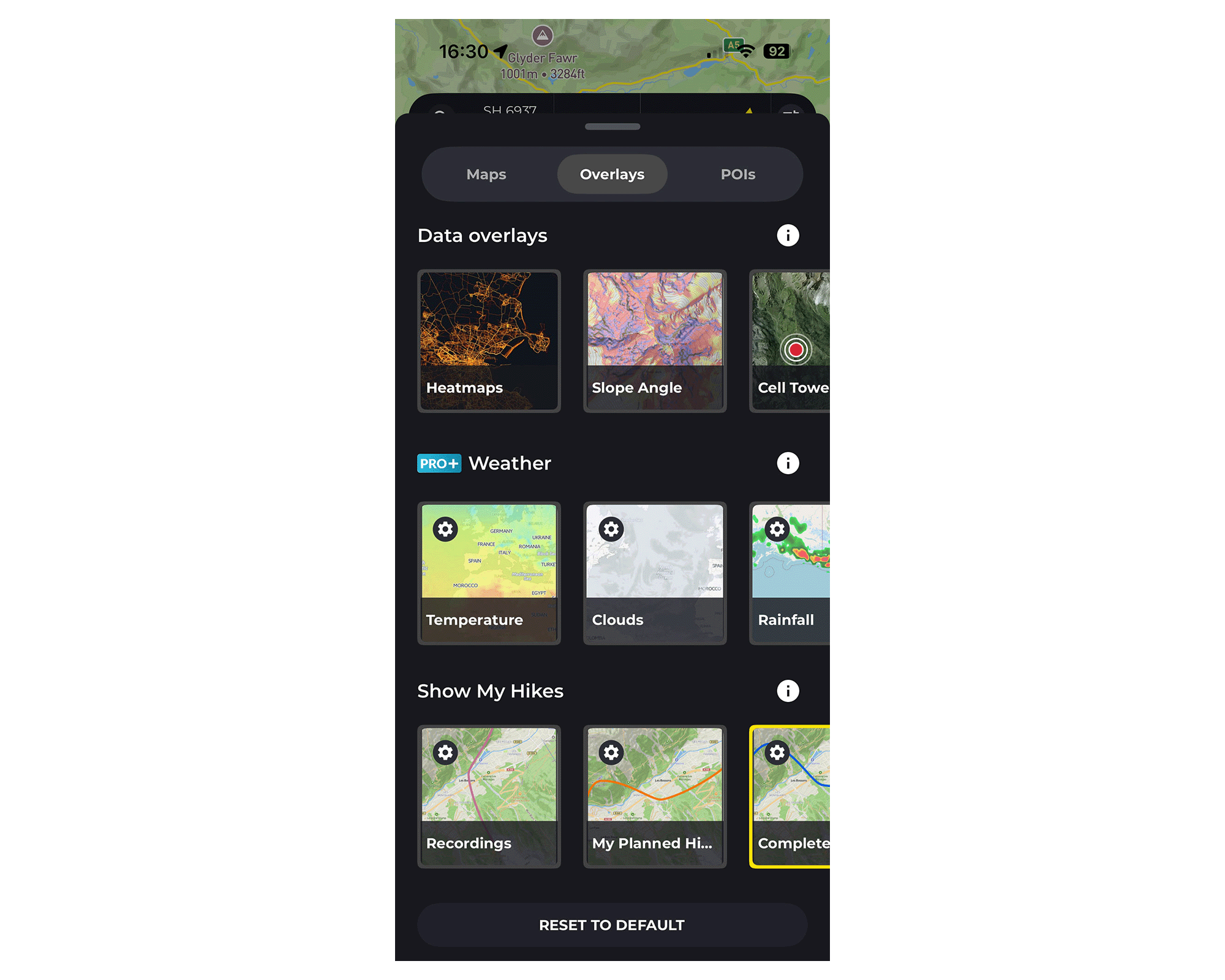
There’s a number of useful overlays here including your usual weather overlays for temperature, clouds, rainfall, snowfall and wind, as well as data overlays such as heatmaps, slope angles, ‘official’ hiking routes, public access paths, and cycling routes.
One overlay which I found particularly interesting was the ‘Celltower’ overlay. I haven’t come across it on other hiking apps and can see it being useful on more remote hiking trails, especially when trying to plan ahead for no service zones.
Another nice touch is the option to overlay all of your ‘completed hikes’ onto the maps. This enables you to see every hiking route you have completed and logged in the app on a much wider scale. I think this adds a nice, personalised touch to the app experience.
An in-app view of the ‘overlays’ screen on HiiKER.
With the 3D mode toggle switched on, I’ve found the slope angle overlay helpful for visualising steepness and potential rock fall areas, though I’ve found it a little pixelated and harder to read the subtle colour changes when the 3D mode is off.
I’ve found the cycling overlay relatively useful if you’re cycling to a trailhead to begin a hike, though I personally wouldn’t want to solely rely on it for anything more technical than that. The overlay mostly uses national cycling routes and cycle-friendly paths and roads, and lacks a more detailed network of off-road sections too. That being said, this is a hiking app not a cycling app, and with that in mind, it’s not a deal breaker for me.
I’ve had no issue with any of the weather overlays so far; the rainfall and wind overlays have been accurate and I’ve enjoyed using the cloud overlay for predicting visibility levels as well as clear sky moments when taking photos on my hiking trips.
Points Of Interest
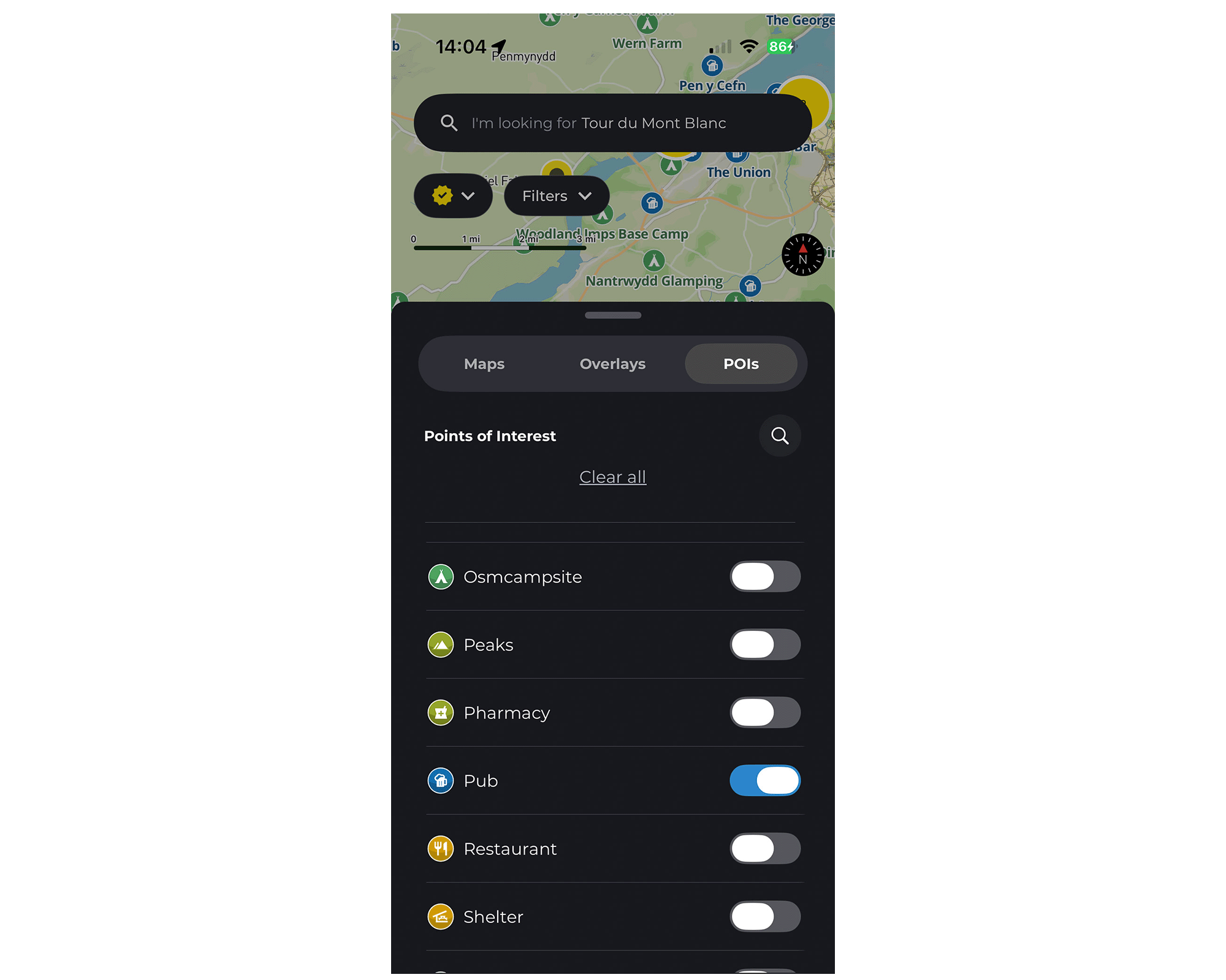
I always find points of interest (POIs) useful on hiking maps, particularly when searching for campsites and water sources, both of which you can search for with HiiKER. It saves so much time having it all on one app rather than having to flick between google maps for campsite recommendations, and then back onto your hiking app for the trail, and vice versa.
What stands out with HiiKER, however, is just how easy you can find these points of interest. The POIs toggle is situated right next to maps and overlays so you can easily integrate what you want to show up on your map. It becomes a natural part of the route finding process in this sense, which, in my experience, makes booking campsites (and finding good pubs) along your route a hell of a lot easier.
An in-app view of the ‘points of interest’ tab on HiiKER.
Other useful POIs you can toggle on or off include: peaks, shelter, caves, coffee, information, restrooms, wifi, waterfalls and more.
Route Planning
I’ve found route planning very easy and intuitive using the HiiKER app. You simply pick a starting point and a finishing point on the map, and then the simplest walking route will be selected (‘snapped’) using existing hiking trails. From there you can add waypoints by tapping at points on the map, change the direction of the route, or create a looped route depending on your preference.
Something that’s really useful is the ability to create your own multi-day hiking routes and divide them by days within the app. Rather than saving each day’s worth of hiking as separate hikes, this stores them all together under the same trip/ overall route. I’ve found this very practical for real-world use on multi-day hiking trips – it helps you avoid spending too much time searching through your app and also helps you envisage your daily progress in a more intuitive way.
Another practical feature: you can adjust how the app estimates your hike time depending on your average pace. There’s four options: slow (1.9 miles per hour), average (3.1 miles per hour), fast (4.3 miles per hour), or trail runner (6.2 miles per hour). I’ve found this helpful to use as I tend to switch up my pace a lot depending on my energy levels, especially on multi-day hiking routes.
I’m yet to plan a route using the web version of the app but I’ll come back and update this review as and when I do.
3D Flyover
Visual learners will love this feature. Here’s an example of what it looks like:
If you like sharing this type of thing on your socials, or including it within videos, I think you’ll like this feature. Personally, I just find it useful (and fun) to visualise the exact journey I’m about to go on from a bird’s eye perspective. It also gives you a really nice sense of achievement when you look back at the flyovers post-hike.
Community Features
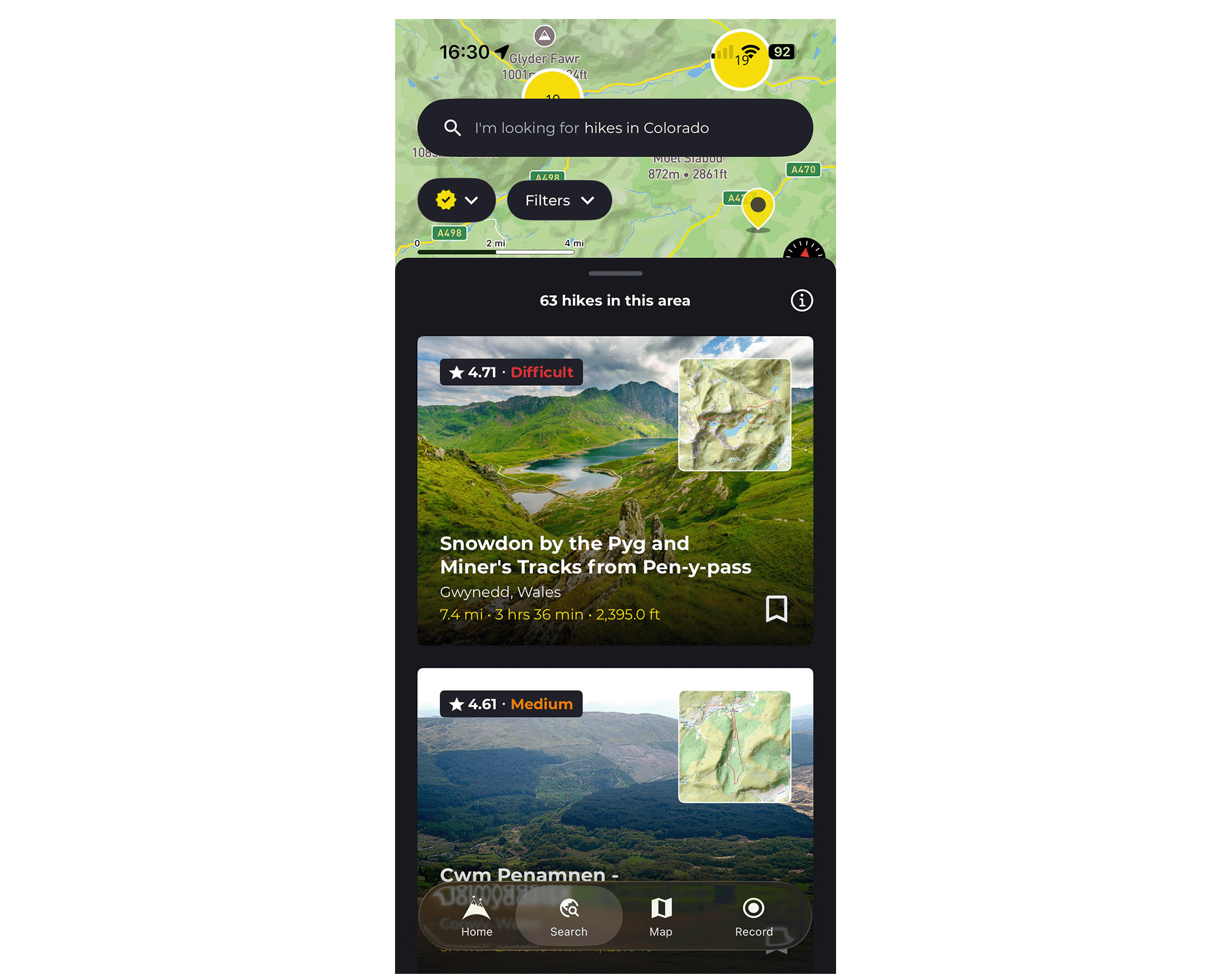
Like most navigation apps on the market, you’ll find an array of different community routes to explore. These are based on routes that HiiKER and individual users have created and posted for the public to see. They usually also include photos and options for commenting.
Since HiiKER is a relatively young app by comparison to others, there are inevitably less existing routes to explore, however, I’ve found it easy enough to import GPX files from other apps where necessary. This will, however, be a bit of a downside for folks who primarily like to use other people’s recorded routes.
An in-app view of the ‘search’ screen on the app. This is where you’ll find pre-existing routes that users have created.
Something that stands out for me here is the fact that community routes aren’t automatically displayed across your maps like with Komoot, for example. With HiiKER, the two are separated via the ‘search’ and ‘map’ buttons at the bottom of the screen. In my experience, this makes it so much easier to explore and analyse the different maps. There’s less clutter across the map and I’m less likely to accidentally click on someone’s route when I’m searching for specific trails. I also think it encourages you to explore the map for yourself which is always a plus in my book.
User-Friendliness
This is where I think HiiKER really shines compared to other hiking apps on the market. The whole interface feels refreshingly stripped back and simple, yet highly functional at the same time. In a world of obsessive stats, ads popping up everywhere, and an intense amount of faff, I love how easy it is to simply get on with the job with HiiKER.
Other Features
Live Locator – This is a safety feature that lets you share your real-time position with friends and family. Usefully, you can set how long you want to keep the locator ‘live’ (from 1 minute up to 72 hours) to avoid draining your battery too much.
Measurement Tool – By pinpointing two points on the map (A to B), you can quickly measure how long walking between the two points will take, as well as how much ascent and descent there will be. Although this only measures the distance as the crow flies, I’ve found it quite useful for very rough and quick measurements about how long it will take to get back to the car park, for example.
Integrations – You’ve got the option to connect and sync the HiiKER app with Strava, Garmin, Apple Health, Google Fit, and some AI platforms here. If, like me, you don’t use any of these, it’s still easy enough to export the GPX file to external apps. I’ve been exporting files to my Suunto app and have had no problems.
My Stats – This feature sits on the homepage and adds up the data from your recorded hikes to give you an overview of how many hikes you’ve done, the distance and elevation you’ve travelled, as well as the time you’ve spent hiking overall. You can choose to view this by week, month, year, or by ‘all time’.
Print option – Admittedly, I don’t know how many people will use this but I think it’s a really nice option to have regardless. I can see it being handy if you know you’ll be heading into remote territory and you want a paper back-up of your exact route. It could also be beneficial for race organisers.
Overall Verdict
All in all, I love the simple usability and all-around functionality of this app. It feels clear, to me at least, that this is an app made by hikers for hikers, avoiding the ‘jack of all trades’ approach of navigation apps targeted towards more general outdoor use. Granted, that means you lose a certain level of versatility across activities, but in my opinion, what you get is something much more functional and genuinely useful for its dedicated purpose, namely: hiking.
For people looking for a hiking app that genuinely operates to get you on the trail, rather than keep you constantly staring at your screen, this is the app I’d recommend. At £29.99 per year, considering the use you could get out of it, and the fact that some competitors’ annual fees range from £40 right up to £60 per year, I’d also consider HiiKER very good value for your money.
It’s also refreshing to hear from other hikers and users of this app that HiiKER are constantly making updates to the system. From what I’ve heard in person and also read across the web, it seems as though the folks at HiiKER genuinely listen to their user’s feedback which is always a great sign in my book.
Where To Buy
HiiKER App
Our tester’s verdict: “For people looking for a hiking app that genuinely operates to get you on the trail, rather than keep you constantly staring at your screen – this is the app I’d recommend.”