Anyone who’s used Harvey Maps for a hike will know that they’re fine-tuned to support you in the act of exploring wild areas. They’re maps specifically made by walkers for walkers and the company has been doing this since as far back as 1977.
Their process is painstaking too, because not only do they spend weeks and weeks plotting their maps based on aerial photos but they also get out on the ground to check where farmers have added or removed fencing, where forestry might have been felled, or perhaps where a pub might have opened up or poured its last pint.
Waterproof, durable, lightweight and easy to fold, Harvey Maps are also extremely practical for walkers to use, saving them from problems that a lot of other maps fall short on.
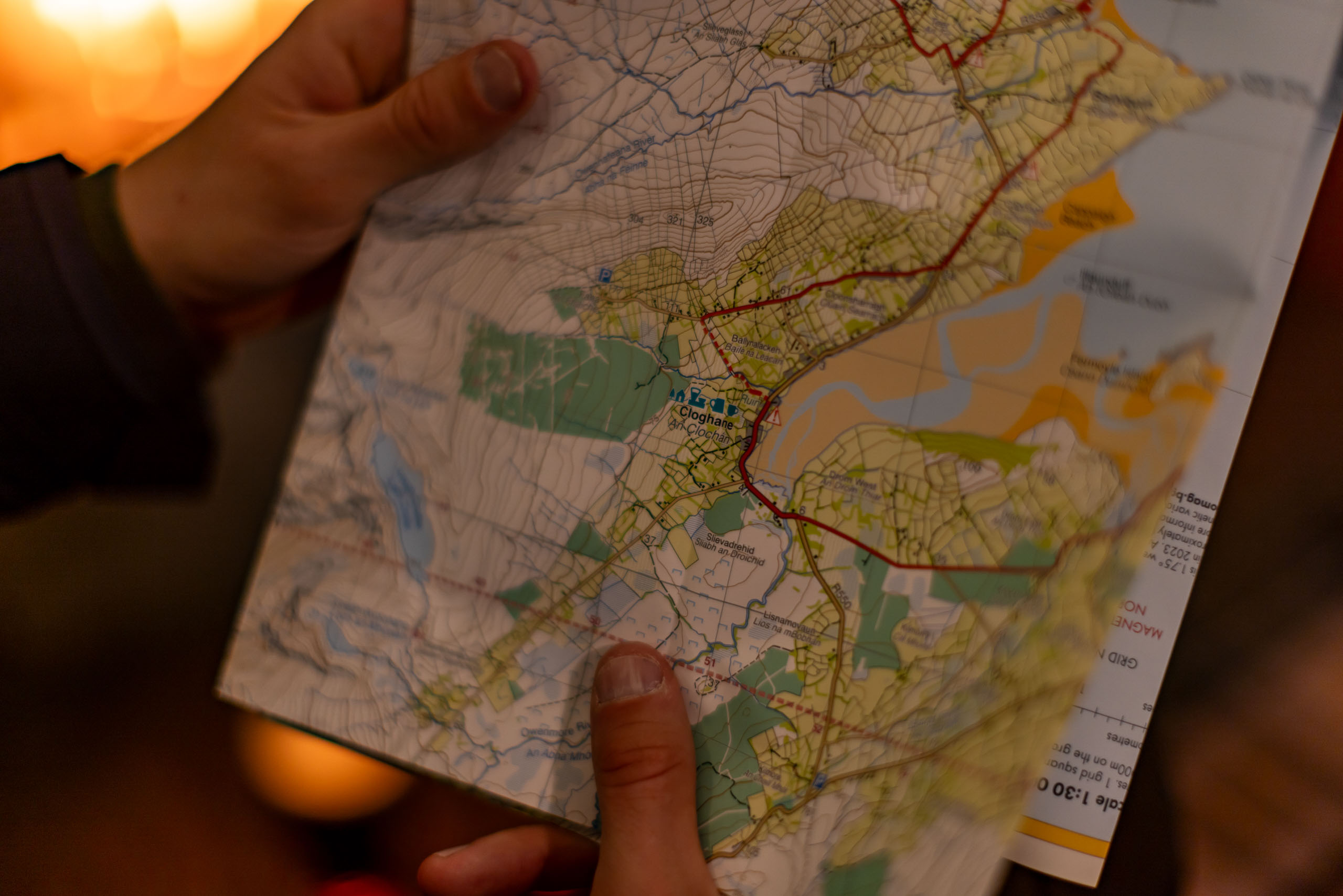
Recent news from the brand is that they’ve just released a map that covers the whole Dingle Peninsula in southwest Ireland. This is a pretty big deal as, as far as we’re aware, nothing anywhere near as comprehensive as this currently exists. So, if you want to explore the Slieve Mish mountains or climb the craggy ridges of Mount Brandon, there’s now a resource that will provide you with information on the exact lay of the land and the footpaths to follow or obstacles to avoid. They’ve also plotted the whole of the Dingle Way onto the map too, giving those walking the 179km trail details of every turn and contour and the towns and the amenities they’ll find along the way – all contained in one 60g map that’ll fit into a trouser pocket.