Komoot | The New App That Makes Route Planning Incredibly Simple - Outdoors Magic

Outdoors Gear, Equipment, News, Reviews, Forums, Walking Routes and More at OutdoorsMagic.com

Share

News

Komoot | The New App That Makes Route Planning Incredibly Simple

This new app by outdoor enthusiasts for outdoor enthusiasts could change the way you plan your adventures

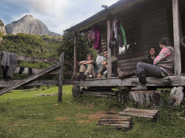
Planning a hike in the hills can be a time consuming process, even if you’re just going out for a day. There’s the equipment to pack and normally some transport logistics to sort out as well, plus you also need to think about how you are going to stay fed and watered.

Then there’s the plotting of the route – the part that usually takes a good chunk of time. For this, some people will go for the classic approach of pouring over a map laid out in front of them. Others will go for the more modern approach that involves clicking point to point on route planning software. If only there was a faster way…

Enter Komoot, a route planning app that already has a community of over four million users, and that number is growing quickly. In fact it’s already the number one choice in Germany.

Komoot In A Nutshell

Kommot enables outdoor enthusiasts to experience more of the outdoors with its highly detailed, yet simple to use planning interface combined with community-generated recommendations of local highlights. Available for free for iOS and Android systems and the web, users can create and follow their own routes, or follow routes set by other people.

What’s Unique About Komoot

Granted, route planning apps are certainly nothing new, but Komoot offers something genuinely different. Imagine you’re planning a hike from one train station to another one and want to get between them by the most convenient route.  All you need to do is enter each station as your start and finish points and the app will generate a mapped route for you in an instant.

Screenshots showing various of Komoot’s functions. The follow function (left) the navigation function (centre) and the highlight function (right). Photo: Komoot

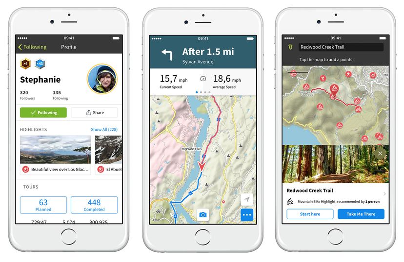
This route doesn’t have to be completely out of your hands either. In fact, if you want it to take in a certain viewpoint or pub and include some recommended Highlights from other hikers, or need to adapt it to fit with your level of experience and ability (an essential consideration when planning mountain routes) then you can simply drag and drop the line or select waypoints that you’d like to go via.

Terrain Control

Komoot’s biggest strength lies in its ability to generate routes based on the type of terrain you’d like to travel over. For instance, if you want the app to plan a straightforward route between A and B, choose the ‘Hiking’ setting and it’ll find one that sticks to off-road paths as much as possible without taking on too much altitude. On the flip side, If you choose the ‘Mountain Climbing’ setting, it won’t hesitate to take you over the hills rather than around them. There are also settings that will work out the best routes for mountain bikers, runners, road cyclists – even road cyclists that want to take on a bit of gravel.

Route Descriptions and Map Types

What’s also really useful is the amount of information that Komoot provides. As well as describing the waytypes and surfaces encountered, it shows the difficulty level and the fitness required, and there’s also a graph that shows ascent and descent.

The software uses a number of different map types, including Open Cycle Maps and one created by Komoot themselves. Both of these show detailed topographical information that can be used while on the fly with a data connection, or offline if you purchase offline mapping for a region (£3.99) or the whole world (£29.99). Turn on voice navigation and you don’t even need to take your device out of your pocket!

Join the Community

The community-led aspect of Komoot means you can tap into other users’ local knowledge too in order to find recommended routes in an area or certain highlights worth visiting.

Komoot is designed specifically to be easy to use, so it’s great for introducing people to the outdoors. Photo: Komoot

A safe bet is to keep an eye out for the routes that have been created by a ‘Pioneer’. These are users who’ve contributed local or first-hand information to the map, in the form of what Komoot calls ‘Highlights’, consisting of segments of trail or places like breathtaking viewpoints, historical monuments or a cosy hut or bothy you should definitely include in your outdoor adventure.

While some apps rank performance and give out prizes for the quickest times, Komoot is more about encouraging friendly co-operation. Of course, you can share your routes with details of times, speeds etc. should you wish, but there’s no league table here. It’s simply about all joining together to enhance our outdoor experiences for one another.

From short circular walks after a lunch with friends, to mega multi-day backpacking journeys, this could really change the way you plan you experience the outdoors.

Download the Komoot app for iOS or Android now, or visit www.komoot.com to sign up.

Sponsored by
Newsletter Terms & Conditions

Please enter your email so we can keep you updated with news, features and the latest offers. If you are not interested you can unsubscribe at any time. We will never sell your data and you'll only get messages from us and our partners whose products and services we think you'll enjoy.

Read our full Privacy Policy as well as Terms & Conditions.

production