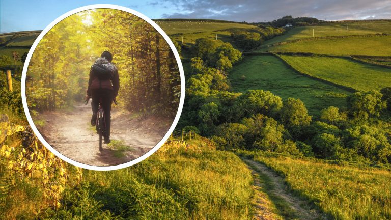
Situated in the north-east of England and sharing a border with Scotland, the Cheviot Hills form a spectacularly green and beautiful part of the country. With some of the most remote spaces you’ll find south of Hadrian’s Wall, it’s a place that deserves to be on any UK outdoor enthusiast’s bucket list. We’ve covered the best walks in the Cheviots and the best road cycles, now it’s time to fill you in on the best odd-road bike routes around the area.
As part of our series in collaboration with komoot, the route planning app for runners, bikers, and long-distance hikers, we reached out to local expert Amy Jurries and asked her to plan out her top 5 favourite trails within the Cheviots. Amy is a professional writer and an avid mountain biker with several years of experience taking on the twists, turns, dips and jumps of this highly rewarding yet little-known area of the UK. Over to you Amy…
Alwinton Short Route
Difficulty: Intermediate
Length: 13.6 miles
Elevation: 450 m
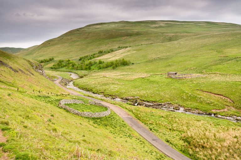
Alwinton, a pretty village set amongst the rolling moorland and meandering waters of Upper Coquetdale, serves as one of the main gateways to the Cheviots. It makes a great starting and end point for numerous rides in the area thanks to an overnight car park with toilets and the Rose and Thistle pub for your post-ride food and drinks.
This short ride serves as a great introduction to what the Cheviots has to offer. As soon as you leave the village, settle in for a long and steady climb up to Pass Peth before plunging down to The Knocks and the tiny hamlet of Shillmoor. From here you are in for a treat, as the Usway Burn is one of the nicest valleys in the Cheviots. Enjoy the flowy singletrack after Batailshiel Haugh farmhouse as the last section through the rooty and rocky woods to Fairhaugh farmhouse is a bit of a doozy.
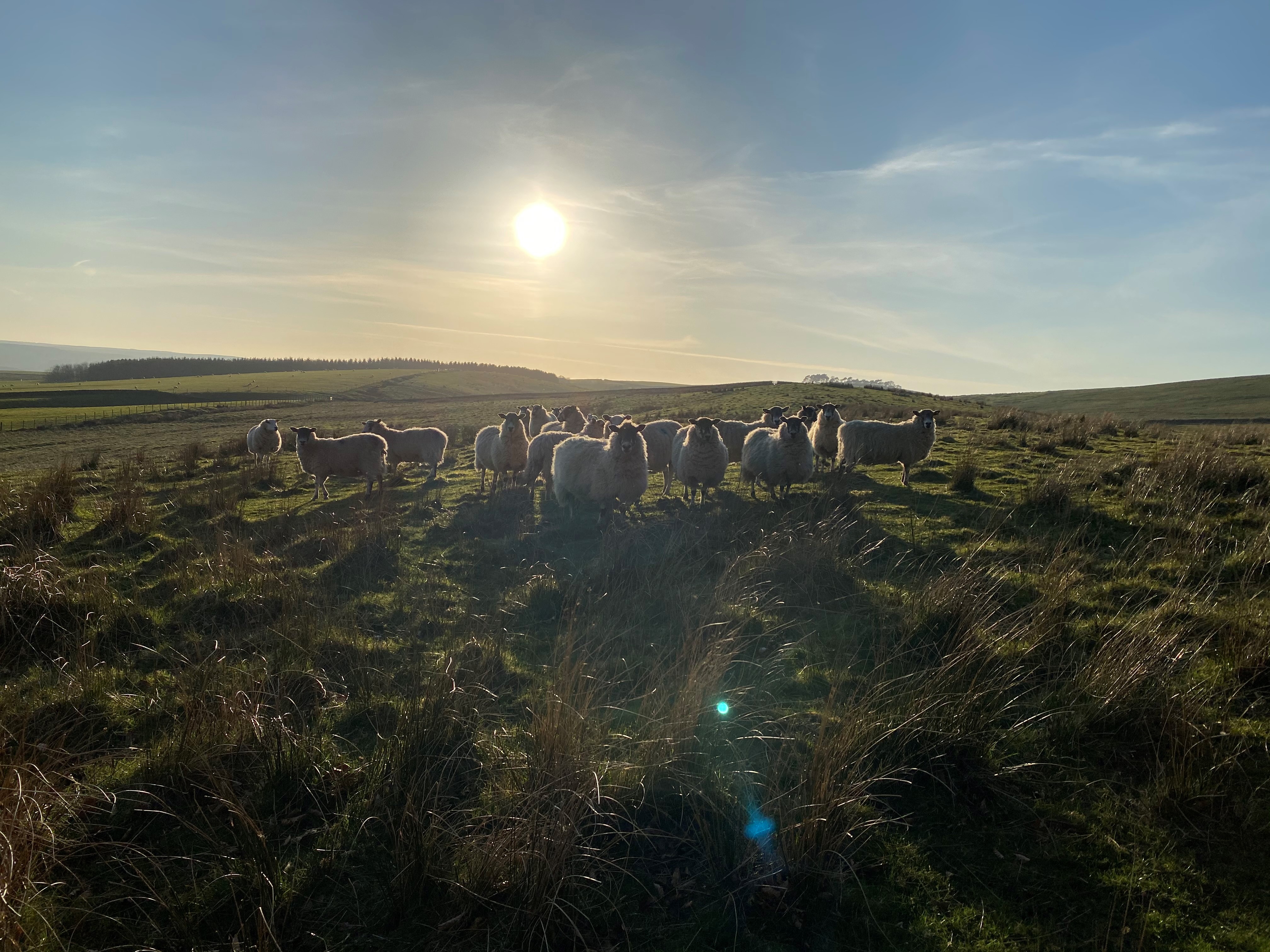
Turning back on the opposite side of the Usway Burn, a long grassy climb awaits followed by some undulating forest track before you pop out to 360-degree views of the Cheviots. This is where the fun begins. A grin-inducing grassy descent down the ancient trading route of Clennell Street (be thankful you didn’t have to ride up it!) leads you back into town for a cheeky pint or two. Watch out for the sheep.
Classic Cheviots Loop
Difficulty: Intermediate
Length: 23.8 miles
Elevation: 815 m
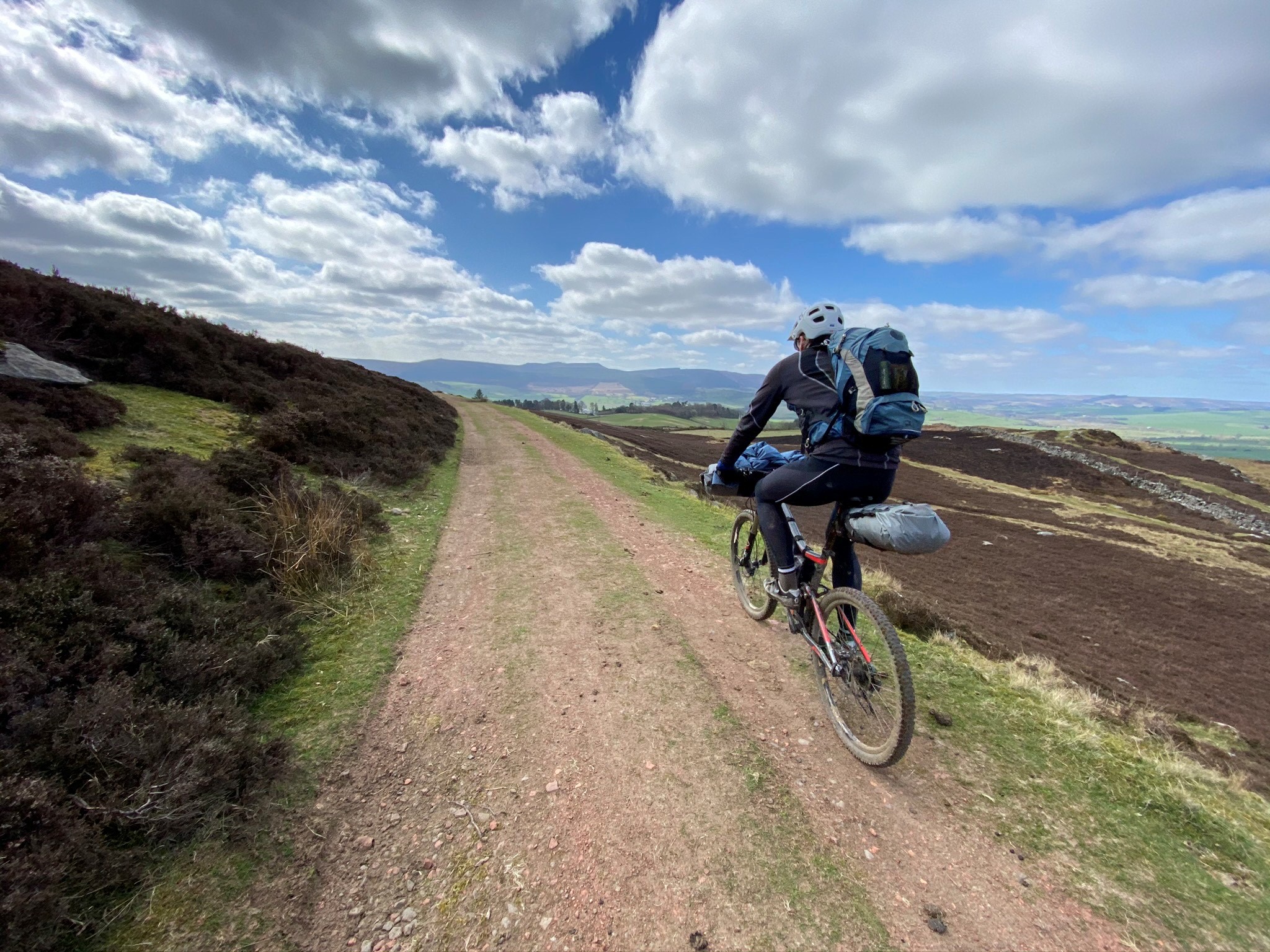
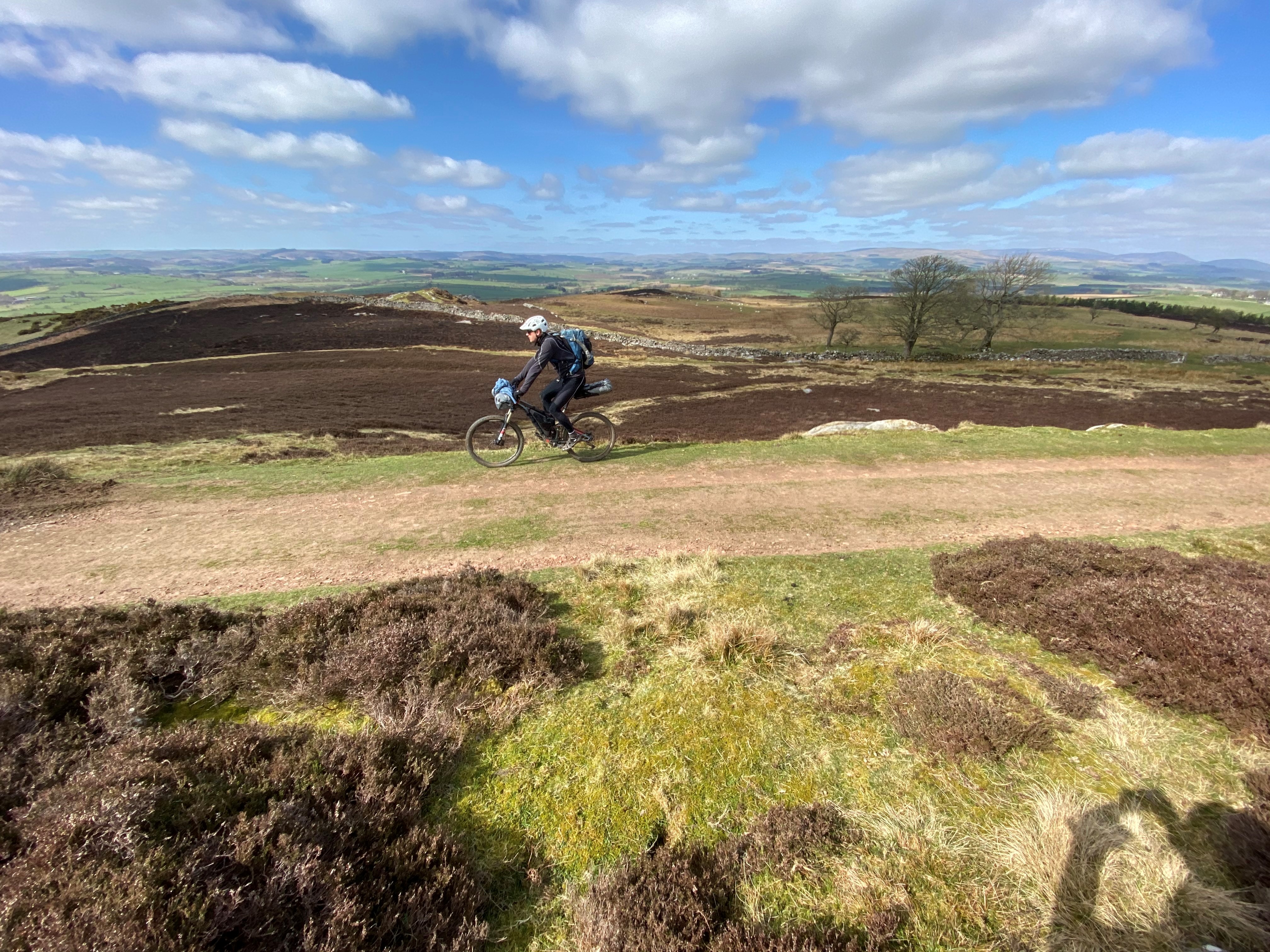
From Alwinton in the words of Yazz, “the only way is up,” and whilst rideable all the way you’ll be thankful for the smattering of gates as you edge your way up the infamous Clennell Street. But once at the top you’ll be greeted with the most amazing views that Northumberland has to offer.
The longest climb of the day over, you’ll be thankful for warmed up legs as you tackle steeper, shorter sections ahead on Salter’s Road, a route that switches between open moorland, forest trails, sweet grassy singletrack, and just about everything in between.
This is one of the most remote parts of the UK, so don’t expect any tea shops along the way. You’ll need to be self sufficient and even in the height of summer (whichever few days that is) the weather can change rapidly up here so be prepared. It’s a very open landscape too (especially at the start and end of the ride) and when the wind blows… boy it blows! You might even get a few pesky midges in the forested sections so a dab of deet behind the ears won’t go amiss.
Salter’s Road takes you all the way down towards Alnham where you join up with the Sandstone Way to roll back into Alwinton. The Rose and Thistle pub awaits or instead, head to the Star Inn just down the road in Harbottle to refuel with a wood fired pizza and a selection of local ales.
East Cheviots From Wooler
Difficulty: Intermediate
Length: 17.6 miles
Elevation: 640m
Exploring the East Cheviots outside of Wooler, this route delivers a nice mix of woodland and open moorland along a smattering of both single and double track.
The ride starts with a steady climb out of Wooler following National Cycle Route 68 (part of the Sandstone Way) through the town of Idleston before tackling the bridleway climb up to Heddon Hill. After the crossing through Threestoneburn Wood, the landscape opens up to moorland, affording a great view of Hedgehope Hill in the distance.
Enjoy the undulating traverse of the moor before dropping into the valley of Harthope Burn where you’ll cross the bridge and climb back up towards Carey Burn. A partial woodland descent of the burn (keep an eye out for the waterfalls) gets you to the final climb towards Wooler Common and its fantastic views of the higher Cheviot peaks in the distance. A link up with St Cuthbert’s Way brings you the final kilometres back into town to complete the route.
Be sure to stop at Doddington Dairy Milk Bar in town for ice cream made just down the road from their own cows’ milk.
Ingram Hills
Difficulty: Intermediate
Length: 16.9 miles
Elevation: 648 m
This loop ride starts and ends in Ingram, a small village located on the River Breamish. The Breamish Valley, with its high rolling hills speckled with prehistoric hill forts and lovely river setting, is one of my favourite places in the Cheviots.
The route starts with a slow and steady climb up to Shill Moor, first on tarmac then open moorland circumnavigating the peak. After dropping back down to the river, highlights ahead include fording the stream of Cobden Sike and the forest trail on the Salter’s Road ascent. As you roll back into town on the open doubletrack trail of the Sandstone Way, you are afforded fantastic views in all directions. Since much of the ride is on open moorland, it can be a bit of a slog when wet but fun and fast when dry. Finish your ride with a coffee and a fresh made scone or toastie at the Ingram Cafe.
Northumberland and Scotland
Difficulty: Difficult
Length: 38.1 miles
Elevation: 1364 m
The eastern end of the frontier between England and Scotland not only features some massive star-filled skies but also contains some similarly huge climbs, great descents and even the odd section of delightful, technical singletrack. This cross-border route links together classic rides on either side as you circumnavigate Windy Gyle, a prominent Cheviots peak that straddles the frontier.
The opening leg from Alwinton to Usway Burn is already featured in another one of our rides for good reason—it’s stunning. From here, it’s rough tracks all the way up onto the remote border ridge and a point of no return. The long drop into Scotland along a winding route of well-surfaced track will test your brakes as you try to keep from picking up too much speed.
The village of Kirk Yetholm marks the halfway point. This is where multiple long-distance routes converge such as the Pennine Way, St Cuthbert’s Way, and National Cycle Route 1. You could also choose to start and end the ride here.
Grab a bite to eat at The Border Inn but maybe skip the cheeky half as don’t forget, you need to climb back up to the ridge and it’s much tougher this side. Once back in Northumberland, you wind your way through the heather before hitting the classic Clennell Street descent.
While this ride is doable in one huge day, you could make two days of it, taking side trips to ride up to the summit of Windy Gyle and visit some Iron Age hill forts.
Komoot: Your Route to Adventure
Komoot is an app that lets you find, plan, and share adventures with the easy route planner. Driven by a desire to explore, and powered by the outdoor community’s recommendations, it’s komoot’s mission to inspire great adventures making them accessible to all.
New to komoot? For a free regional bundle (worth £8.99) simply follow this link to komoot.com and create your free account today.
You May Also Like:
Best Off-road Cycle Routes Near Fort William