Komoot, in case you’re not familiar with it, is a unique app that allows outdoor enthusiasts to quickly and easily plan out or discover routes in areas they want to explore. It can also be used to navigate along a route and to record a journey as well. Want to work out the best route from one place to another that sticks to off-road paths? Komoot can sort that out for you in a couple of clicks. Want turn-by-turn audio instructions while you’re trail running. Komoot’s the app for you.
And now there’s a nifty new feature, one that could well be a game-changer when it comes to the route planning process. It’s called Trail View.
Related: Best Navigation Apps For Hiking
With Trail View, komoot users can now use the app to see images of trails within the area they want to explore in order to make better-informed decisions as to whether a specific path is suitable for their chosen sport or experience level.
Komoot’s community of 28 million users contribute to this vast and ever-growing image bank, with AI-powered image recognition technology making sure that only straightforward pictures of paths, tracks and bridleways are shown.
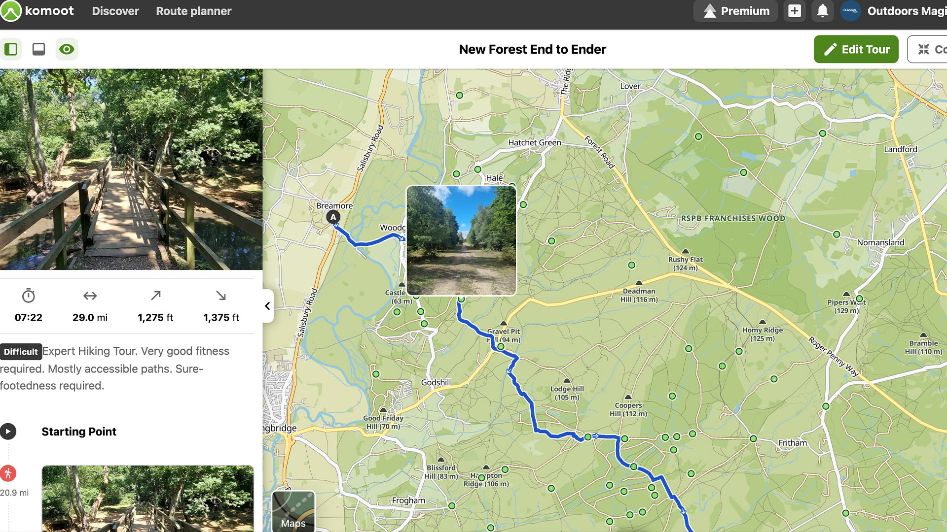
So, if you’re a bikepacker for instance, with Trail View you’ll be able to check whether the route you’ve planned will be right for the tires you’re planning to ride on. Or, if you’re hiking with a young family, you can check whether a path is going to be suitable or safe for your little adventurers.
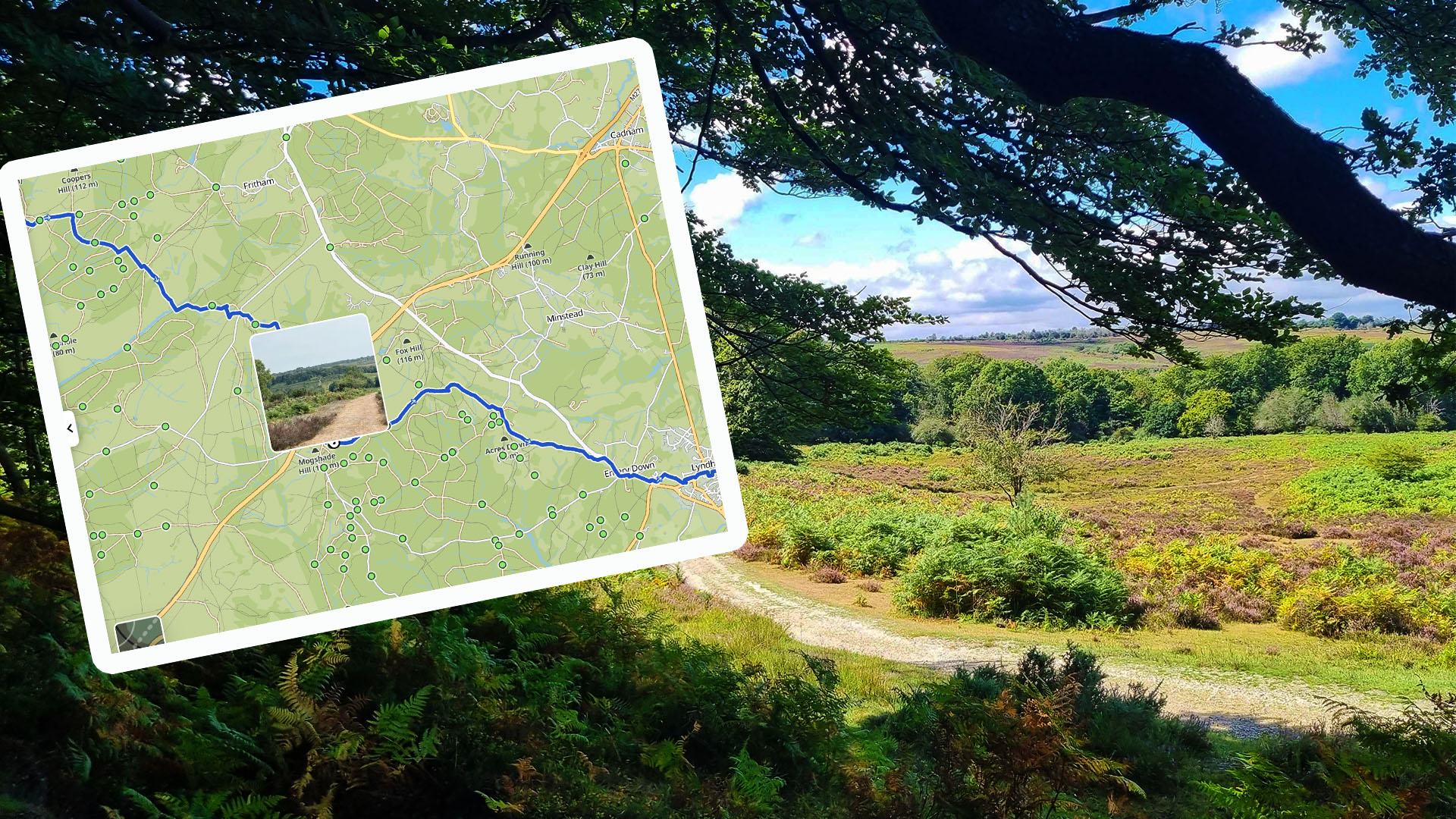
I recently used Trail View to plan out a 24-hour attempt to run from one side of the New Forest National Park to the other. With this new function I was able to tweak my route to visit trails over alluring heathland that the images showed to me. I was even able to use Trail View to double check there was a bridge where I wanted to cross a stream.
Related: Best Hikes in the New Forest
It also helped to inform my gear decisions prior to the trip. You see, using Trail View I could see that most of the paths I’d be running on would be gravelly tracks. I therefore decided it would be a good idea to bring mini gaiters to keep out debris and I chose shoes with a nice bit of flex and cushioning.
Here’s how that trip went…
Quite satisfyingly, a couple of days after finishing the run, all of my own images of the trail that I’d uploaded as I went along got added onto Trail View. Nice eh? That means anyone who wants to try out my route will be even better informed than I was when I planned it out.
But not every image that’s taken by users will necessarily qualify for Trail View. The app’s AI scans all uploaded images and shows only those that show paths and trails. Images that do not fit the criteria (ie. images that include faces, animals, landscapes, buildings etc.) don’t pass selection.
Here’s a useful guide to using Trail View…
For the launch of Trail View, over 15 Million images uploaded to komoot by its community were automatically scanned to identify approx. 1 Million that show trails and paths. And the best thing is that it will only get better as the community contributes more informative images of trails to help others to visualise their adventure before setting out.
New to komoot? For a free regional bundle (worth £8.99) simply follow this link to komoot.com and create your free account today.

