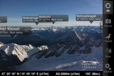
Ever wished you could point your iPhone at an unknown peak and find out what it is? Well, somewhat predictably there’s now an app for that in the shape of ‘Peaks’ from Augmented Outdoors which promises to do just that.
The app works even without an internet connection and uses the iPhone’s integral GPS and compass to locate you before labelling the peaks you can see on the screen with names, altitude and distance.
Not only that, you can take a photo which is then captioned with your location, bring up a google map with pins marking the major hills and generate a tweet so your mates can feel suitably envious.
It’s all very neat and a quick office experiment showed that it correctly identified Bleaklow, Kinder and Axe Edge, though without the benefit of X-Ray vision, we couldn’t actually see any of them…
It covers the entire world and works with iPhone 3GS, cost is £1.79 and we’re provisionally quietly impressed with the little fella. You can find Peaks at itunes.apple.com.


