Beautiful hillcountry, an abundance of nature and a smoke grenade or two here and there. The Epynt Way has to be one of the quirkiest walking trails in the world
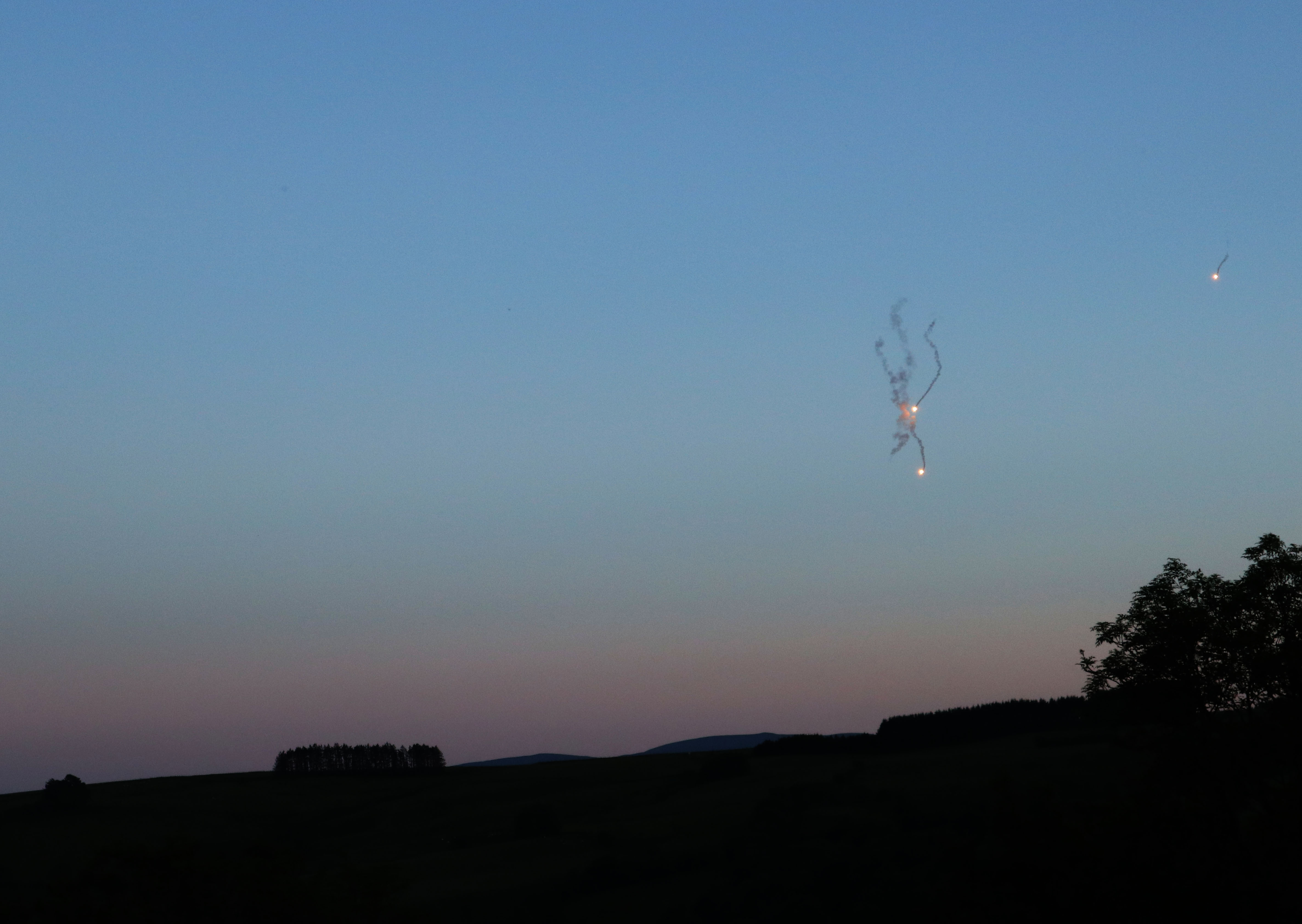
The crack-crack-crack of an assault rifle sounded in the wooded clough to my right, then as if in response, a flare whooshed up from the other side of the hedge behind me. Shouting followed: “ALARM. ALARM. ALARM.” I screwed the cap back on my whisky bottle, retreated into my tent and awaited ambush.
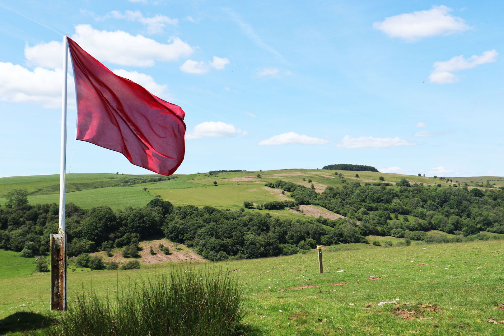
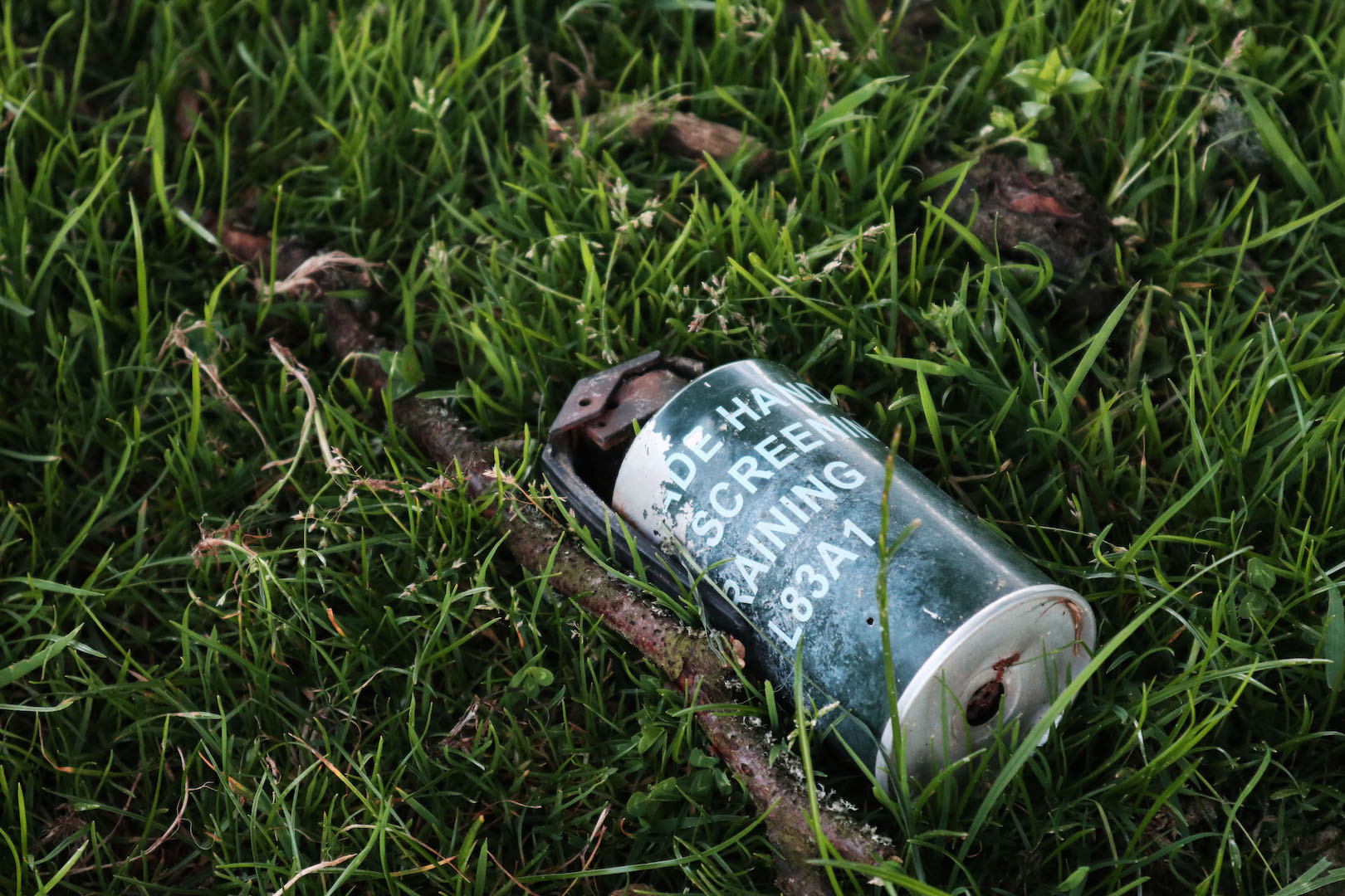
A few hours earlier, I’d parked my car up, swung on my backpack and had set off on my journey on what was a warm summer evening; a beautiful golden hour with nothing but the sound of skylarks and dry bracken snapping and crunching under my boots. I’d begun to suspect that the rumour I’d heard might be true: that the red warning flags I had seen on my arrival to this wild part of Wales tend to be left up – even when the army’s exercises had finished. I didn’t get far before the sight of a small object on the trail caused me to halt in my tracks: a small green object topped with a long black lever. I gave it a wide berth.
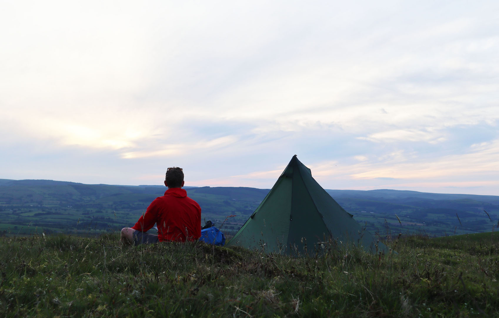
It had been a long drive to get here and the light was fading quickly, so as soon as a suitable enough spot to pitch my tent arrived I took it; one behind a hedgerow with a wide panorama of the Brecon Beacons, Pen y Fan as the centrepiece, laid out ahead of me. I stretched out on the long grass in front of my tent, ate, sipped at some whisky and enjoyed the serene moment that was about to be snatched away from me by Her Royal Majesty’s Armed Forces.
Day One: The Eastern Fringe
The gun fight that broke my whisky induced slumber during those early hours of the morning, while ferocious, only lasted an hour or so and fortunately I was able to avoid capture and see out the night in relative peace. Still, it had been quite some introduction to the area, Mynydd Epynt, a range which I had planned to circumnavigate over the next two days on an 80km trail called the Epynt Way.
Although often referred to as the Epynt Hills, the geography here is better described as one broad moorland plateau, one that only reaches as high as 475m. Spanning around 40,000 acres, it was once home to a community of neighbouring farmsteads and was known for the quality of the ponies, called the Welsh cob, that were bred here – the word ‘Epynt’, by the way, is Brythonic for ‘Haunt of the Horse’. Everything suddenly changed in 1939 however, when, with war escalating in Europe, the army moved in and turned the hills into one big training ground to cater for mass mobilisation. The Second World War came and went, but the army stayed put in Epynt and has remained to this day.
“I turned my head to see a soldier in full camouflage crouched in the long grass.”
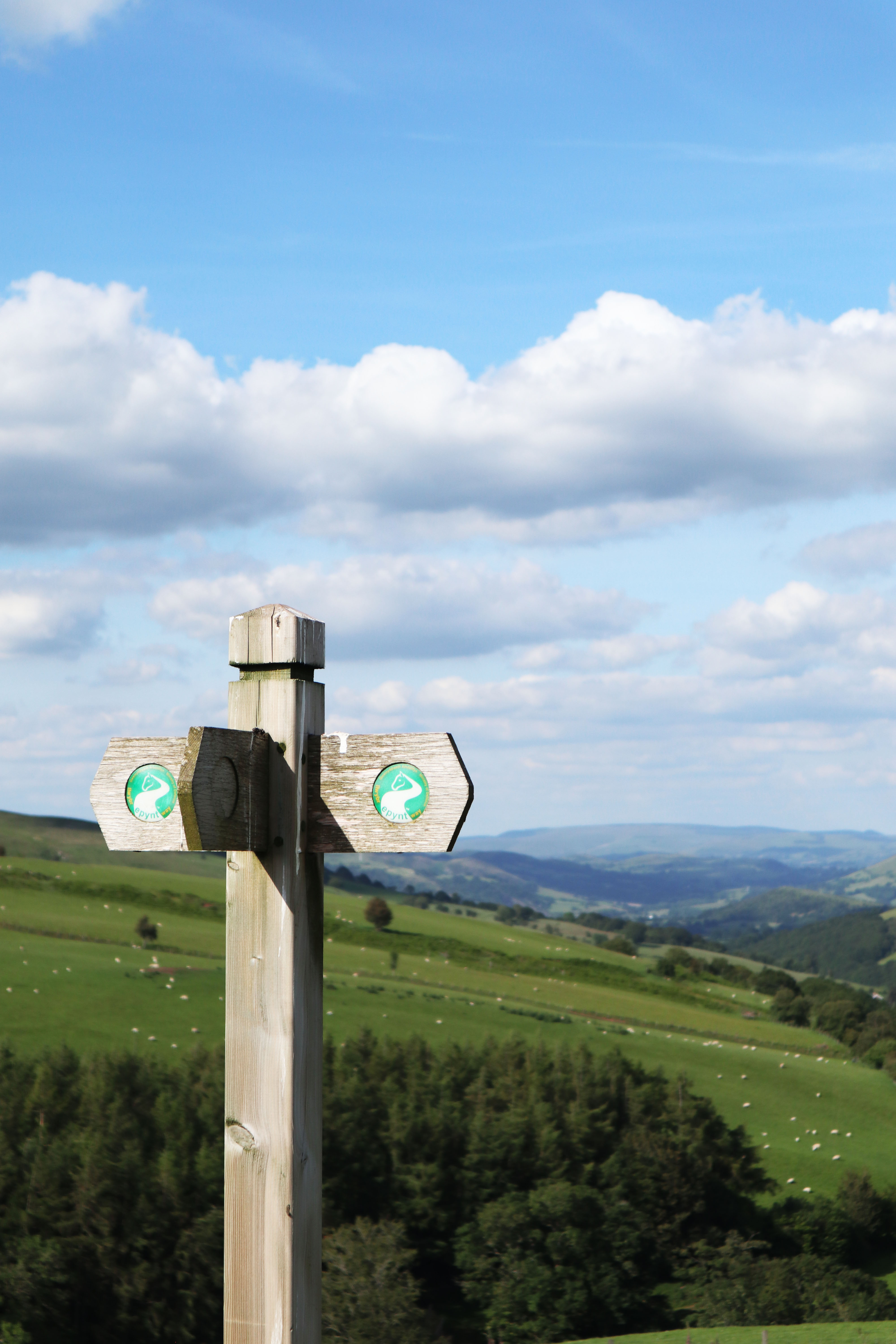
So, when the red flags are up, all rights of way are off the card, with one exception. That exception is the Epynt Way which remains open all year-round. It is in fact completely safe to walk, never quite straying from the edge of the plateau into the midst of Epynt where all the action happens. Created by the Ministry of Defence back in 2004, one would guess it was a way of pacifying the local hillwalking community, who, with the passing of the Countryside and Rights of Way Act in 2000, would’ve been wanting to broaden their horizons. A well-marked and maintained trail around the fringe of the training area would at least mean the army could keep walkers where they could see them. That’s my assumption anyway.
The Epynt Way can still be walked even when the flags are raised.
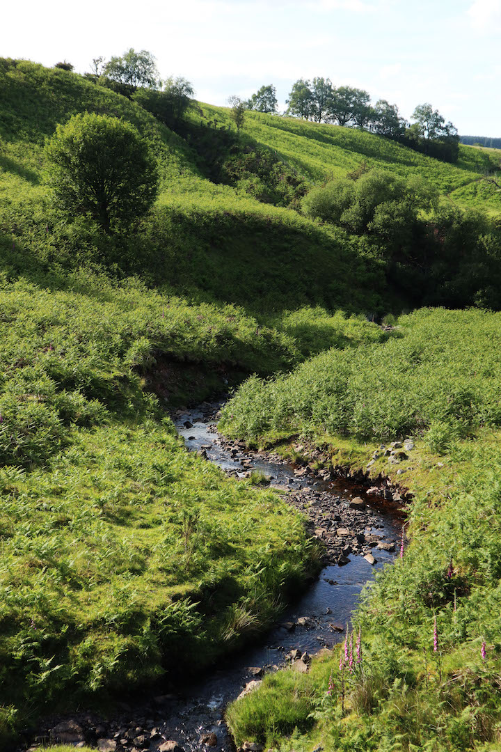
I packed up my tent and began my walk along the trail. It was a glorious day and I was very grateful for it. Wales in general has a reputation for its wet weather of course, but this area is particularly notorious. I’d lucked out. To the left of the path, red kites floated on thermals over the moorland, while on the right, farmland meadows buzzed with the noise of insects. At my feet, red clouds of dust followed me, kicked up by each step onto the parched trail. The route dipped downhill into a small valley filled with oak woodland where I found a gentle running stream. Clear and waist deep, it was too enticing to pass up on such a hot August morning, so in I went.
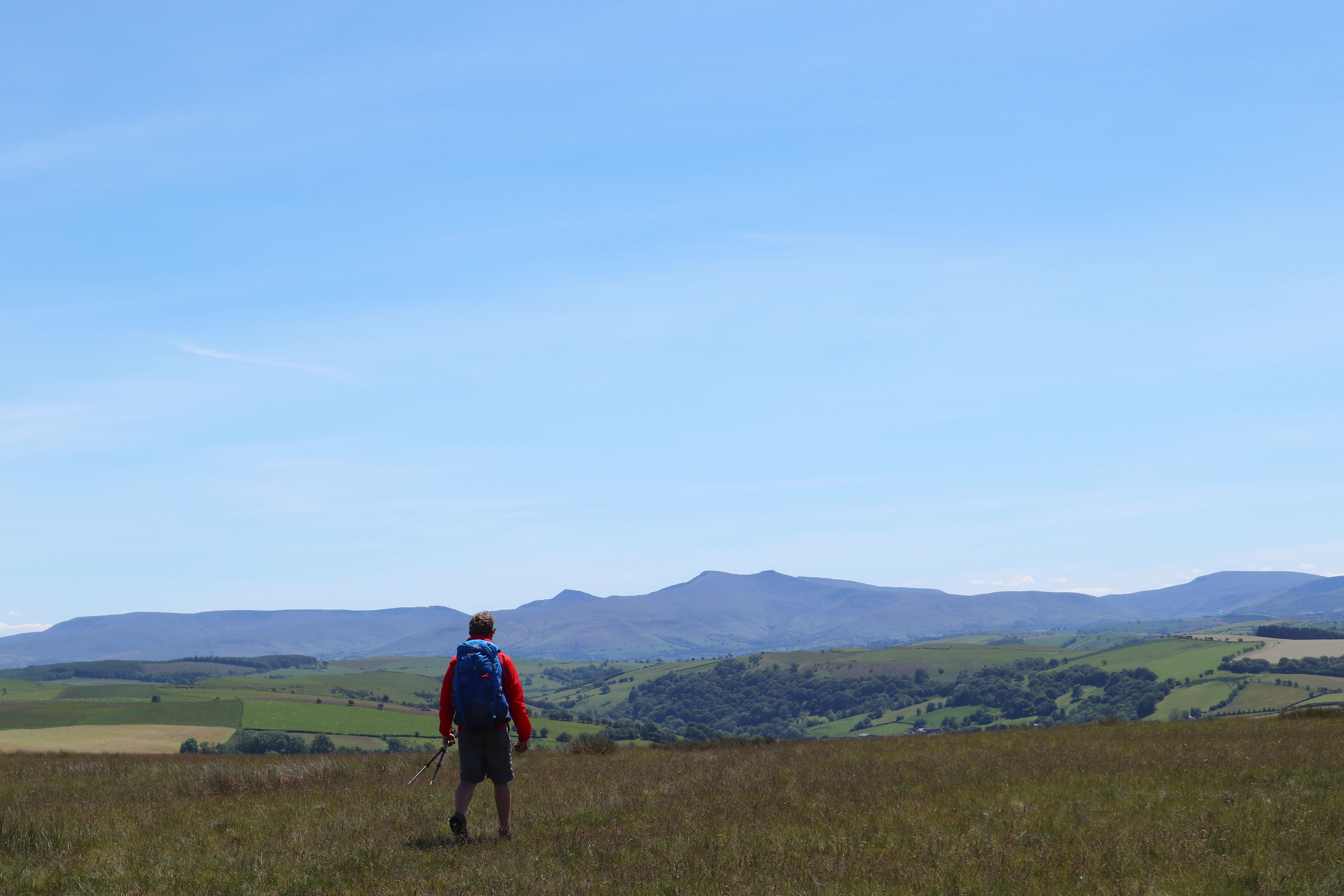
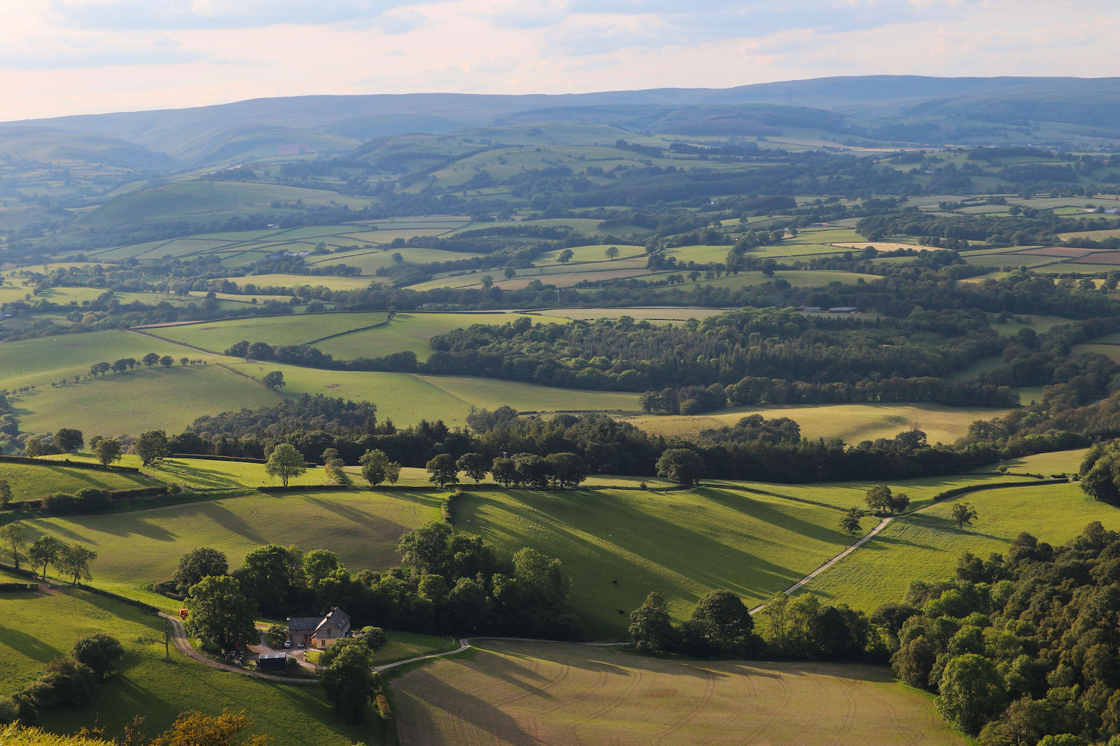
I soon realised that it’s virtually impossible to get lost on this trail. With waymarked finger posts every 50m, it seems the MOD are taking no chances of having disoriented hikers wandering into their danger zone. The beauty of this was that my map and compass could stay in my pack and I could focus on my surroundings instead. Occupying the skyline to the south were all the ranges of the Brecon Beacons; the giant step of the Black Mountain furthest west, the altar of Pen y Fan, then the whalebacks of the Black Mountains in the east. As I curved round to the north on my anti-clockwise walk along the trail, the softer but still undulating landscape of mid Wales was gradually revealed, with thousands of fields all fading into the distance where mountains loomed on a hazy horizon.
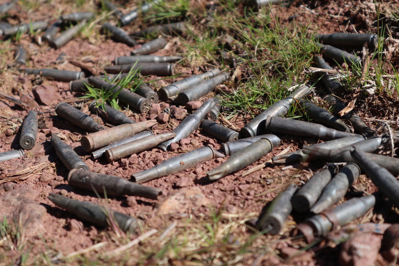
A spent smoke grenade – a common sight!
Many of the houses that were vacated with the arrival of the army still stand today, a number of which are passed on the trail. From a distance they look well kept, still lived in, but closer inspection reveals that they’re quite literally just shells, the walls inside covered in the graffitied profanities of young squaddies. The best example of these abandoned buildings is the Drover’s Arms which is located at one of Epynt’s highest points. Many a thirsty driver on the B4519 must have pulled over here at the site of its swinging hangboard only to be disappointed – a quick glance through one of the windows will reveal an interior that’s long been empty.
“Gunfire and explosions sounded from within the midst of the moorland.”
As I skirted the edge of the plateau’s northern facing escarpment, following a fence that marked the upland’s boundary, I thought about what Epynt might look like had the MOD not moved in. When the principal tenant is there to, among other things, blow stuff up, you’d be naturally inclined to think that their presence is at the detriment to the landscape, but there’s more to it than that. The fence I was following created a juxtaposing line separating bright green farmland and the dullish browns of Epynt’s moorland, grassland and peat bogs. With little interest in the agricultural productivity of the landscape here, the army have, by and large, left nature to do its thing. Sheep still graze freely but there are no fertilisers spread, nor is there any ploughing or draining. Agriculturally, it’s classed as unimproved land but ecologically, you could say it’s been improved. It’s a place where birds of prey (birds in general actually) and insects thrive – you just need to listen to realise that – and it’s where fragile but vitally important plant life, like sphagnum moss, is in abundance.
Another common sight.
There were constant reminders of the military’s presence here throughout this first day of walking. Gunfire and explosions sounded from within the midst of the moorland to my left, flares popped in the distance to leave drifting trails of smoke, and all kinds of leftovers were encountered on the trail itself; from smoke grenades and flare rounds to mounds of empty bullet casings, some seemingly new, some perhaps almost historic. At one point, as I had been enjoying the evening light, I noticed something moving out of the corner of my eye. I turned my head to see a soldier in full camouflage crouched in the long grass, rifle in hand, about 50 metres away from me. He didn’t seem to have spotted me – perhaps he had more important things to look out for. How many others had I walked past throughout the course of the day without realising, I wondered?
At the best of times, I can be quite particular when choosing a place to make camp. I usually only settle for spots that I can be sure are out of view from roads and nearby houses; where I can rest easy, knowing that I won’t get caught by an angry farmer. With the worry of getting in the way of the military, that choosiness took on a whole different level. I eventually found a perfect spot however, on a little ledge on Epynt’s far north western escarpment. There, I was concealed from the moorland interior (where the soldiers would be) but had a big, open view ahead across a wide green valley towards the Cambrian Mountains. I sat, ate, rubbed my feet, watched the sun set behind the hills and made another dent in my whisky supplies.
Day Two: The Western Fringe
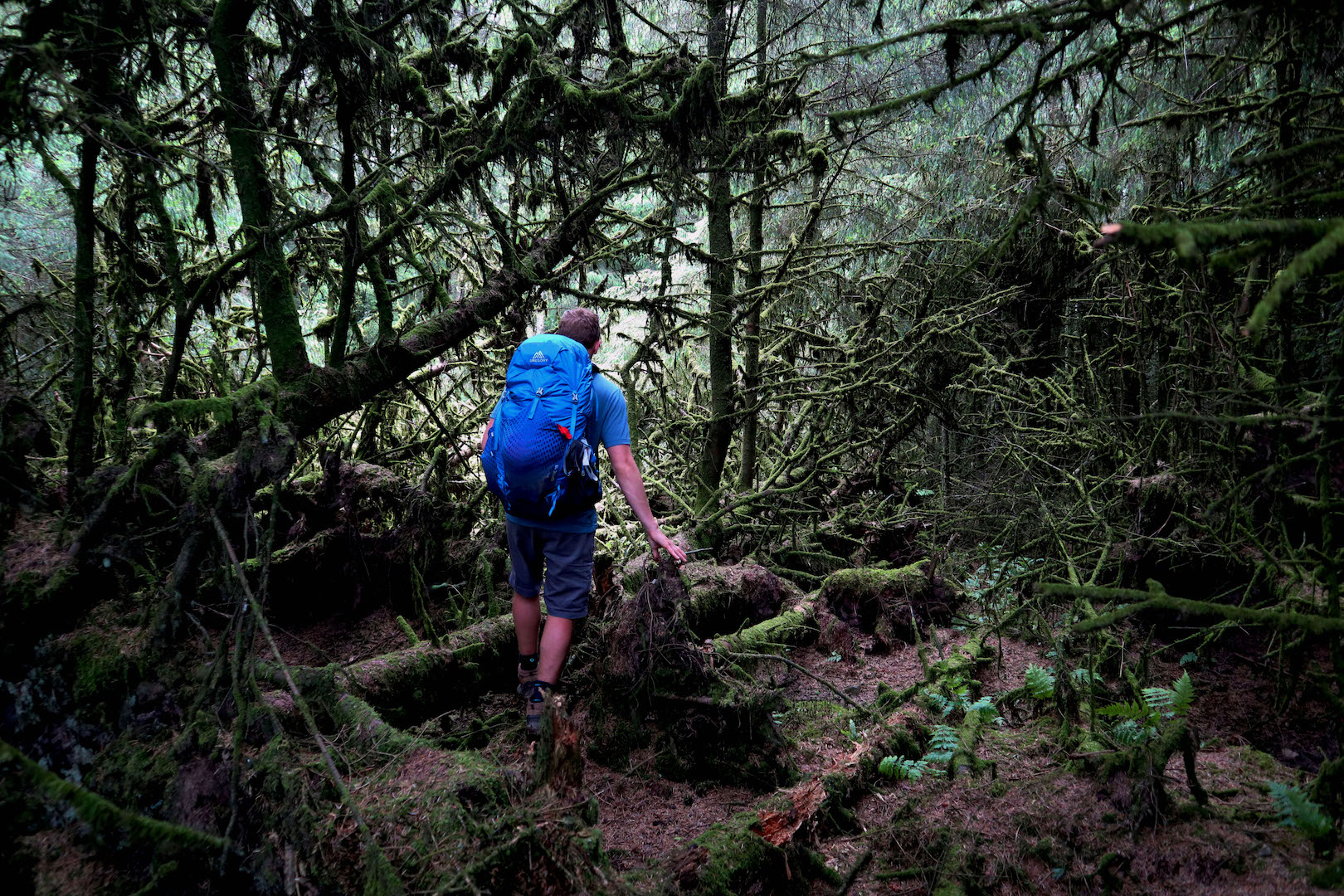
The next day, I rounded the top end of this circular trail and, for the first time, began working my way back to where I had started out. While the first half of the walk along the eastern edge of Epynt was characterised by open country, this half tended to hug along the edges of forestry. Peer into it and each time you’re met with a jungle-like scene, where the skeletal remains of older forests are smothered in bright green moss while only a deep black darkness lies beyond.
There were some beautiful woodland flanked valleys encountered on this section of the trail as well, where ancient trackways led steeply down to tucked-away, wildflower-filled meadows, alongside which sat the ruined cottages of those who once lived off the land here.
A curious bimble off the trail into one of the patches of forestry.
The view from Epynt's western escarpment.
Camp Two, looking towards the Cambrian Mountains.
The weather turned in an instant – so often the case in Wales’ hills but still always a surprise – with sunshine switching to heavy showers. Nearing the end of the trail, I quickened my pace, spurred on by an urgency to escape the rain but also by the prospect of a pint in Tafarn y Crydd – a quintessential village pub, unchanged for decades.
Looking back on that walk, those words that I passed across the bar were the first to leave my mouth in two days and two nights. Aside from that soldier and a few cars in the distance, I had encountered no one on the trail – a balmy hot August weekend and not a single other person out walking.
Despite those frequent explosions, the rifle fire and shouting, I think Mynydd Epynt was, in a way, one of the most peaceful places that I’ve walked in Wales.