Ten Of The Best Outdoor Smartphone Apps - Outdoors Magic

Outdoors Gear, Equipment, News, Reviews, Forums, Walking Routes and More at OutdoorsMagic.com

Share

Outdoor Features

Ten Of The Best Outdoor Smartphone Apps

Here's our selection of the top outdoor apps on the market from weather forecasting to GPS mapping.

What an era of technology we’re in. It’s odd to think that just a few years ago hikers were roaming the fells with only over-sized OS maps, magnetic compasses, and, if they had a phone at all, it weighed a ton and more often than not struggled for any sort of reception.

Obviously you still need to know how to use a traditional map and compass, but modern smartphones can add another dimension to your walking in all sorts of ways from helping you keep on top of changes in the weather through to working as a fully featured GPS.

To give you some smartphone inspiration, we’ve picked out ten of our favourite outdoor apps, mixing established stars with a few that you may not have heard before.

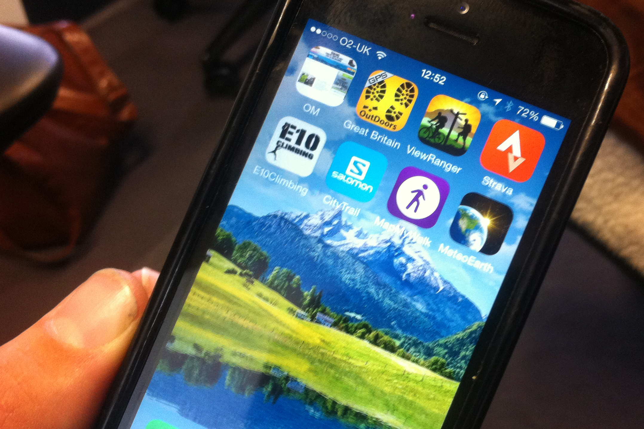
ViewRanger | Strava | Map My Walk | E10 Climbing | MeteoEarth | Salomon City Trail | Outdoors Great Britain | Peak Scanner | Hill Lists | Mountain Steps UK

ViewRanger GPS App

Price (£): Free app. Option to buy commercial mapping.
Compatibility: Requires iOS 5.1.1 or later
Platform: iPhone, iPad, iPod touch (optimised for iPhone 5) and Android
Current version rating: 5 / 5

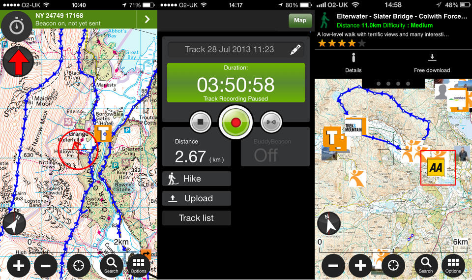
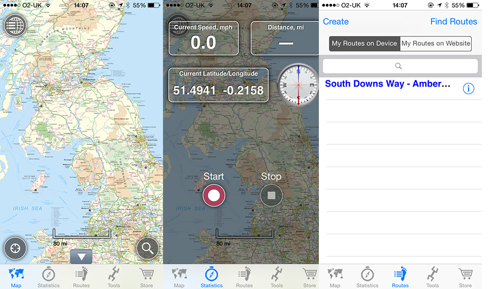
There are plenty of OS mapping compatible GPS apps out there, but for us ViewRanger is still the best. It converts your phone into a sophisticated, easy to use GPS with clear, easy to use controls and has the capability to download maps either as full areas or individual tiles. If you don’t want to pay for Ordnance Survey mapping, you can opt for free mapping like Open Streetmap.

You can also track your speed, course, time and other variables and the app doesn’t need a data connection to work as maps are cached on the device. You can even use the Buddy Beacon feature to follow your mates and share your own position with others. Finally you can share your own routes and download others from the excellent My ViewRamger community website or buy commercial routes from bodies like the AA and download them on the fly.

We also like Anquet’s cloud-based Outdoor Map Navigator app.

More details at www.viewranger.com.

Back to top

Strava

Price (£): Free with paid-for premium option
Compatibility: Requires iOS 7 or later
Platform: iPhone, iPad, iPod touch (optimised for iPhone 5) and Android
Current version rating: 4.5 / 5

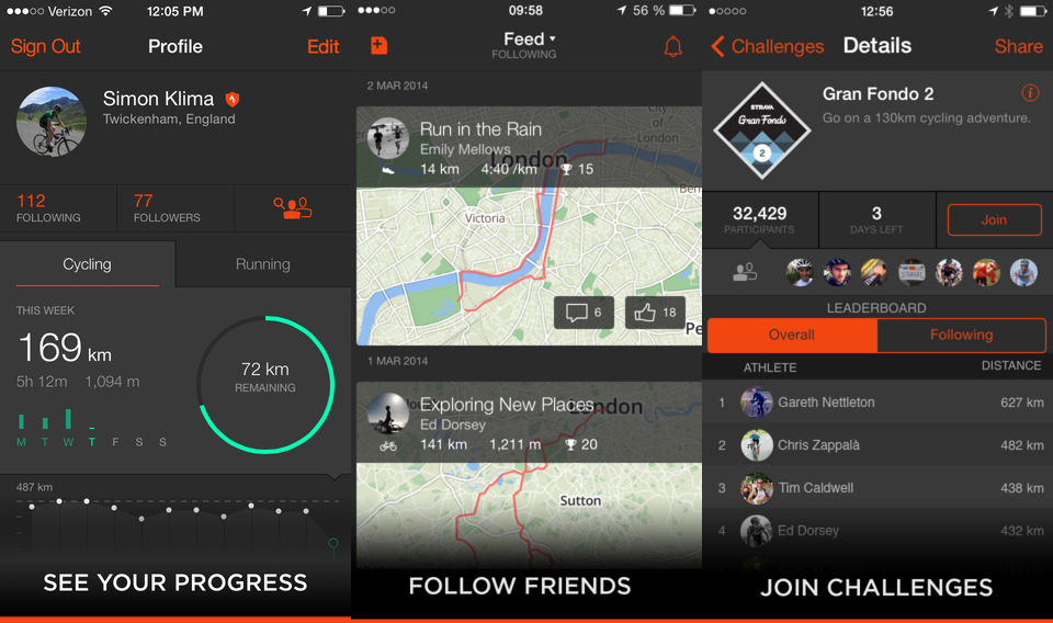
The Strava app is a little slice of genius that’s aimed principally at cyclists and runners, but can also be used to record walks. You start recording when you set off and the device tracks your route and speed. The really clever bit is that once you’re home, you upload your track to Strava’s web site and it will tell you how your performance compares with others on selected ‘segments’ of the route, generally hills or descents.

You’re awarded ‘cups’ for top ten performances or personal bests, but the beauty of it is that you can also follow your mates and see both what they’re getting up to and how you compare. Think of it as motivational fun, but approach with caution if you’re rabidly competitive. For a more walking orientated take on tracking, check out Map My Hike instead.

More information at www.strava.com.

Back to top

Map My Walk

Price (£): Free
Compatibility: Requires iOS 7 or later
Platform: iPhone, iPad, iPod touch (optimised for iPhone 5) and Android
Current version rating: 4.5 / 5

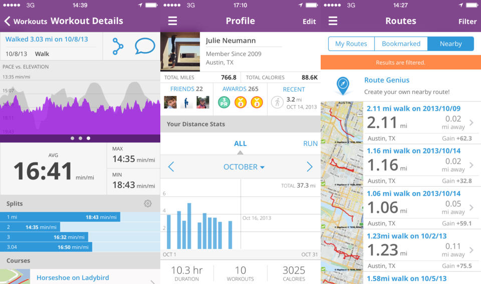
We all need an incentive to get out there and do exercise every now and then and that’s exactly what Map My Walk achieves. The app does a bit of everything by tracking your walk on a map, working out the amount of calories burnt and how far you’ve travelled. With GPS Route Mapping you can record walks on to your phone as well as searching for other routes in your area. There are also three other apps in the ‘Map My…’ series that focus on running, cycling and fitness. All the apps are laid out very similarly and there are only slight differences in each however, it’s worth downloading them all to see which one best suits you.

More information at www.mapmywalk.com.

Back to top

E10 Climbing 

Price (£): Free
Compatibility: Requires iOS 6 or later
Platform: iPhone, iPad, and iPod touch (optimised for iPhone 5) and Android
Current version rating: 4.5 / 5

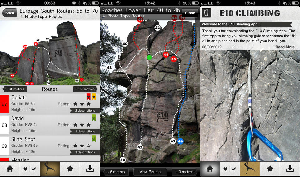
The E10 Climbing App is a new mobile climbing guide for the UK with almost 4000 routes and over 700 photos available to download and carry with you everywhere you go. It also includes a free download of Stanage Popular End in the Peak District, which has over 400 routes and 50 photos just for that region. There are a number of different’y graded climbs so this app appeals to both the beginner and intermediate climber. There are also directions for finding each of the routes and a section where users can leave their top tips and advice to make your experience even better.

More information at www.e10climbing.com.

Back to top

MeteoEarth

Price (£): 1.99
Compatibility: Requires iOS 6 or later
Platform: iPhone, iPad, iPod touch (optimised for iPhone 5) and Android
Current version rating: 3.5 / 5

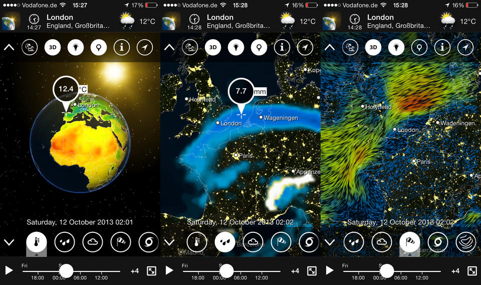
Not strictly an outdoors app, but one that’s actually incredibly useful when it comes to planning trips, MeteoEarth is a brilliant animated weather map generator which will show you projected weather patterns over the next few days – you choose cloud, or precipitation or wind or pressure. I’s stunningly beautiful, but also really useful for the big picture of what’s going on with the weather and the small picture of whether what’s just hit you is a light shower or the start of an endless wave of heavy rain. It’s even better on an iPad. The same guys are behind the excellent Weather Pro iPhone and iPad apps.

More information www.meteoearth.com.

Back to top

Salomon CityTrail

Price (£): Free
Compatibility: Requires iOS 7 or later
Platform: iPhone, iPad, iPod touch (optimised for iPhone 5)  and Android
Current version rating: 4 / 5

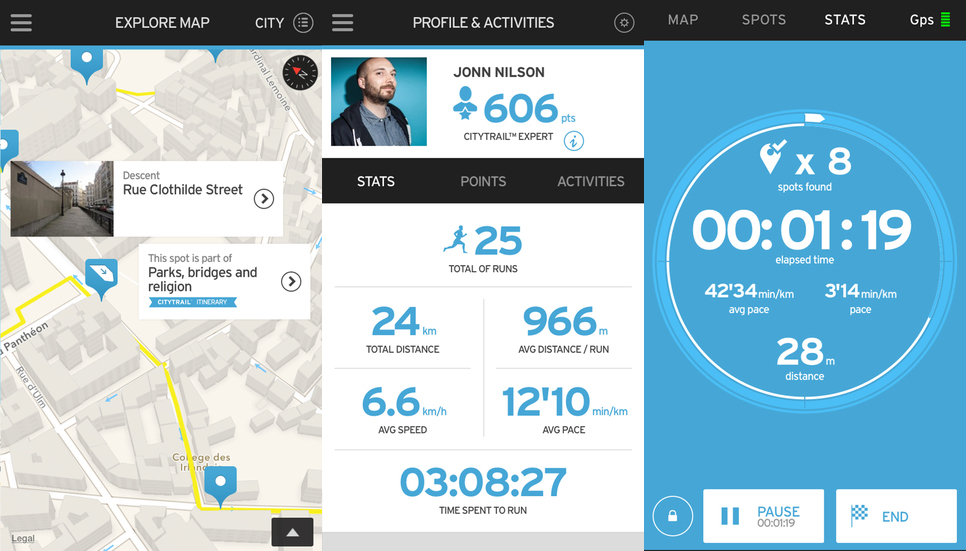
Covering over 90 cities worldwide, Salomon’s City Trail app helps you find the best trails in your home city or elsewhere across the globe and is brilliant if you’re traveling for work or pleasure and want to go for a run in a city you don’t know. You’ll get a different view of a new place by by following routes created by Salomon guides, discovering hidden spots, joining community runs and experiencing trail running in an urban environment.

Finally, if you just want someone to run with in a place near you, there is a community section where you can join up for free and meet like-minded city runners.

More information at www.citytrail.salomonrunning.com.

Back to top

Outdoors Great Britain

Price (£): Free
Compatibility: Requires iOS 6 or later
Platform: iPhone, iPad, and iPod touch (optimised for iPhone 5)
Current version rating: 4 / 5

OutDoors GPS makes it really easy to enjoy the great British countryside in confidence, so you can spend less time staring at maps and more time stretching your legs. It’s another great GPS mapping app that requires no signal on the hill as all maps can be stored to your device. You can choose from five different map types including satellite and OS and it’s the cheapest place to purchase OS area maps at just £4.99 for each. Not as comprehensive as ViewRanger, but does the job.

More information at www.outdoorsgps.com.

Back to top

Peak Scanner

Price (£): 1.99
Compatibility: Requires iOS 5 or later
Platform: iPhone, iPad, iPod touch (optimised for iPhone 5) and Android
Current version rating: 4 / 5

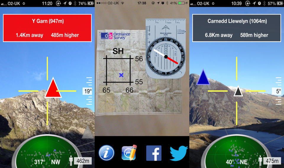
Ever wondered what that mountain over there might be? The Peak Scanner app is like having a knowledgeable mate on your phone – line-up the cross hairs and it’ll identify the mountain, tell you how far away it is and how much higher than your current position. Sit the phone flat and it’ll give you your OS grid reference too along with a compass. We’ve used it in the UK and the Alps, you can even take a photo of the mountains in question complete with with labelling. Genius though you sometimes need a steady hand to line things up accurately.

More information www.peakscanner.com

Back to top

Hill Lists

Price (£): 1.49
Compatibility: Requires iOS 6 or later
Platform: iPhone, iPad, iPod touch (optimised for iPhone 5) and Android (called British Hills)
Current version rating: 4.5 / 5

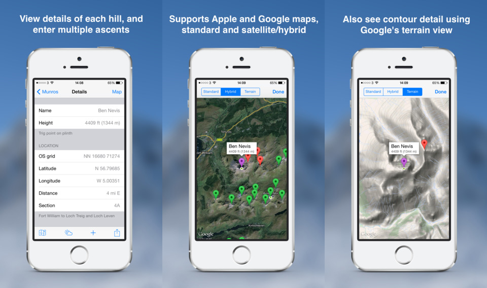
Hill Lists is an extremely handy mountain database to have in your pocket. While allowing you to record all the mountains you’ve walked in a comprehensive list of Munros, trail 100s etc it also provides a multitude of information on each peak. You can also add your own routes on to each mountain with all the key statistics for usage again in the future.

More information on the hills’ database at www.hills-database.co.uk.

Back to top

Mountain Steps UK

Price (£): 3.99
Compatibility: Requires iOS 4.3 or later
Platform: iPhone, iPad, iPod touch (optimised for iPhone 5) and Android
Current version rating: 4 / 5

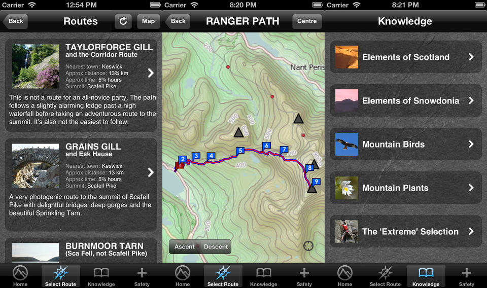
Mountain Steps UK has two elements to it. The first is an in-app guide with GPS topo mapping to the main routes to the summit on Snowdon, Scafell Pike and Ben Nevis. It makes sense to target those three high-points initially, particularly as it opens up the whole ‘Three Peaks’ market, though it will, apparently, be expanded to cover other mountains in the future. The second part of the app is a whole bunch of more general outdoors information along with some quite neat safety touches. Oh and one other point, ten per-cent of profits from the app, before director renumeration, go to Mountain Rescue.

More information at www.mountain-steps.co.uk.

Back to top

Newsletter Terms & Conditions

Please enter your email so we can keep you updated with news, features and the latest offers. If you are not interested you can unsubscribe at any time. We will never sell your data and you'll only get messages from us and our partners whose products and services we think you'll enjoy.

Read our full Privacy Policy as well as Terms & Conditions.

production