This is part of our series in collaboration with Komoot, the route planning app for runners, bikers, and long-distance hikers. In search of the best hikes in Lochaber, we reached out to local mountaineer and walking guide Connor Holdsworth and asked him to plot his five favourite routes using the Komoot app. Connor is the founder of Atlas Mountaineering, one of the highest rated outdoor activity providers in Scotland. The team at Atlas are dedicated to showing people the natural wonders this country has to offer; they provide a range of guided adventures, spanning from your first try at climbing to your group of friends finally summitting Ben Nevis. Year-round, these guys ought to be your first phone call if you’re looking to explore the area.
Take it away, Connor:
The 5 Best Walks Near Fort William
- Lower Falls and Paddy’s Bridge
- Mullach nan Coirean(Summit of the Corries) and Stob Ban (white peak)
- Dun Deardail & Outlandia
- Commando Memorial and Highbridge
- Tour de Ben
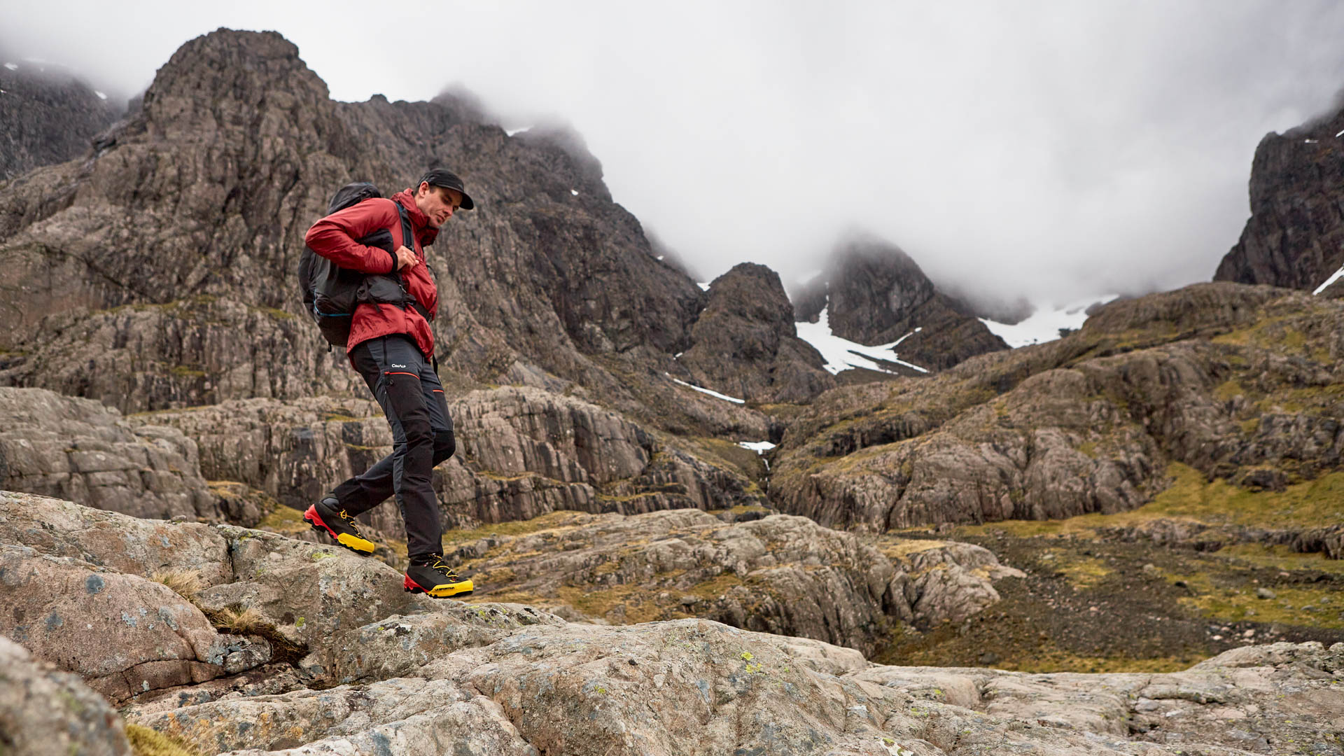
I’ve lived in the Lochaber area for nearly 12 years now and although I moved here under the guise of studying a degree program it was definitely, not-so-secretly for the mountains. I put together these five walks to give a flavour for the area, to give something for everyone and also to give some balance in terms of local and natural history. Three of them are great rambling walks and remain at a lower altitude, perfect for some driech Lochaber days. The other two are serious mountain outings, requiring navigational skill with a map and compass, and an appropriate backup and adequate clothing.
Lower Falls and Paddy’s Bridge
Distance: 2 miles / 3.2 km
Start/End: Lower Falls Car Park
This walk starts at a pay and display car park next to this famous local waterfall. On days after lots of rain, the spray from the waterfall comes up and over the road in dramatic fashion. A public bus runs to this car park in the summer and there are toilets available too. Open the gate and you’re off. It immediately feels like a proper Scottish highland walk, there are huge rocky hillsides everywhere you look and the river Nevis tumbles down beside you. Once you reach Paddy’s bridge look down into the gorge at the crystal clear water and ponder life’s mysteries. It’s time to turn around, enjoy the walk back downstream, there’s some great swim and picnic spots so take your time with this one.
Mullach nan Coirean (Summit of the Corries) and Stob Ban (white peak)
Distance: 9 miles / 15 km
Start/End: Glen Nevis Road (optional)
It wouldn’t be a Lochaber walking guide without throwing in some Munros with great ridges! I like to start this walk with Mullach nan Coirean and the last bit of the Stob Ban Is a little boggy. Mullach Nan Coirean is also a great hill. An easy path leads you up through the woods to a deer fence and some pathless hillside. You have to put in some graft here but once you gain a little height it turns into a nice broad ridge that narrows just as it reaches the summit plateau. Great mountain walking takes you to the spot height marked 912m on the OS map. From here you need to switch your navigational noggin on for the ascent and descent of the rocky Munro of Stob Ban, it soon becomes obvious where the Gaelic name comes from as the sharp cut quartz is all around you. The west ridge starts a few meters south of the true summit and looks reasonably serious from above, but stick to the worn section and it is fine. It soon becomes less steep and rocky. Once at the bealach a track leads north into the coire and back out to Achriabhach where you started the walk.
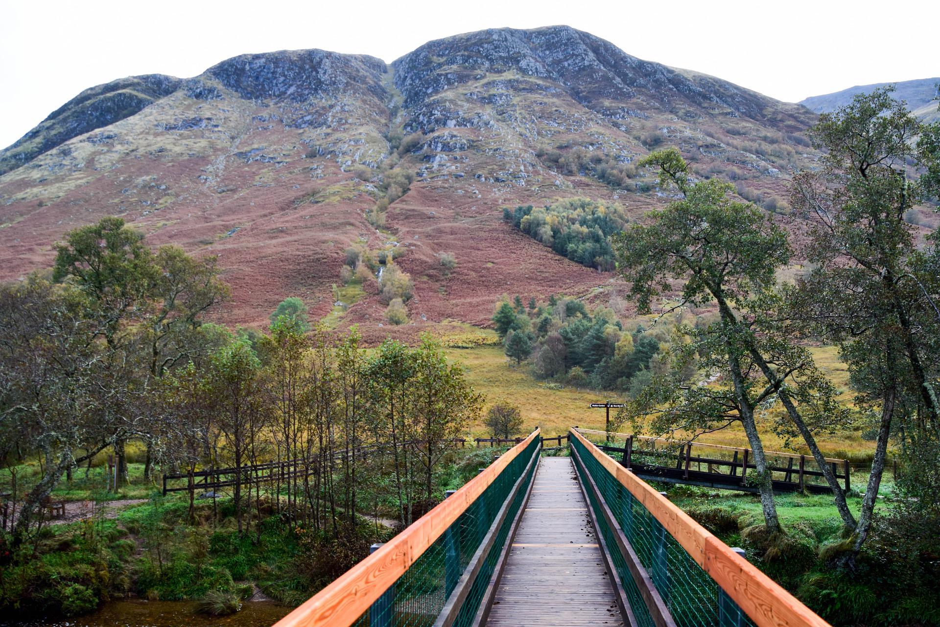
Dun Deardail & Outlandia
Distance: 3.3 miles / 5 km
Start/End: Glen Nevis Car Park
These could be split into two separate outings but I put them together as they give pleasant contrast together and create a longer but still low altitude day out. The contrast for me is not only to do with setting but also to do with the age, architecture and modernity of the two locations. Outlandia is an off-grid artists’ field station, a treehouse built by a local builder in 2010 deep in the managed woodland, whereas Dun Deardail is an iron age fort and a site of huge archaeological and historical importance cast upon a hillside with wide open views. It brings together some things that I love about Lochaber life. Balance and a reminder that we, and the hills, have been here for a long time together.